TopoQuest Logo
Do you find TopoQuest useful?
Help keep TopoQuest running and adding new maps/features by donating!
Bitcoin:  19c7KJd3qBynnjoSw5npx9KScwjBe4ifkT
Litecoin:  LXs6TkuXGGXo1vDsWCkWVdjQX94eUKd6ui
Home View Maps Find Maps Find Places Resources & Links


Dunseith, North Dakota Topographic Map

USGS Map Title: Dunseith, ND
USGS Map MRC: 48100G1
DRG (GeoTIFF) Download: o48100g1.tif


Neighboring USGS Topographic Map Quads:


  Boundary Lake, ND  
48100H2
 

  International Peace Garden, ND  
48100H1
 

  Carpenter Lake, ND  
48099H8
 

  Lords Lake, ND  
48100G2
 

  Dunseith, ND  
48100G1
 

  Lake Upsilon SW, ND  
48099G8
 

  Overly, ND  
48100F2
 

  Fonda, ND  
48100F1
 

  Thorne, ND  
48099F8


Map MRC Location:

N49°
W101°
N49°
W100°
H8 H7 H6 H5 H4 H3 H2 H1
G8 G7 G6 G5 G4 G3 G2 G1
F8 F7 F6 F5 F4 F3 F2 F1
E8 E7 E6 E5 E4 E3 E2 E1
D8 D7 D6 D5 D4 D3 D2 D1
C8 C7 C6 C5 C4 C3 C2 C1
B8 B7 B6 B5 B4 B3 B2 B1
A8 A7 A6 A5 A4 A3 A2 A1
N48°
W101°
N48°
W100°

Dunseith, ND USGS 1:24K Topographic Map Preview:
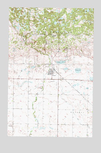
Dunseith, ND USGS Topographic Map
Click on map above to begin viewing in our Map Viewer.

This topographic map contains these locations and features:
Feature Name Type Latitude Longitude GNIS ID View Map
Bigham LakeLakeN48.8146°W100.0227°1028002View Map
Carlisle LakeLakeN48.8733°W100.0091°1028279View Map
City of DunseithCivilN48.8130°W100.0624°1036000View Map
Currie SchoolSchoolN48.7597°W100.1182°1028572View Map
DunseithPopulated PlaceN48.8131°W100.0610°1028750View Map
Dunseith City HallBuildingN48.8133°W100.0623°2744113View Map
Dunseith Community Nursing HomeBuildingN48.8136°W100.0591°2748698View Map
Dunseith Day Elementary SchoolSchoolN48.8484°W100.0540°1028751View Map
Dunseith Elementary SchoolSchoolN48.8114°W100.0633°2747698View Map
Dunseith Fire DepartmentBuildingN48.8134°W100.0623°2637621View Map
Dunseith High SchoolSchoolN48.8096°W100.0649°2747699View Map
Dunseith Landing Field (historical)AirportN48.8000°W100.0587°1033017View Map
Dunseith Post OfficePost OfficeN48.8132°W100.0598°2741976View Map
East DunseithPopulated PlaceN48.8656°W100.0168°1867442View Map
East Dunseith Census Designated PlaceCensusN48.8546°W100.0285°2392984View Map
Indian CreekStreamN48.8300°W100.0712°1029613View Map
Log House Information CenterBuildingN48.8082°W100.0619°2748918View Map
Mineral CreekStreamN48.8397°W100.0987°1030239View Map
Riverside CemeteryCemeteryN48.7980°W100.0760°1030923View Map
Saint Louis CemeteryCemeteryN48.7980°W100.0777°1031197View Map
Saint Marys MissionChurchN48.8497°W100.0399°1031228View Map
Saint Sylvan CemeteryCemeteryN48.8400°W100.0692°1031301View Map
Saint Sylvan MissionChurchN48.8494°W100.0710°1031302View Map
San HavenPopulated PlaceN48.8347°W100.0390°1031333View Map
Schutte LakeLakeN48.8225°W100.0482°1031999View Map
Smith LakeLakeN48.8630°W100.0295°1032137View Map
Thorn LakeLakeN48.8626°W100.0074°1032474View Map
Township of RussellCivilN48.7833°W100.0171°1759626View Map
Wee'l Turtle StatueParkN48.8078°W100.0620°2748919View Map

Note: Coordinates in the location and feature list above are referenced to NAD83 datum.


Copyright (C) 2008-2024 Ryan Niemi / Sunset Dynamics ... All Rights Reserved