TopoQuest Logo
Do you find TopoQuest useful?
Help keep TopoQuest running and adding new maps/features by donating!
Bitcoin:  19c7KJd3qBynnjoSw5npx9KScwjBe4ifkT
Litecoin:  LXs6TkuXGGXo1vDsWCkWVdjQX94eUKd6ui
Home View Maps Find Maps Find Places Resources & Links


International Peace Garden, North Dakota Topographic Map

USGS Map Title: International Peace Garden, ND
USGS Map MRC: 48100H1
DRG (GeoTIFF) Download: o48100h1.tif


Neighboring USGS Topographic Map Quads:


  Boundary Lake, ND  
48100H2
 

  International Peace Garden, ND  
48100H1
 

  Carpenter Lake, ND  
48099H8
 

  Lords Lake, ND  
48100G2
 

  Dunseith, ND  
48100G1
 

  Lake Upsilon SW, ND  
48099G8


Map MRC Location:

N49°
W101°
N49°
W100°
H8 H7 H6 H5 H4 H3 H2 H1
G8 G7 G6 G5 G4 G3 G2 G1
F8 F7 F6 F5 F4 F3 F2 F1
E8 E7 E6 E5 E4 E3 E2 E1
D8 D7 D6 D5 D4 D3 D2 D1
C8 C7 C6 C5 C4 C3 C2 C1
B8 B7 B6 B5 B4 B3 B2 B1
A8 A7 A6 A5 A4 A3 A2 A1
N48°
W101°
N48°
W100°

International Peace Garden, ND USGS 1:24K Topographic Map Preview:
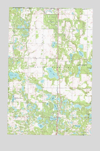
International Peace Garden, ND USGS Topographic Map
Click on map above to begin viewing in our Map Viewer.

This topographic map contains these locations and features:
Feature Name Type Latitude Longitude GNIS ID View Map
Anderson LakeLakeN48.9108°W100.0584°1027702View Map
Berry LakeLakeN48.9333°W100.1178°1027913View Map
Brennan LakeLakeN48.9552°W100.0168°1028128View Map
Butler LakeLakeN48.8914°W100.0579°1028211View Map
Eldridge LakeLakeN48.9024°W100.0540°1028843View Map
International Peace GardenParkN48.9919°W100.0626°1029620View Map
International Peace Garden AirportAirportN48.9979°W100.0497°1033018View Map
Jones LakeLakeN48.9055°W100.0662°1029695View Map
KelvinPopulated PlaceN48.9372°W100.0510°1033869View Map
Little PrairieAreaN48.9617°W100.0749°1029946View Map
Little Prairie ChurchChurchN48.9500°W100.0846°1029947View Map
Lockhart LakeLakeN48.9526°W100.0319°1029957View Map
Long LakeLakeN48.9374°W100.0203°1029991View Map
Lyde LakeLakeN48.9355°W100.0598°1030050View Map
Myer LakeLakeN48.9641°W100.0577°1030348View Map
Rabbit City LakeLakeN48.8842°W100.0204°1030831View Map
Rose LakeLakeN48.8838°W100.0757°1030983View Map
Schmidt LakeLakeN48.9100°W100.1171°1031383View Map
Turtle MountainsRangeN48.9419°W100.0665°1035893View Map

Note: Coordinates in the location and feature list above are referenced to NAD83 datum.


Copyright (C) 2008-2025 Ryan Niemi / Sunset Dynamics ... All Rights Reserved