TopoQuest Logo
Do you find TopoQuest useful?
Help keep TopoQuest running and adding new maps/features by donating!
Bitcoin:  19c7KJd3qBynnjoSw5npx9KScwjBe4ifkT
Litecoin:  LXs6TkuXGGXo1vDsWCkWVdjQX94eUKd6ui
Home View Maps Find Maps Find Places Resources & Links


Dutch Creek, California Topographic Map

USGS Map Title: Dutch Creek, CA
USGS Map MRC: 41123H1
DRG (GeoTIFF) Download: o41123h1.tif


Neighboring USGS Topographic Map Quads:


  Carberry Creek, OR  
42123A2
 

  Squaw Lakes, OR  
42123A1
 

  Dutchman Peak, OR  
42122A8
 

  Kangaroo Mountain, CA  
41123H2
 

  Dutch Creek, CA  
41123H1
 

  Condrey Mountain, CA  
41122H8
 

  Seiad Valley, CA  
41123G2
 

  Hamburg, CA  
41123G1
 

  Horse Creek, CA  
41122G8


Map MRC Location:

N42°
W124°
N42°
W123°
H8 H7 H6 H5 H4 H3 H2 H1
G8 G7 G6 G5 G4 G3 G2 G1
F8 F7 F6 F5 F4 F3 F2 F1
E8 E7 E6 E5 E4 E3 E2 E1
D8 D7 D6 D5 D4 D3 D2 D1
C8 C7 C6 C5 C4 C3 C2 C1
B8 B7 B6 B5 B4 B3 B2 B1
A8 A7 A6 A5 A4 A3 A2 A1
N41°
W124°
N41°
W123°

Dutch Creek, CA USGS 1:24K Topographic Map Preview:
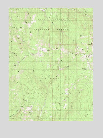
Dutch Creek, CA USGS Topographic Map
Click on map above to begin viewing in our Map Viewer.

This topographic map contains these locations and features:
Feature Name Type Latitude Longitude GNIS ID View Map
Black MountainSummitN41.9540°W123.0650°1657574View Map
Bloomfield PassGapN41.9637°W123.1242°1657577View Map
Blue Ledge MineMineN41.9635°W123.0950°257262View Map
Boggs MineMineN41.9996°W123.0648°1657579View Map
City GulchValleyN41.9993°W123.0323°258388View Map
Cobb MineMineN41.9965°W123.0748°1657588View Map
Copper ButteSummitN41.9371°W123.1162°258697View Map
Dutch CreekStreamN41.9962°W123.0745°259627View Map
East Fork Horse CreekStreamN41.9107°W123.0695°259735View Map
EileenPopulated PlaceN41.9629°W123.1053°1657604View Map
Johnson DairyLocaleN41.9471°W123.0775°1657634View Map
Knutzen CabinBuildingN41.9943°W123.0628°1657640View Map
Little Dutch CreekStreamN41.9635°W123.0303°1657644View Map
Lowdens CabinBuildingN41.9521°W123.0767°1664801View Map
Manzanita GulchValleyN41.9782°W123.1200°1657648View Map
Middle Creek RidgeRidgeN41.8876°W123.0042°263512View Map
Morgan RanchLocaleN41.8924°W123.0423°277168View Map
Nabob RidgeRidgeN41.9804°W123.0987°1657660View Map
Onion FlatFlatN41.9551°W123.0087°1657664View Map
Park GulchValleyN41.9979°W123.1023°264520View Map
Reeves Ranch SpringsSpringN41.9319°W123.0101°265363View Map
Scraggy MountainSummitN41.9607°W123.0025°265949View Map
Seiad Low GapGapN41.8912°W123.1092°252550View Map
Selby CabinLocaleN41.9504°W123.0309°277171View Map
Sheep CampLocaleN41.9471°W123.0337°266064View Map
Slaughter House FlatFlatN41.9551°W123.0775°1657681View Map
Tin Cup MineMineN41.9660°W123.0956°1657691View Map
West Fork Dutch CreekStreamN41.9890°W123.0720°268899View Map
West Fork Horse CreekStreamN41.9107°W123.0695°268903View Map
White MountainSummitN41.9537°W123.0581°1656407View Map
Willow FlatFlatN41.9687°W123.0184°1657697View Map

Note: Coordinates in the location and feature list above are referenced to NAD83 datum.


Copyright (C) 2008-2025 Ryan Niemi / Sunset Dynamics ... All Rights Reserved