TopoQuest Logo
Do you find TopoQuest useful?
Help keep TopoQuest running and adding new maps/features by donating!
Bitcoin:  19c7KJd3qBynnjoSw5npx9KScwjBe4ifkT
Litecoin:  LXs6TkuXGGXo1vDsWCkWVdjQX94eUKd6ui
Home View Maps Find Maps Find Places Resources & Links


Condrey Mountain, California Topographic Map

USGS Map Title: Condrey Mountain, CA
USGS Map MRC: 41122H8
DRG (GeoTIFF) Download: o41122h8.tif


Neighboring USGS Topographic Map Quads:


  Squaw Lakes, OR  
42123A1
 

  Dutchman Peak, OR  
42122A8
 

  Siskiyou Peak, OR  
42122A7
 

  Dutch Creek, CA  
41123H1
 

  Condrey Mountain, CA  
41122H8
 

  Buckhorn Bally, CA  
41122H7
 

  Hamburg, CA  
41123G1
 

  Horse Creek, CA  
41122G8
 

  McKinley Mountain, CA  
41122G7


Map MRC Location:

N42°
W123°
N42°
W122°
H8 H7 H6 H5 H4 H3 H2 H1
G8 G7 G6 G5 G4 G3 G2 G1
F8 F7 F6 F5 F4 F3 F2 F1
E8 E7 E6 E5 E4 E3 E2 E1
D8 D7 D6 D5 D4 D3 D2 D1
C8 C7 C6 C5 C4 C3 C2 C1
B8 B7 B6 B5 B4 B3 B2 B1
A8 A7 A6 A5 A4 A3 A2 A1
N41°
W123°
N41°
W122°

Condrey Mountain, CA USGS 1:24K Topographic Map Preview:
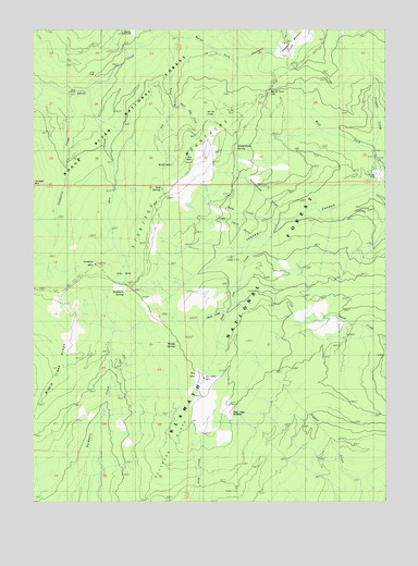
Condrey Mountain, CA USGS Topographic Map
Click on map above to begin viewing in our Map Viewer.

This topographic map contains these locations and features:
Feature Name Type Latitude Longitude GNIS ID View Map
Alex CreekStreamN41.9835°W122.9817°256175View Map
Alex HoleBendN41.9379°W122.9675°256176View Map
Bearground GulchValleyN41.9496°W122.9142°256745View Map
Bearground SpringSpringN41.9697°W122.9285°218915View Map
Big RockPillarN41.9651°W122.9456°256995View Map
Buckeye CreekStreamN41.9504°W122.9925°1657582View Map
Buckhorn CampLocaleN41.9310°W122.9687°1657583View Map
Buckhorn SpringSpringN41.9309°W122.9672°257611View Map
Cinnabar MineMineN41.9599°W122.8817°258375View Map
Condrey MountainSummitN41.9376°W122.9792°258632View Map
Dead Cow CreekStreamN41.9443°W122.9189°259108View Map
Deer CampLocaleN41.8974°W122.9314°259201View Map
Deer Camp MeadowsFlatN41.8985°W122.9317°252556View Map
Dog ForkStreamN41.9976°W122.9495°259440View Map
Donomore CreekStreamN41.9918°W122.9325°259481View Map
Donomore MeadowsFlatN41.9985°W122.9098°259482View Map
Dry LakeBasinN41.9082°W122.9428°252543View Map
Dry Lake LookoutLocaleN41.9074°W122.9414°259585View Map
Dry Lake MountainSummitN41.9076°W122.9406°1657597View Map
East Dog ForkStreamN41.9796°W122.9517°274663View Map
Elk FlatFlatN41.9882°W122.9795°1657605View Map
Jaynes CanyonValleyN41.9562°W122.8809°261913View Map
MiddlehellAreaN41.9643°W122.9545°1657653View Map
Miller GladeFlatN41.9779°W122.9398°263632View Map
Mud SpringSpringN41.9578°W122.9556°263944View Map
Penn MineMineN41.9829°W122.9895°264636View Map
Perks PastureFlatN41.9985°W122.9667°267118View Map
Rock CreekStreamN41.9471°W122.9164°265480View Map
Short CreekStreamN41.9251°W122.9331°266133View Map
Silver ForkStreamN41.9993°W122.9542°266186View Map
Studhorse CreekStreamN41.9826°W122.9884°267820View Map
Toms Cabin GulchValleyN41.9449°W122.9248°268348View Map
Trapper CreekStreamN41.9674°W122.8834°268388View Map
Trapper PointCapeN41.9965°W122.8759°236517View Map
Wards ForkStreamN41.9993°W122.9542°268779View Map
Wards Fork GapGapN41.9810°W122.9178°252547View Map
Windy CampLocaleN41.9160°W122.9509°269225View Map
Windy SpringSpringN41.9166°W122.9491°252546View Map

Note: Coordinates in the location and feature list above are referenced to NAD83 datum.


Copyright (C) 2008-2025 Ryan Niemi / Sunset Dynamics ... All Rights Reserved