TopoQuest Logo
Do you find TopoQuest useful?
Help keep TopoQuest running and adding new maps/features by donating!
Bitcoin:  19c7KJd3qBynnjoSw5npx9KScwjBe4ifkT
Litecoin:  LXs6TkuXGGXo1vDsWCkWVdjQX94eUKd6ui
Home View Maps Find Maps Find Places Resources & Links


Seiad Valley, California Topographic Map

USGS Map Title: Seiad Valley, CA
USGS Map MRC: 41123G2
DRG (GeoTIFF) Download: o41123g2.tif


Neighboring USGS Topographic Map Quads:


  Figurehead Mountain, CA  
41123H3
 

  Kangaroo Mountain, CA  
41123H2
 

  Dutch Creek, CA  
41123H1
 

  Slater Butte, CA  
41123G3
 

  Seiad Valley, CA  
41123G2
 

  Hamburg, CA  
41123G1
 

  Huckleberry Mountain, CA  
41123F3
 

  Grider Valley, CA  
41123F2
 

  Scott Bar, CA  
41123F1


Map MRC Location:

N42°
W124°
N42°
W123°
H8 H7 H6 H5 H4 H3 H2 H1
G8 G7 G6 G5 G4 G3 G2 G1
F8 F7 F6 F5 F4 F3 F2 F1
E8 E7 E6 E5 E4 E3 E2 E1
D8 D7 D6 D5 D4 D3 D2 D1
C8 C7 C6 C5 C4 C3 C2 C1
B8 B7 B6 B5 B4 B3 B2 B1
A8 A7 A6 A5 A4 A3 A2 A1
N41°
W124°
N41°
W123°

Seiad Valley, CA USGS 1:24K Topographic Map Preview:
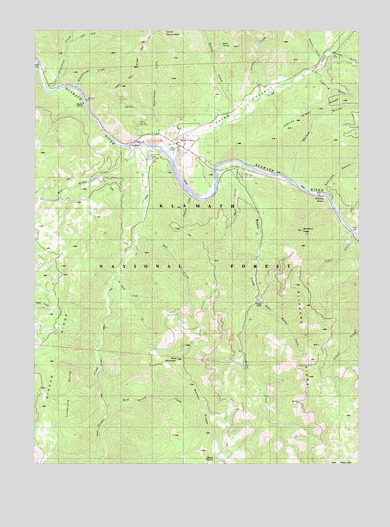
Seiad Valley, CA USGS Topographic Map
Click on map above to begin viewing in our Map Viewer.

This topographic map contains these locations and features:
Feature Name Type Latitude Longitude GNIS ID View Map
Bark Shanty CreekStreamN41.7660°W123.2242°218667View Map
Bittenbender CreekStreamN41.8582°W123.2353°219333View Map
Blue MountainSummitN41.7799°W123.1964°219508View Map
Canyon CreekStreamN41.8549°W123.1656°220560View Map
Caroline CreekStreamN41.8268°W123.1900°220631View Map
Darkey CreekStreamN41.8499°W123.1748°222026View Map
East Fork Portuguese CreekStreamN41.8721°W123.2376°222893View Map
East Walker CreekStreamN41.7976°W123.1670°1657602View Map
Fern SpringSpringN41.8484°W123.2100°1657610View Map
Gard CreekStreamN41.8310°W123.1809°1657616View Map
Granite PointCapeN41.8265°W123.1389°1657618View Map
Grider CreekStreamN41.8410°W123.2084°224611View Map
Grider Creek RanchLocaleN41.8387°W123.2067°1657619View Map
Hoags CampLocaleN41.7962°W123.1662°1657621View Map
Lightning GulchValleyN41.8626°W123.1439°227086View Map
Limestone BluffsCliffN41.7707°W123.2384°1657643View Map
Louie CreekStreamN41.8157°W123.1270°252552View Map
Lowden School (historical)SchoolN41.8451°W123.2045°1682353View Map
Maple SpringSpringN41.7515°W123.1808°228063View Map
Maple Spring CampLocaleN41.7512°W123.1803°276851View Map
No Name CreekStreamN41.8049°W123.2181°252551View Map
Portuguese CreekStreamN41.8582°W123.2473°230968View Map
Quail SpringSpringN41.8711°W123.1784°1657670View Map
Rocky Bar CampgroundLocaleN41.8160°W123.1284°231759View Map
Salt CreekStreamN41.8162°W123.2123°232306View Map
Sawmill GulchValleyN41.8671°W123.1431°232621View Map
Schoolhouse CreekStreamN41.8440°W123.2037°232675View Map
Schutts GulchValleyN41.8290°W123.1400°234660View Map
Seiad CreekStreamN41.8410°W123.1987°232792View Map
Seiad Elementary SchoolSchoolN41.8421°W123.1931°1701894View Map
Seiad Oaks Administration SiteLocaleN41.8460°W123.1864°276453View Map
Seiad ValleyPopulated PlaceN41.8404°W123.1925°232793View Map
Seiad ValleyValleyN41.8435°W123.1970°232794View Map
Seiad Valley Post OfficePost OfficeN41.8422°W123.1961°2760051View Map
Seiad Valley Volunteer Fire DepartmentBuildingN41.8416°W123.1938°2621932View Map
Seiad Work CenterLocaleN41.8404°W123.1970°276452View Map
Slinkard PeakSummitN41.8174°W123.1489°233291View Map
Slinkard RidgeRidgeN41.7865°W123.1403°1657682View Map
Walker CreekStreamN41.8357°W123.1714°237170View Map
Walker GulchValleyN41.8335°W123.1520°237176View Map
Walker RidgeRidgeN41.7662°W123.1848°1657693View Map
West Grider CreekStreamN41.8418°W123.2125°237491View Map
Williams GulchValleyN41.8679°W123.1378°237848View Map

Note: Coordinates in the location and feature list above are referenced to NAD83 datum.


Copyright (C) 2008-2025 Ryan Niemi / Sunset Dynamics ... All Rights Reserved