TopoQuest Logo
Do you find TopoQuest useful?
Help keep TopoQuest running and adding new maps/features by donating!
Bitcoin:  19c7KJd3qBynnjoSw5npx9KScwjBe4ifkT
Litecoin:  LXs6TkuXGGXo1vDsWCkWVdjQX94eUKd6ui
Home View Maps Find Maps Find Places Resources & Links


Eagan, Tennessee Topographic Map

USGS Map Title: Eagan, TN
USGS Map MRC: 36083E8
DRG (GeoTIFF) Download: o36083e8.tif


Neighboring USGS Topographic Map Quads:


  Saxton, KY  
36084F1
 

  Frakes, KY  
36083F8
 

  Kayjay, KY  
36083F7
 

  Jellico East, TN  
36084E1
 

  Eagan, TN  
36083E8
 

  Fork Ridge, TN  
36083E7
 

  La Follette, TN  
36084D1
 

  Well Spring, TN  
36083D8
 

  Ausmus, TN  
36083D7


Map MRC Location:

N37°
W84°
N37°
W83°
H8 H7 H6 H5 H4 H3 H2 H1
G8 G7 G6 G5 G4 G3 G2 G1
F8 F7 F6 F5 F4 F3 F2 F1
E8 E7 E6 E5 E4 E3 E2 E1
D8 D7 D6 D5 D4 D3 D2 D1
C8 C7 C6 C5 C4 C3 C2 C1
B8 B7 B6 B5 B4 B3 B2 B1
A8 A7 A6 A5 A4 A3 A2 A1
N36°
W84°
N36°
W83°

Eagan, TN USGS 1:24K Topographic Map Preview:
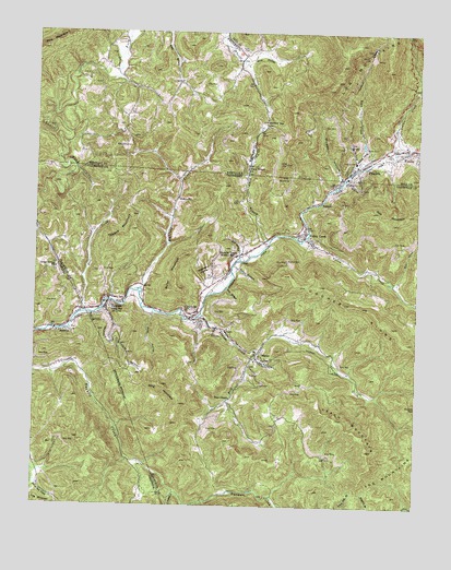
Eagan, TN USGS Topographic Map
Click on map above to begin viewing in our Map Viewer.

This topographic map contains these locations and features:
Feature Name Type Latitude Longitude GNIS ID View Map
AnthrasPopulated PlaceN36.5459°W83.9902°1275780View Map
Anthras Baptist ChurchChurchN36.5456°W83.9916°1318820View Map
Apple Grove ChurchChurchN36.5854°W83.8967°2554665View Map
Archer Center SchoolSchoolN36.5623°W83.9930°1275845View Map
Arnold Number Two MineMineN36.5384°W83.8999°1650660View Map
Back CreekStreamN36.5892°W83.8938°488203View Map
Bear CreekStreamN36.5598°W83.8833°1276602View Map
Bens BranchStreamN36.5026°W83.9219°1310684View Map
Big Three HollowValleyN36.5901°W83.8852°1310685View Map
Blue HollowValleyN36.6175°W83.9318°487523View Map
Boneyard HollowValleyN36.5846°W83.8821°1310686View Map
Bostica CemeteryCemeteryN36.5648°W83.9174°1278008View Map
Buck Hole HollowValleyN36.5632°W83.8911°1310689View Map
Buffalo CreekStreamN36.5570°W83.9658°1278909View Map
Buffalo SchoolSchoolN36.5812°W83.9535°1305510View Map
ClairfieldPopulated PlaceN36.5501°W83.9502°1280581View Map
Clairfield Elementary SchoolSchoolN36.5481°W83.9474°1317034View Map
Clairfield Missionary Baptist ChurchChurchN36.5487°W83.9449°1644772View Map
Clairfield Post OfficePost OfficeN36.5583°W83.9426°1650671View Map
Clear Fork Volunteer Fire DepartmentBuildingN36.5690°W83.9258°2654381View Map
Commissioner District 9CivilN36.5425°W83.8757°2464712View Map
Cooper RidgeRidgeN36.5529°W83.8927°1281221View Map
Days ChapelChurchN36.5284°W83.9358°1269521View Map
EaganPopulated PlaceN36.5520°W83.9769°1283282View Map
Eagan Baptist ChurchChurchN36.5545°W83.9769°1644778View Map
Eagan Post OfficePost OfficeN36.5550°W83.9750°1650677View Map
Eagan School (historical)SchoolN36.5534°W83.9771°1317041View Map
FondePopulated PlaceN36.5942°W83.8774°492295View Map
Fox BranchStreamN36.5648°W83.9341°1284762View Map
Hamlin TownPopulated PlaceN36.5659°W83.9344°1286670View Map
Hatfield GapGapN36.6015°W83.9241°493865View Map
Huddleson BranchStreamN36.5204°W83.9730°1311304View Map
Hurricane BranchStreamN36.5123°W83.9688°1311305View Map
Johnson HollowValleyN36.5086°W83.9143°1310716View Map
KidwellPopulated PlaceN36.5809°W83.9071°1315325View Map
King CemeteryCemeteryN36.5945°W83.9705°495737View Map
King HollowValleyN36.5505°W83.9617°1290225View Map
King MountainSummitN36.5317°W83.9580°1290228View Map
Kings BranchStreamN36.5031°W83.9383°1310717View Map
Leach MountainSummitN36.5148°W83.8905°1290860View Map
Little Tackett CreekStreamN36.5037°W83.9535°1291687View Map
MarionPopulated PlaceN36.5404°W83.9271°1292685View Map
Miller MountainSummitN36.5570°W83.9530°1293960View Map
Morgan HollowValleyN36.5868°W83.9001°498593View Map
Nolan BranchStreamN36.5640°W83.9349°1295800View Map
Partin CemeteryCemeteryN36.6201°W83.9302°500226View Map
Patterson HollowValleyN36.5690°W83.9562°1310720View Map
Pearl DivisionCivilN36.6081°W83.9735°1937194View Map
PrudenPopulated PlaceN36.5862°W83.9010°1310724View Map
PrudenPopulated PlaceN36.5906°W83.8913°501387View Map
Pruden Number Six MileMineN36.5806°W83.9035°1650702View Map
Pruden Post OfficePost OfficeN36.5848°W83.9021°1650703View Map
Pruden SchoolSchoolN36.5867°W83.8980°1317070View Map
Rock CreekStreamN36.5404°W83.9266°1299748View Map
Rogerston HollowValleyN36.5584°W83.9430°1300023View Map
Rose CreekStreamN36.5506°W83.9830°1300071View Map
Sowder CreekStreamN36.5934°W83.8855°504015View Map
Spar BranchStreamN36.5576°W83.9377°1270951View Map
Straight CreekStreamN36.5495°W83.9469°1303872View Map
Tackett Creek School (historical)SchoolN36.5148°W83.9441°1317087View Map
Teague MountainSummitN36.5726°W83.9683°1272263View Map
Tracy BranchStreamN36.5701°W83.9233°1304148View Map
Tracy Branch Baptist ChurchChurchN36.5890°W83.9302°505457View Map
Upper Eagan MineMineN36.5348°W83.9644°1650713View Map
Valley CreekPopulated PlaceN36.5720°W83.9119°1273332View Map
Valley CreekStreamN36.5698°W83.9130°1273334View Map
Valley Creek Missionary Baptist ChurchChurchN36.5704°W83.9102°1644830View Map
Valley Creek School (historical)SchoolN36.5715°W83.9102°1317094View Map

Note: Coordinates in the location and feature list above are referenced to NAD83 datum.


Copyright (C) 2008-2024 Ryan Niemi / Sunset Dynamics ... All Rights Reserved