TopoQuest Logo
Do you find TopoQuest useful?
Help keep TopoQuest running and adding new maps/features by donating!
Bitcoin:  19c7KJd3qBynnjoSw5npx9KScwjBe4ifkT
Litecoin:  LXs6TkuXGGXo1vDsWCkWVdjQX94eUKd6ui
Home View Maps Find Maps Find Places Resources & Links


East Dixfield, Maine Topographic Map

USGS Map Title: East Dixfield, ME
USGS Map MRC: 44070E3
DRG (GeoTIFF) Download: o44070e3.tif


Neighboring USGS Topographic Map Quads:


  Weld, ME  
44070F4
 

  Mount Blue, ME  
44070F3
 

  Farmington, ME  
44070F2
 

  Dixfield, ME  
44070E4
 

  East Dixfield, ME  
44070E3
 

  Wilton, ME  
44070E2
 

  Worthley Pond, ME  
44070D4
 

  Canton, ME  
44070D3
 

  Livermore Falls, ME  
44070D2


Map MRC Location:

N45°
W71°
N45°
W70°
H8 H7 H6 H5 H4 H3 H2 H1
G8 G7 G6 G5 G4 G3 G2 G1
F8 F7 F6 F5 F4 F3 F2 F1
E8 E7 E6 E5 E4 E3 E2 E1
D8 D7 D6 D5 D4 D3 D2 D1
C8 C7 C6 C5 C4 C3 C2 C1
B8 B7 B6 B5 B4 B3 B2 B1
A8 A7 A6 A5 A4 A3 A2 A1
N44°
W71°
N44°
W70°

East Dixfield, ME USGS 1:24K Topographic Map Preview:
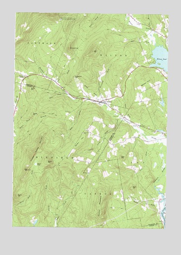
East Dixfield, ME USGS Topographic Map
Click on map above to begin viewing in our Map Viewer.

This topographic map contains these locations and features:
Feature Name Type Latitude Longitude GNIS ID View Map
Allen BrookStreamN44.5615°W70.2781°561178View Map
Bates BrookStreamN44.6034°W70.2628°561717View Map
Beaver PondSwampN44.5367°W70.3559°561958View Map
Birchland CemeteryCemeteryN44.5564°W70.2581°562360View Map
Brown MountainSummitN44.5381°W70.3470°563058View Map
Browns PeakSummitN44.6047°W70.3301°563080View Map
Burnt HillSummitN44.5181°W70.3713°563232View Map
Butterfield BrookStreamN44.5734°W70.3015°563304View Map
Butterfield HillSummitN44.5878°W70.3266°563308View Map
Canton MountainSummitN44.5078°W70.3031°563463View Map
Childs HillSummitN44.5659°W70.3595°563942View Map
Colonel Holman MountainSummitN44.5423°W70.3581°564246View Map
Cram BrookStreamN44.5840°W70.3401°564451View Map
Dean BrookStreamN44.5765°W70.3298°564912View Map
East DixfieldPopulated PlaceN44.5734°W70.3037°565599View Map
East Dixfield CemeteryCemeteryN44.5753°W70.3071°2736285View Map
East Dixfield Post OfficePost OfficeN44.5736°W70.3048°2789356View Map
Fletcher BrookStreamN44.5053°W70.3395°566297View Map
Gould HillSummitN44.5798°W70.3617°566994View Map
Hugh BrookStreamN44.5748°W70.3131°568440View Map
Intervale CemeteryCemeteryN44.6192°W70.2720°568661View Map
Jolly BrookStreamN44.5348°W70.2512°568943View Map
Law MountainSummitN44.6028°W70.3107°569405View Map
Little MountainSummitN44.5334°W70.3623°569919View Map
Nebo MountainSummitN44.5410°W70.2871°572079View Map
Paine HillSummitN44.5237°W70.2776°572929View Map
Pine BrookStreamN44.6162°W70.2659°573346View Map
PinnacleSummitN44.5320°W70.3181°573434View Map
Potash BrookStreamN44.5712°W70.2984°573707View Map
Ridley BrookStreamN44.5156°W70.2539°574205View Map
Science HillSummitN44.5655°W70.3454°575036View Map
Science Hill CemeteryCemeteryN44.5668°W70.3296°575037View Map
Sevenmile StreamStreamN44.5170°W70.2514°575247View Map
Severy HillSummitN44.5500°W70.3216°575250View Map
Severy Hill CemeteryCemeteryN44.5551°W70.3181°575251View Map
Tainter CornerPopulated PlaceN44.5876°W70.3653°579757View Map
Tainter Corner CemeteryCemeteryN44.5879°W70.3660°2736315View Map
Tucker Valley BrookStreamN44.5631°W70.2859°577389View Map
Walker HillSummitN44.5826°W70.2709°577793View Map
Wilson PondLakeN44.5967°W70.2504°578552View Map
Wilson StreamStreamN44.6070°W70.2562°578557View Map

Note: Coordinates in the location and feature list above are referenced to NAD83 datum.


Copyright (C) 2008-2024 Ryan Niemi / Sunset Dynamics ... All Rights Reserved