TopoQuest Logo
Do you find TopoQuest useful?
Help keep TopoQuest running and adding new maps/features by donating!
Bitcoin:  19c7KJd3qBynnjoSw5npx9KScwjBe4ifkT
Litecoin:  LXs6TkuXGGXo1vDsWCkWVdjQX94eUKd6ui
Home View Maps Find Maps Find Places Resources & Links


Livermore Falls, Maine Topographic Map

USGS Map Title: Livermore Falls, ME
USGS Map MRC: 44070D2
DRG (GeoTIFF) Download: o44070d2.tif


Neighboring USGS Topographic Map Quads:


  East Dixfield, ME  
44070E3
 

  Wilton, ME  
44070E2
 

  Farmington Falls, ME  
44070E1
 

  Canton, ME  
44070D3
 

  Livermore Falls, ME  
44070D2
 

  Fayette, ME  
44070D1
 

  Buckfield, ME  
44070C3
 

  Turner Center, ME  
44070C2
 

  Wayne, ME  
44070C1


Map MRC Location:

N45°
W71°
N45°
W70°
H8 H7 H6 H5 H4 H3 H2 H1
G8 G7 G6 G5 G4 G3 G2 G1
F8 F7 F6 F5 F4 F3 F2 F1
E8 E7 E6 E5 E4 E3 E2 E1
D8 D7 D6 D5 D4 D3 D2 D1
C8 C7 C6 C5 C4 C3 C2 C1
B8 B7 B6 B5 B4 B3 B2 B1
A8 A7 A6 A5 A4 A3 A2 A1
N44°
W71°
N44°
W70°

Livermore Falls, ME USGS 1:24K Topographic Map Preview:
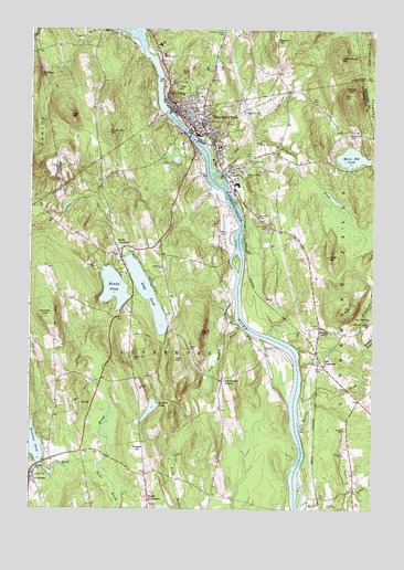
Livermore Falls, ME USGS Topographic Map
Click on map above to begin viewing in our Map Viewer.

This topographic map contains these locations and features:
Feature Name Type Latitude Longitude GNIS ID View Map
Alden CemeteryCemeteryN44.4162°W70.2406°561117View Map
Androscoggin River ReservoirReservoirN44.4713°W70.1907°1773532View Map
Androscoggin River ReservoirReservoirN44.4787°W70.2008°1773534View Map
Bartlett PondLakeN44.4012°W70.2055°561613View Map
Beals BrookStreamN44.3870°W70.2262°561769View Map
Billington BrookStreamN44.4176°W70.1278°562274View Map
Boothby CemeteryCemeteryN44.3764°W70.2056°2729304View Map
Bowman FieldAirportN44.4116°W70.1458°582178View Map
Brackett CemeteryCemeteryN44.4514°W70.1673°562835View Map
Brettuns PondReservoirN44.3918°W70.2498°562935View Map
Brettuns Pond DamDamN44.3849°W70.2479°1774308View Map
Chase HillSummitN44.3910°W70.2099°563877View Map
Cheney Private YardCemeteryN44.4398°W70.2161°2729307View Map
ChisholmPopulated PlaceN44.4815°W70.1995°563957View Map
Chisholm Census Designated PlaceCensusN44.4917°W70.1919°2377898View Map
Chisholm SquareParkN44.4796°W70.1968°2585678View Map
Clay BrookStreamN44.4617°W70.1798°564060View Map
Cow HillSummitN44.4775°W70.2353°564407View Map
East LivermorePopulated PlaceN44.4131°W70.1439°579274View Map
East Livermore ChurchChurchN44.4240°W70.1256°565632View Map
Emmanuel Assembly of God ChurchChurchN44.4734°W70.1717°1908823View Map
Fish Meadow BrookStreamN44.4228°W70.1734°566207View Map
Ford BrookStreamN44.3848°W70.2412°566373View Map
Ford HillSummitN44.4410°W70.1412°566376View Map
Fuller CemeteryCemeteryN44.4150°W70.2126°2736220View Map
Gibbs CemeteryCemeteryN44.4170°W70.1917°566773View Map
Goding CemeteryCemeteryN44.4628°W70.2183°2729360View Map
Hackett HillSummitN44.4249°W70.2448°567406View Map
Haines CornerPopulated PlaceN44.4223°W70.1442°579375View Map
Hillman CemeteryCemeteryN44.4167°W70.1653°568058View Map
Holy Cross CemeteryCemeteryN44.4484°W70.1634°568223View Map
Hunton BrookStreamN44.3970°W70.1514°568485View Map
Intermediate Learning CenterSchoolN44.4690°W70.1809°1908861View Map
Jay Elementary SchoolSchoolN44.4961°W70.2029°568780View Map
Jay Fire Rescue Station 2BuildingN44.4881°W70.2008°2552920View Map
Jay Post OfficePost OfficeN44.4955°W70.2047°1908346View Map
Jug HillSummitN44.4270°W70.1359°569016View Map
Lakeside CemeteryCemeteryN44.3864°W70.2478°569323View Map
Lamb CemeteryCemeteryN44.4627°W70.2183°2729710View Map
Little Moose HillSummitN44.4931°W70.1376°569910View Map
LivermorePopulated PlaceN44.3840°W70.2492°570129View Map
Livermore CenterPopulated PlaceN44.4090°W70.1798°579482View Map
Livermore Elementary SchoolSchoolN44.4380°W70.2024°570131View Map
Livermore FallsPopulated PlaceN44.4753°W70.1881°570130View Map
Livermore Falls CemeteryCemeteryN44.4709°W70.1803°1908905View Map
Livermore Falls Census Designated PlaceCensusN44.4723°W70.1808°2377929View Map
Livermore Falls DamDamN44.4713°W70.1907°1773531View Map
Livermore Falls Fire DepartmentBuildingN44.4723°W70.1898°2552899View Map
Livermore Falls Fire DepartmentBuildingN44.4720°W70.1848°2552801View Map
Livermore Falls High SchoolSchoolN44.4710°W70.1795°1908906View Map
Livermore Falls Middle School (historical)SchoolN44.4684°W70.1809°1908907View Map
Livermore Falls Police DepartmentBuildingN44.4722°W70.1898°2735836View Map
Livermore Falls Post OfficePost OfficeN44.4745°W70.1911°2768957View Map
Livermore Fire DepartmentBuildingN44.4412°W70.2183°2552753View Map
Livermore Post OfficePost OfficeN44.3834°W70.2497°2768956View Map
Long PondLakeN44.4312°W70.2071°570276View Map
Long Pond Seaplane BaseAirportN44.4334°W70.2156°582197View Map
Meadow BrookStreamN44.4176°W70.1276°571076View Map
Moose HillSummitN44.4837°W70.1331°571591View Map
Moose Hill CemeteryCemeteryN44.4731°W70.1337°571595View Map
Moose Hill PondLakeN44.4667°W70.1328°571596View Map
Mosquito BrookStreamN44.4984°W70.2092°571728View Map
New England Region - 2-digit Hydrologic Unit Code - 01AreaN44.3827°W70.2126°2730131View Map
Norland ChurchChurchN44.4065°W70.2103°572230View Map
Norlands Living History CenterLocaleN44.4076°W70.2106°1908933View Map
North LivermorePopulated PlaceN44.4423°W70.2178°572360View Map
North Livermore CemeteryCemeteryN44.4437°W70.2197°1908937View Map
Northstar Emergency Medical Services LivermoreBuildingN44.4646°W70.1925°2666821View Map
Noyes CemeteryCemeteryN44.4462°W70.1806°572533View Map
Oak HillSummitN44.4148°W70.1952°572584View Map
Otis DamDamN44.4787°W70.2008°1773533View Map
Philbrick HillSummitN44.4731°W70.2216°573255View Map
Pitts CemeteryCemeteryN44.4419°W70.2124°2736105View Map
Pleasant Hill CemeteryCemeteryN44.4651°W70.1706°573482View Map
Pleasant Valley CemeteryCemeteryN44.4237°W70.1264°573523View Map
Pleasant View CemeteryCemeteryN44.4623°W70.1723°573524View Map
Primary Learning CenterSchoolN44.4765°W70.1870°1908959View Map
Redwater BrookStreamN44.4726°W70.1698°574114View Map
Richs MountainSummitN44.4211°W70.1874°574180View Map
Round PondLakeN44.4327°W70.2193°574502View Map
Scott BrookStreamN44.3765°W70.1503°575047View Map
Shy CornerPopulated PlaceN44.4628°W70.1789°579691View Map
Smith SchoolSchoolN44.4409°W70.2181°575644View Map
Spruce Mountain High School NorthSchoolN44.4936°W70.2004°2738135View Map
Spruce Mountain Middle SchoolSchoolN44.4936°W70.1993°568777View Map
Thompson Fruitland CemeteryCemeteryN44.4792°W70.2262°2736610View Map
Town of LivermoreCivilN44.4079°W70.2150°582566View Map
Town of Livermore FallsCivilN44.4325°W70.1426°582567View Map
Treat CemeteryCemeteryN44.4673°W70.1689°577293View Map
Treat HillSummitN44.4838°W70.1965°577294View Map
Treat Memorial LibraryBuildingN44.4743°W70.1908°1909023View Map
Warren HillSummitN44.4967°W70.1603°577847View Map
Waters Hill CemeteryCemeteryN44.4140°W70.2123°577892View Map
Western Maine Family Health CenterHospitalN44.4757°W70.1919°2513248View Map
Whitney HillSummitN44.4881°W70.2489°578418View Map

Note: Coordinates in the location and feature list above are referenced to NAD83 datum.


Copyright (C) 2008-2024 Ryan Niemi / Sunset Dynamics ... All Rights Reserved