TopoQuest Logo
Do you find TopoQuest useful?
Help keep TopoQuest running and adding new maps/features by donating!
Bitcoin:  19c7KJd3qBynnjoSw5npx9KScwjBe4ifkT
Litecoin:  LXs6TkuXGGXo1vDsWCkWVdjQX94eUKd6ui
Home View Maps Find Maps Find Places Resources & Links


East Glacier Park, Montana Topographic Map

USGS Map Title: East Glacier Park, MT
USGS Map MRC: 48113D2
DRG (GeoTIFF) Download: o48113d2.tif


Neighboring USGS Topographic Map Quads:


  Kiowa, MT  
48113E3
 

  Starr School, MT  
48113E2
 

  Browning, MT  
48113E1
 

  Dancing Lady Mountain, MT  
48113D3
 

  East Glacier Park, MT  
48113D2
 

  Big Rock, MT  
48113D1
 

  Summit, MT  
48113C3
 

  Hyde Creek, MT  
48113C2
 

  Half Dome Crag, MT  
48113C1


Map MRC Location:

N49°
W114°
N49°
W113°
H8 H7 H6 H5 H4 H3 H2 H1
G8 G7 G6 G5 G4 G3 G2 G1
F8 F7 F6 F5 F4 F3 F2 F1
E8 E7 E6 E5 E4 E3 E2 E1
D8 D7 D6 D5 D4 D3 D2 D1
C8 C7 C6 C5 C4 C3 C2 C1
B8 B7 B6 B5 B4 B3 B2 B1
A8 A7 A6 A5 A4 A3 A2 A1
N48°
W114°
N48°
W113°

East Glacier Park, MT USGS 1:24K Topographic Map Preview:
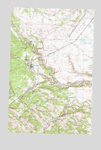
East Glacier Park, MT USGS Topographic Map
Click on map above to begin viewing in our Map Viewer.

This topographic map contains these locations and features:
Feature Name Type Latitude Longitude GNIS ID View Map
32N12W34CBCD01 SpringSpringN48.4880°W113.1593°1635705View Map
Big Spring LakeLakeN48.4115°W113.1540°779881View Map
Bison Creek RanchLocaleN48.4166°W113.2148°779949View Map
Buffalo LakesLakeN48.3909°W113.2369°780553View Map
Chapel of the AscensionChurchN48.4400°W113.2120°1750509View Map
Dawson FallsFallsN48.4233°W113.2092°782123View Map
East Glacier ParkPopulated PlaceN48.4414°W113.2181°782929View Map
East Glacier Park Branch LibraryBuildingN48.4427°W113.2179°1750545View Map
East Glacier Park CemeteryCemeteryN48.4601°W113.2294°782930View Map
East Glacier Park Post OfficePost OfficeN48.4442°W113.2173°1750476View Map
East Glacier Park SchoolSchoolN48.4402°W113.2180°1750445View Map
East Glacier Park VillagePopulated PlaceN48.4469°W113.2231°1867336View Map
East Glacier Park Village Census Designated PlaceCensusN48.4459°W113.2235°2408707View Map
East Glacier Park Volunteer Fire DepartmentBuildingN48.4436°W113.2175°1750451View Map
Elk (historical)LocaleN48.4833°W113.1509°1750474View Map
Firebrand CampgroundLocaleN48.4091°W113.2365°1750534View Map
Glacier ParkLocaleN48.4422°W113.2193°1750475View Map
Glacier Park Lodge Golf CourseLocaleN48.4452°W113.2231°1750546View Map
Lubec RidgeRidgeN48.3877°W113.2261°786698View Map
Midvale CreekStreamN48.4233°W113.1770°787331View Map
Midvale Creek BridgeBridgeN48.3758°W113.2184°1750564View Map
Morning Eagle LakeLakeN48.4082°W113.1942°787691View Map
Railroad CreekStreamN48.4291°W113.1893°789331View Map
Sears Motel and CampgroundLocaleN48.4486°W113.2259°1750531View Map
Smileys RV ParkLocaleN48.4425°W113.2162°1750532View Map
Spotted RobeLocaleN48.4814°W113.1531°791184View Map
Two Medicine FallsFallsN48.4654°W113.2215°792556View Map
Y Lazy R RV ParkLocaleN48.4400°W113.2168°1750530View Map

Note: Coordinates in the location and feature list above are referenced to NAD83 datum.


Copyright (C) 2008-2025 Ryan Niemi / Sunset Dynamics ... All Rights Reserved