TopoQuest Logo
Do you find TopoQuest useful?
Help keep TopoQuest running and adding new maps/features by donating!
Bitcoin:  19c7KJd3qBynnjoSw5npx9KScwjBe4ifkT
Litecoin:  LXs6TkuXGGXo1vDsWCkWVdjQX94eUKd6ui
Home View Maps Find Maps Find Places Resources & Links


Half Dome Crag, Montana Topographic Map

USGS Map Title: Half Dome Crag, MT
USGS Map MRC: 48113C1
DRG (GeoTIFF) Download: o48113c1.tif


Neighboring USGS Topographic Map Quads:


  East Glacier Park, MT  
48113D2
 

  Big Rock, MT  
48113D1
 

  Magee Ranch, MT  
48112D8
 

  Hyde Creek, MT  
48113C2
 

  Half Dome Crag, MT  
48113C1
 

  Mitten Lake, MT  
48112C8
 

  Crescent Cliff, MT  
48113B2
 

  Morningstar Mountain, MT  
48113B1
 

  Swift Reservoir, MT  
48112B8


Map MRC Location:

N49°
W114°
N49°
W113°
H8 H7 H6 H5 H4 H3 H2 H1
G8 G7 G6 G5 G4 G3 G2 G1
F8 F7 F6 F5 F4 F3 F2 F1
E8 E7 E6 E5 E4 E3 E2 E1
D8 D7 D6 D5 D4 D3 D2 D1
C8 C7 C6 C5 C4 C3 C2 C1
B8 B7 B6 B5 B4 B3 B2 B1
A8 A7 A6 A5 A4 A3 A2 A1
N48°
W114°
N48°
W113°

Half Dome Crag, MT USGS 1:24K Topographic Map Preview:
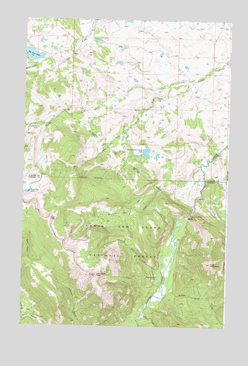
Half Dome Crag, MT USGS Topographic Map
Click on map above to begin viewing in our Map Viewer.

This topographic map contains these locations and features:
Feature Name Type Latitude Longitude GNIS ID View Map
30N12W13CCBB01 WellWellN48.3569°W113.1179°1635087View Map
Coon CreekStreamN48.3305°W113.0612°781618View Map
Dog Gun LakeLakeN48.3612°W113.1236°782443View Map
Half Dome CragSummitN48.2708°W113.0795°784462View Map
Killem Quick CreekStreamN48.2677°W113.0379°785732View Map
Kiyo CragSummitN48.2936°W113.1081°785783View Map
Kiyo Crag LakeLakeN48.3043°W113.1220°785784View Map
Little Badger Forest Service StationLocaleN48.3336°W113.1092°798893View Map
Little Plume PeakSummitN48.2755°W113.0098°786344View Map
Lookout CreekStreamN48.2555°W113.0498°786550View Map
Minnie White Horse LakeLakeN48.3210°W113.0514°787486View Map
North Fork Little Badger CreekStreamN48.3483°W113.0365°788197View Map
PalookavilleLocaleN48.3302°W113.1215°801275View Map
Red Poacher CreekStreamN48.2539°W113.1242°789472View Map
Sawmill CreekStreamN48.3161°W113.0165°790054View Map
Slippery Hoof CreekStreamN48.2744°W113.0359°790681View Map
Slippery Hoof LakeLakeN48.2698°W113.0424°790682View Map
South Fork Little Badger CreekStreamN48.3480°W113.0362°790999View Map

Note: Coordinates in the location and feature list above are referenced to NAD83 datum.


Copyright (C) 2008-2025 Ryan Niemi / Sunset Dynamics ... All Rights Reserved