TopoQuest Logo
Do you find TopoQuest useful?
Help keep TopoQuest running and adding new maps/features by donating!
Bitcoin:  19c7KJd3qBynnjoSw5npx9KScwjBe4ifkT
Litecoin:  LXs6TkuXGGXo1vDsWCkWVdjQX94eUKd6ui
Home View Maps Find Maps Find Places Resources & Links


Summit, Montana Topographic Map

USGS Map Title: Summit, MT
USGS Map MRC: 48113C3
DRG (GeoTIFF) Download: o48113c3.tif


Neighboring USGS Topographic Map Quads:


  Mount Rockwell, MT  
48113D4
 

  Dancing Lady Mountain, MT  
48113D3
 

  East Glacier Park, MT  
48113D2
 

  Blacktail, MT  
48113C4
 

  Summit, MT  
48113C3
 

  Hyde Creek, MT  
48113C2
 

  Mount Bradley, MT  
48113B4
 

  Red Plume Mountain, MT  
48113B3
 

  Crescent Cliff, MT  
48113B2


Map MRC Location:

N49°
W114°
N49°
W113°
H8 H7 H6 H5 H4 H3 H2 H1
G8 G7 G6 G5 G4 G3 G2 G1
F8 F7 F6 F5 F4 F3 F2 F1
E8 E7 E6 E5 E4 E3 E2 E1
D8 D7 D6 D5 D4 D3 D2 D1
C8 C7 C6 C5 C4 C3 C2 C1
B8 B7 B6 B5 B4 B3 B2 B1
A8 A7 A6 A5 A4 A3 A2 A1
N48°
W114°
N48°
W113°

Summit, MT USGS 1:24K Topographic Map Preview:
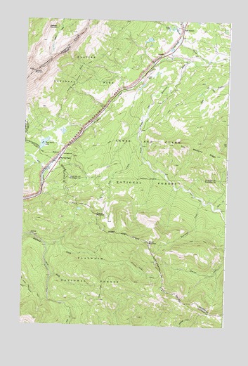
Summit, MT USGS Topographic Map
Click on map above to begin viewing in our Map Viewer.

This topographic map contains these locations and features:
Feature Name Type Latitude Longitude GNIS ID View Map
Cataract (historical)LocaleN48.3486°W113.3101°1750443View Map
Coonsa CreekStreamN48.3597°W113.2620°781628View Map
Elkcalf MountainSummitN48.2844°W113.2980°783126View Map
False SummitPopulated PlaceN48.3719°W113.2795°783300View Map
Flattop MountainSummitN48.2953°W113.3299°783529View Map
Lubec Post Office (historical)Post OfficeN48.3714°W113.2787°1750462View Map
Marias PassGapN48.3166°W113.3548°786843View Map
Pike CreekStreamN48.3250°W113.3037°788854View Map
Pike Post Office (historical)Post OfficeN48.3583°W113.2926°1750427View Map
Rising Wolf (historical)LocaleN48.3714°W113.2787°1750463View Map
Rising Wolf ResortLocaleN48.3314°W113.3029°798887View Map
Roosevelt MemorialLocaleN48.3172°W113.3532°798886View Map
Rowe CreekStreamN48.2989°W113.2562°793896View Map
Skeleton MountainSummitN48.3719°W113.3620°790582View Map
SummitPopulated PlaceN48.3194°W113.3534°791661View Map
SummitLocaleN48.3194°W113.3534°1750426View Map
Summit CampgroundLocaleN48.3197°W113.3509°794047View Map
Summit CreekStreamN48.3583°W113.2759°767971View Map
Summit MountainSummitN48.3537°W113.3705°791670View Map
Summit TrailTrailN48.3214°W113.3657°791673View Map
Three Bears LakeLakeN48.3242°W113.3632°792117View Map
Townsend CreekStreamN48.3011°W113.2648°792299View Map
West Fork Skyland CreekStreamN48.2825°W113.3607°793078View Map

Note: Coordinates in the location and feature list above are referenced to NAD83 datum.


Copyright (C) 2008-2024 Ryan Niemi / Sunset Dynamics ... All Rights Reserved