TopoQuest Logo
Do you find TopoQuest useful?
Help keep TopoQuest running and adding new maps/features by donating!
Bitcoin:  19c7KJd3qBynnjoSw5npx9KScwjBe4ifkT
Litecoin:  LXs6TkuXGGXo1vDsWCkWVdjQX94eUKd6ui
Home View Maps Find Maps Find Places Resources & Links


East Leroy, Michigan Topographic Map

USGS Map Title: East Leroy, MI
USGS Map MRC: 42085B2
DRG (GeoTIFF) Download: o42085b2.tif


Neighboring USGS Topographic Map Quads:


  Augusta, MI  
42085C3
 

  Battle Creek, MI  
42085C2
 

  Ceresco, MI  
42085C1
 

  Climax, MI  
42085B3
 

  East Leroy, MI  
42085B2
 

  Ellis Corners, MI  
42085B1
 

  Leonidas, MI  
42085A3
 

  Union City, MI  
42085A2
 

  Burlington, MI  
42085A1


Map MRC Location:

N43°
W86°
N43°
W85°
H8 H7 H6 H5 H4 H3 H2 H1
G8 G7 G6 G5 G4 G3 G2 G1
F8 F7 F6 F5 F4 F3 F2 F1
E8 E7 E6 E5 E4 E3 E2 E1
D8 D7 D6 D5 D4 D3 D2 D1
C8 C7 C6 C5 C4 C3 C2 C1
B8 B7 B6 B5 B4 B3 B2 B1
A8 A7 A6 A5 A4 A3 A2 A1
N42°
W86°
N42°
W85°

East Leroy, MI USGS 1:24K Topographic Map Preview:
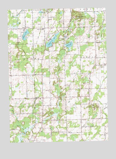
East Leroy, MI USGS Topographic Map
Click on map above to begin viewing in our Map Viewer.

This topographic map contains these locations and features:
Feature Name Type Latitude Longitude GNIS ID View Map
Abscota CemeteryCemeteryN42.1453°W85.1583°2109287View Map
Abscota Post Office (historical)Post OfficeN42.1456°W85.1583°2630180View Map
Abscota SchoolSchoolN42.1445°W85.1578°619795View Map
Alder CreekStreamN42.1545°W85.1303°619923View Map
Binder Park Golf CourseLocaleN42.2361°W85.1583°2629491View Map
Birchwood Estates Mobile Home ParkPopulated PlaceN42.1278°W85.2250°2630119View Map
Blackett SchoolSchoolN42.2025°W85.2075°621539View Map
Burrell SchoolSchoolN42.1873°W85.2467°622321View Map
Camp HolstonLocaleN42.2189°W85.1731°2109294View Map
Cedar Farms Golf ClubLocaleN42.2494°W85.2383°2629486View Map
Charles Binder ParkParkN42.2417°W85.1556°2109293View Map
Coates SchoolSchoolN42.1837°W85.1789°623514View Map
Cotton LakeLakeN42.2157°W85.1722°623865View Map
East LeroyPopulated PlaceN42.1662°W85.2175°625226View Map
East Leroy Community ChurchChurchN42.1592°W85.2058°2630097View Map
East Leroy Elementary SchoolSchoolN42.1658°W85.2106°2630096View Map
East Leroy Post OfficePost OfficeN42.1667°W85.2214°2630094View Map
East Leroy Station (historical)LocaleN42.1661°W85.2178°2630093View Map
French DrainCanalN42.1319°W85.1256°2109286View Map
German CemeteryCemeteryN42.1669°W85.1653°2630242View Map
Graham LakeLakeN42.2195°W85.1942°627070View Map
Hickory Hills Village Mobile Home ParkPopulated PlaceN42.2244°W85.1772°2629510View Map
Houghton DrainCanalN42.1847°W85.1667°2109291View Map
JoppaPopulated PlaceN42.1881°W85.2175°629387View Map
Joppa Post Office (historical)Post OfficeN42.1881°W85.2175°2630162View Map
Joppa Station (historical)LocaleN42.1881°W85.2175°2630056View Map
Leroy Township Fire DepartmentBuildingN42.1904°W85.2172°2636038View Map
Mather CemeteryCemeteryN42.1736°W85.1986°2109292View Map
Miller and Melody DrainCanalN42.1392°W85.1611°2109288View Map
Morgan CemeteryCemeteryN42.2398°W85.1983°632684View Map
Morgan CornersPopulated PlaceN42.2312°W85.2025°632686View Map
Mud LakeLakeN42.2370°W85.2370°632907View Map
Newton Post Office (historical)Post OfficeN42.1967°W85.1389°2630157View Map
Newton SchoolSchoolN42.1959°W85.1386°633384View Map
Newton Township Fire DepartmentBuildingN42.1956°W85.1394°2636256View Map
Old Red SchoolSchoolN42.1662°W85.1969°634013View Map
Paradise SchoolSchoolN42.2134°W85.2467°634348View Map
Pearl LakeLakeN42.2472°W85.2086°634526View Map
Severence CreekStreamN42.2148°W85.2005°637582View Map
SonomaPopulated PlaceN42.2328°W85.2280°638248View Map
Sonoma Elementary SchoolSchoolN42.2311°W85.2050°2629500View Map
Sonoma LakeLakeN42.2259°W85.2280°638249View Map
Sonoma Post Office (historical)Post OfficeN42.2328°W85.2092°2630136View Map
Sonoma Station (historical)LocaleN42.2319°W85.2089°2630061View Map
Stanley CornersPopulated PlaceN42.2175°W85.1378°638721View Map
Stanley Post Office (historical)Post OfficeN42.2175°W85.1378°2630131View Map
Township of LeroyCivilN42.2028°W85.2374°1626607View Map
Walker CemeteryCemeteryN42.1353°W85.2119°2109290View Map
Walker SchoolSchoolN42.1323°W85.2153°1615699View Map
Waterman DrainCanalN42.1400°W85.1894°2109289View Map

Note: Coordinates in the location and feature list above are referenced to NAD83 datum.


Copyright (C) 2008-2025 Ryan Niemi / Sunset Dynamics ... All Rights Reserved