TopoQuest Logo
Do you find TopoQuest useful?
Help keep TopoQuest running and adding new maps/features by donating!
Bitcoin:  19c7KJd3qBynnjoSw5npx9KScwjBe4ifkT
Litecoin:  LXs6TkuXGGXo1vDsWCkWVdjQX94eUKd6ui
Home View Maps Find Maps Find Places Resources & Links


East Middlebury, Vermont Topographic Map

USGS Map Title: East Middlebury, VT
USGS Map MRC: 43073H1
DRG (GeoTIFF) Download: o43073h1.tif


Neighboring USGS Topographic Map Quads:


  Middlebury, VT  
44073A2
 

  South Mountain, VT  
44073A1
 

  Lincoln, VT  
44072A8
 

  Cornwall, VT  
43073H2
 

  East Middlebury, VT  
43073H1
 

  Bread Loaf, VT  
43072H8
 

  Sudbury, VT  
43073G2
 

  Brandon, VT  
43073G1
 

  Mount Carmel, VT  
43072G8


Map MRC Location:

N44°
W74°
N44°
W73°
H8 H7 H6 H5 H4 H3 H2 H1
G8 G7 G6 G5 G4 G3 G2 G1
F8 F7 F6 F5 F4 F3 F2 F1
E8 E7 E6 E5 E4 E3 E2 E1
D8 D7 D6 D5 D4 D3 D2 D1
C8 C7 C6 C5 C4 C3 C2 C1
B8 B7 B6 B5 B4 B3 B2 B1
A8 A7 A6 A5 A4 A3 A2 A1
N43°
W74°
N43°
W73°

East Middlebury, VT USGS 1:24K Topographic Map Preview:
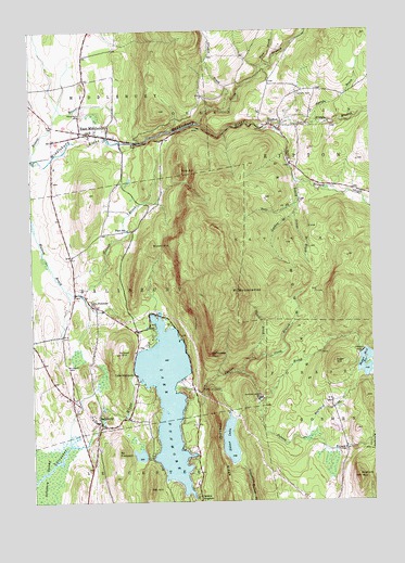
East Middlebury, VT USGS Topographic Map
Click on map above to begin viewing in our Map Viewer.

This topographic map contains these locations and features:
Feature Name Type Latitude Longitude GNIS ID View Map
Barnard BrookStreamN43.8917°W73.0243°1460559View Map
Beaver BrookStreamN43.9662°W73.1240°1460581View Map
Blueberry Hill Winter Sports AreaLocaleN43.8928°W73.0062°1461697View Map
Branbury State ParkParkN43.9059°W73.0715°1461699View Map
Brandy BrookStreamN43.9540°W73.0021°1460654View Map
Bryant MountainSummitN43.9431°W73.0804°1460673View Map
Camp Brebeuf for BoysLocaleN43.8867°W73.0829°1918059View Map
Camp CharidanLocaleN43.9759°W73.0143°1918060View Map
Camp KeewaydinLocaleN43.9251°W73.0759°1918061View Map
Chandler RidgeRidgeN43.8878°W73.0559°1460717View Map
Cooks CemeteryCemeteryN43.9832°W73.0260°1460753View Map
Dragon BrookStreamN43.9784°W73.0534°1460809View Map
Dutton BrookStreamN43.9017°W73.0418°1460818View Map
East MiddleburyPopulated PlaceN43.9734°W73.1062°1460830View Map
East Middlebury Census Designated PlaceCensusN43.9747°W73.1056°2586629View Map
East Middlebury Post OfficePost OfficeN43.9736°W73.1066°1918084View Map
Falls of LanaFallsN43.9042°W73.0626°1461057View Map
Falls of Lana Picnic GroundsLocaleN43.9092°W73.0593°1461695View Map
Falls of Lana TrailTrailN43.9056°W73.0626°1918094View Map
Fire BrookStreamN43.9909°W73.0390°1460873View Map
Galvin CemeteryCemeteryN43.9567°W73.0026°1460894View Map
Gea CemeteryCemeteryN43.9859°W73.0487°1918105View Map
Gee CemeteryCemeteryN43.9859°W73.0487°1461687View Map
Gonya BrookStreamN43.9523°W73.0276°1460909View Map
Goshen BrookStreamN43.9603°W73.0276°1460916View Map
Goshen DamDamN43.9145°W73.0037°1460917View Map
Hale BrookStreamN43.9553°W73.0262°1460947View Map
Hogback MountainSummitN43.8812°W73.0054°1460994View Map
Keewaydin TrailTrailN43.9284°W73.0662°1461038View Map
Lake Dumore KampersvilleLocaleN43.9234°W73.0846°1918137View Map
Lake DunmorePopulated PlaceN43.9090°W73.0871°1461054View Map
Lake DunmoreLakeN43.9026°W73.0752°1460815View Map
Lake Dunmore DamDamN43.9101°W73.0879°1766630View Map
Lake Dunmore SchoolSchoolN43.9273°W73.1018°1461055View Map
Middle Branch Middlebury RiverStreamN43.9740°W73.0351°1461145View Map
Middlebury Airport (historical)AirportN43.9856°W73.0957°1461686View Map
Middlebury State AirportAirportN43.9854°W73.0964°1461938View Map
Middlebury Volunteer Fire Department - Station 2BuildingN43.9736°W73.1052°2121348View Map
Moosalamoo CampgroundLocaleN43.9192°W73.0282°1461694View Map
Mount MoosalamooSummitN43.9303°W73.0498°1461169View Map
Mount Moosalamoo Campground TrailTrailN43.9131°W73.0412°1918176View Map
Mount Moosalamoo TrailTrailN43.9281°W73.0426°1461811View Map
Mount PleasantSummitN43.8884°W73.0923°1461286View Map
Nabby Cooper CemeteryCemeteryN43.9066°W73.1149°1918178View Map
Nature TrailTrailN43.9106°W73.0648°1918179View Map
North Branch Middlebury RiverStreamN43.9753°W73.0629°1461218View Map
North Branch Sucker BrookStreamN43.9095°W73.0484°1461220View Map
North Branch TrailTrailN43.9120°W73.0407°1461696View Map
North Goshen CemeteryCemeteryN43.9028°W73.0148°1918185View Map
Oak HillSummitN43.8781°W73.0826°1461238View Map
Oak Ridge TrailTrailN43.9453°W73.0529°1461691View Map
Pine HillSummitN43.9628°W73.0698°1461279View Map
Plain SchoolSchoolN43.9473°W73.0896°1461284View Map
Prospect CemeteryCemeteryN43.9776°W73.1059°1461297View Map
Rattlesnake PointCliffN43.9145°W73.0601°1461312View Map
Rice CemeteryCemeteryN43.9471°W73.0987°1918208View Map
Riley Bostwick Wildlife Management AreaParkN43.9256°W73.0934°1918212View Map
RiptonPopulated PlaceN43.9737°W73.0340°1461330View Map
Ripton Elementary SchoolSchoolN43.9851°W73.0382°1918214View Map
Ripton Fire DepartmentBuildingN43.9862°W73.0374°2121345View Map
Robert Frost Interpretive TrailTrailN43.9562°W73.0112°1461693View Map
Robert Frost WaysideLocaleN43.9615°W73.0179°1918217View Map
Robert Frost WaysideParkN43.9598°W73.0084°1461692View Map
SalisburyPopulated PlaceN43.8965°W73.0998°1461370View Map
Salisbury CemeteryCemeteryN43.9111°W73.1130°1461371View Map
Salisbury Community SchoolSchoolN43.9196°W73.1181°1918228View Map
Salisbury Congregational ChurchChurchN43.8973°W73.1037°1918229View Map
Salisbury HatcheryLocaleN43.9237°W73.1004°1918230View Map
Salisbury Municipal ForestForestN43.9403°W73.0909°1918231View Map
Salisbury Post OfficePost OfficeN43.8965°W73.1010°2759993View Map
Salisbury Volunteer DepartmentBuildingN43.9236°W73.1106°2121359View Map
Sarah Partridge LibraryBuildingN43.9734°W73.1073°1918234View Map
Satans KingdomPopulated PlaceN43.8765°W73.0643°1461375View Map
Silver LakeReservoirN43.8909°W73.0526°1461401View Map
Silver Lake Camp and Picnic GroundsLocaleN43.8951°W73.0507°1461700View Map
Silver Lake DamDamN43.8915°W73.0532°1766637View Map
Silver Lake Recreation AreaLocaleN43.8984°W73.0507°1918244View Map
Silver Lake TrailTrailN43.8987°W73.0532°1918243View Map
Silver Towers CampLocaleN43.9565°W73.0259°1918245View Map
Silver Towers CampLocaleN43.9545°W73.0243°1461690View Map
South Branch Middlebury RiverStreamN43.9742°W73.0357°1461424View Map
Sparks BrookStreamN43.9751°W73.0332°1461453View Map
Stewart DamDamN43.8951°W73.0162°1766524View Map
Sucker BrookStreamN43.9051°W73.0732°1461485View Map
Sucker Brook DamDamN43.9023°W73.0418°1461486View Map
Sucker Brook ReservoirReservoirN43.9023°W73.0418°1766662View Map
Sugar HillSummitN43.9117°W73.0134°1461489View Map
Sugar Hill DamDamN43.9145°W73.0037°1766603View Map
Sugar Hill ReservoirReservoirN43.9121°W73.0023°1461490View Map
Sunset HillSummitN43.9142°W73.0926°1461498View Map
Town of SalisburyCivilN43.9231°W73.1114°1462200View Map
United State Forest Service Silver Lake CampgroundLocaleN43.8973°W73.0496°1918930View Map
United States Forest Service Mount Moosalamoo CampgroundLocaleN43.9190°W73.0271°1918929View Map
Valley Bible ChurchChurchN43.9731°W73.1068°1918935View Map
Village CemeteryCemeteryN43.8947°W73.1035°1918970View Map
Voters BrookStreamN43.9131°W73.0443°1461567View Map

Note: Coordinates in the location and feature list above are referenced to NAD83 datum.


Copyright (C) 2008-2024 Ryan Niemi / Sunset Dynamics ... All Rights Reserved