TopoQuest Logo
Do you find TopoQuest useful?
Help keep TopoQuest running and adding new maps/features by donating!
Bitcoin:  19c7KJd3qBynnjoSw5npx9KScwjBe4ifkT
Litecoin:  LXs6TkuXGGXo1vDsWCkWVdjQX94eUKd6ui
Home View Maps Find Maps Find Places Resources & Links


Cornwall, Vermont Topographic Map

USGS Map Title: Cornwall, VT
USGS Map MRC: 43073H2
DRG (GeoTIFF) Download: o43073h2.tif


Neighboring USGS Topographic Map Quads:


  Middlebury, VT  
44073A2
 

  South Mountain, VT  
44073A1
 

  Bridport, VT  
43073H3
 

  Cornwall, VT  
43073H2
 

  East Middlebury, VT  
43073H1
 

  Orwell, VT  
43073G3
 

  Sudbury, VT  
43073G2
 

  Brandon, VT  
43073G1


Map MRC Location:

N44°
W74°
N44°
W73°
H8 H7 H6 H5 H4 H3 H2 H1
G8 G7 G6 G5 G4 G3 G2 G1
F8 F7 F6 F5 F4 F3 F2 F1
E8 E7 E6 E5 E4 E3 E2 E1
D8 D7 D6 D5 D4 D3 D2 D1
C8 C7 C6 C5 C4 C3 C2 C1
B8 B7 B6 B5 B4 B3 B2 B1
A8 A7 A6 A5 A4 A3 A2 A1
N43°
W74°
N43°
W73°

Cornwall, VT USGS 1:24K Topographic Map Preview:
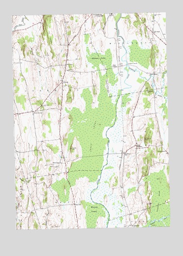
Cornwall, VT USGS Topographic Map
Click on map above to begin viewing in our Map Viewer.

This topographic map contains these locations and features:
Feature Name Type Latitude Longitude GNIS ID View Map
Beaver BrookStreamN43.9984°W73.2390°1456334View Map
Bingham Memorial SchoolSchoolN43.9640°W73.2064°2427400View Map
Bond IslandIslandN43.9003°W73.2101°1456522View Map
Cady SchoolSchoolN43.9887°W73.1357°1456715View Map
Cedar SwampSwampN43.9287°W73.1868°1456807View Map
Central CemeteryCemeteryN43.9626°W73.2098°1918063View Map
Central SchoolSchoolN43.9192°W73.1279°1456833View Map
CornwallPopulated PlaceN43.9609°W73.2104°1457024View Map
Cornwall Congregational ChurchChurchN43.9620°W73.2098°1918072View Map
Cornwall Fire Department - West StationBuildingN43.9446°W73.2348°2121339View Map
Cornwall Swamp Wildlife Management AreaParkN43.9406°W73.1948°1918074View Map
Cornwall Volunteer Fire DepartmentBuildingN43.9707°W73.2069°2121353View Map
De Long HillSummitN43.9212°W73.2279°1457128View Map
Dyer HillSummitN43.9259°W73.1426°1457231View Map
Evergreen CemeteryCemeteryN43.9471°W73.2260°1457384View Map
FarmingdalePopulated PlaceN43.9648°W73.1351°1460416View Map
Foote Street CemeteryCemeteryN43.9984°W73.1348°1457469View Map
Halnon BrookStreamN43.9528°W73.1332°1460953View Map
Helen Porter Healthcare and Rehabilitation CenterBuildingN43.9988°W73.1694°2655002View Map
Hollands Pasture IslandIslandN43.9587°W73.1737°1457870View Map
Huntley IslandIslandN43.8765°W73.1401°1457940View Map
Jerusalem SchoolSchoolN43.8765°W73.1565°1458006View Map
Middlebury Country ClubLocaleN43.9995°W73.1823°1461799View Map
Middlebury RiverStreamN43.9695°W73.1568°1461149View Map
Middlebury SwampSwampN43.9742°W73.1798°1458437View Map
Middlebury Union Middle SchoolSchoolN43.9983°W73.1526°2427383View Map
Old South CemeteryCemeteryN43.9126°W73.2187°1918190View Map
Piper CrossingPopulated PlaceN43.9689°W73.1648°1460445View Map
Pleasant View CemeteryCemeteryN43.9114°W73.2143°1459008View Map
Porter Medical CenterHospitalN43.9999°W73.1683°1459051View Map
Porter Medical Center Medical Library and Information ServiceBuildingN43.9998°W73.1773°1918205View Map
Salisbury StationPopulated PlaceN43.9181°W73.1609°1459354View Map
Salisbury SwampSwampN43.8906°W73.1340°1461372View Map
School Number 1SchoolN43.8892°W73.2026°1459403View Map
School Number 2SchoolN43.9709°W73.2076°1459408View Map
School Number 4SchoolN43.9134°W73.2143°1459414View Map
Scove HillSummitN43.9217°W73.2034°1459438View Map
Seeley CemeteryCemeteryN43.9649°W73.1406°1918235View Map
Seymour BrookStreamN43.8798°W73.1318°1461384View Map
Station Covered BridgeBridgeN43.9181°W73.1743°1918252View Map
The LedgeCliffN43.9980°W73.2221°1459870View Map
Threemile BridgeBridgeN43.9701°W73.1576°1459901View Map
Town of CornwallCivilN43.9602°W73.2160°1462076View Map
Wainwright HillSummitN43.9562°W73.1409°1460034View Map
West CemeteryCemeteryN43.9439°W73.2382°1918265View Map
West CornwallPopulated PlaceN43.9437°W73.2346°1460129View Map
West SalisburyPopulated PlaceN43.9228°W73.1512°1460170View Map
West Salisbury CemeteryCemeteryN43.9208°W73.1513°1918268View Map
WFAD-AM (Middlebury)TowerN43.9992°W73.1593°1461879View Map
Whiting SwampSwampN43.8834°W73.1871°1460233View Map

Note: Coordinates in the location and feature list above are referenced to NAD83 datum.


Copyright (C) 2008-2025 Ryan Niemi / Sunset Dynamics ... All Rights Reserved