TopoQuest Logo
Do you find TopoQuest useful?
Help keep TopoQuest running and adding new maps/features by donating!
Bitcoin:  19c7KJd3qBynnjoSw5npx9KScwjBe4ifkT
Litecoin:  LXs6TkuXGGXo1vDsWCkWVdjQX94eUKd6ui
Home View Maps Find Maps Find Places Resources & Links


Arched Rock, California Topographic Map

USGS Map Title: Arched Rock, CA
USGS Map MRC: 38123D2
DRG (GeoTIFF) Download: o38123d2.tif


Neighboring USGS Topographic Map Quads:


  Plantation, CA  
38123E3
 

  Fort Ross, CA  
38123E2
 

  Cazadero, CA  
38123E1


  Arched Rock, CA  
38123D2
 

  Duncans Mills, CA  
38123D1


  Bodega Head, CA  
38123C1


Map MRC Location:

N39°
W124°
N39°
W123°
H8 H7 H6 H5 H4 H3 H2 H1
G8 G7 G6 G5 G4 G3 G2 G1
F8 F7 F6 F5 F4 F3 F2 F1
E8 E7 E6 E5 E4 E3 E2 E1
D8 D7 D6 D5 D4 D3 D2 D1
C8 C7 C6 C5 C4 C3 C2 C1
B8 B7 B6 B5 B4 B3 B2 B1
A8 A7 A6 A5 A4 A3 A2 A1
N38°
W124°
N38°
W123°

Arched Rock, CA USGS 1:24K Topographic Map Preview:
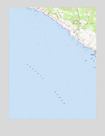
Arched Rock, CA USGS Topographic Map
Click on map above to begin viewing in our Map Viewer.

This topographic map contains these locations and features:
Feature Name Type Latitude Longitude GNIS ID View Map
Arched RockArchN38.4327°W123.1264°218348View Map
East Branch Russian GulchValleyN38.4784°W123.1516°222861View Map
Goat RockSummitN38.4402°W123.1272°1658627View Map
Goat Rock BeachBeachN38.4466°W123.1264°224252View Map
Halfmile RockIslandN38.4430°W123.1342°224795View Map
Jenner BeachBeachN38.4541°W123.1331°1799299View Map
Jewell GulchValleyN38.4908°W123.1954°226226View Map
Little Black MountainSummitN38.4852°W123.1564°227193View Map
Meyer GulchValleyN38.4848°W123.1832°228553View Map
Middle Branch Russian GulchValleyN38.4791°W123.1522°228574View Map
Mile RocksIslandN38.4405°W123.1422°228652View Map
Mill GulchValleyN38.4999°W123.2228°228715View Map
MunizCivilN38.4919°W123.1631°246364View Map
Russian GulchValleyN38.4666°W123.1564°232048View Map
Russian Gulch CreekStreamN38.4669°W123.1567°1723332View Map
Russian RiverStreamN38.4505°W123.1294°267200View Map
Timber GulchValleyN38.4972°W123.2121°236357View Map
West Branch Russian GulchValleyN38.4794°W123.1525°237436View Map

Note: Coordinates in the location and feature list above are referenced to NAD83 datum.


Copyright (C) 2008-2024 Ryan Niemi / Sunset Dynamics ... All Rights Reserved