TopoQuest Logo
Do you find TopoQuest useful?
Help keep TopoQuest running and adding new maps/features by donating!
Bitcoin:  19c7KJd3qBynnjoSw5npx9KScwjBe4ifkT
Litecoin:  LXs6TkuXGGXo1vDsWCkWVdjQX94eUKd6ui
Home View Maps Find Maps Find Places Resources & Links


Plantation, California Topographic Map

USGS Map Title: Plantation, CA
USGS Map MRC: 38123E3
DRG (GeoTIFF) Download: o38123e3.tif


Neighboring USGS Topographic Map Quads:


  Stewarts Point, CA  
38123F4
 

  Annapolis, CA  
38123F3
 

  Tombs Creek, CA  
38123F2


  Plantation, CA  
38123E3
 

  Fort Ross, CA  
38123E2


  Arched Rock, CA  
38123D2


Map MRC Location:

N39°
W124°
N39°
W123°
H8 H7 H6 H5 H4 H3 H2 H1
G8 G7 G6 G5 G4 G3 G2 G1
F8 F7 F6 F5 F4 F3 F2 F1
E8 E7 E6 E5 E4 E3 E2 E1
D8 D7 D6 D5 D4 D3 D2 D1
C8 C7 C6 C5 C4 C3 C2 C1
B8 B7 B6 B5 B4 B3 B2 B1
A8 A7 A6 A5 A4 A3 A2 A1
N38°
W124°
N38°
W123°

Plantation, CA USGS 1:24K Topographic Map Preview:
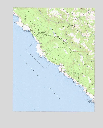
Plantation, CA USGS Topographic Map
Click on map above to begin viewing in our Map Viewer.

This topographic map contains these locations and features:
Feature Name Type Latitude Longitude GNIS ID View Map
Benitz Ranch CemeteryCemeteryN38.5302°W123.2692°1989428View Map
Cannon GulchValleyN38.5974°W123.3506°220545View Map
Chinese GulchValleyN38.5894°W123.3433°221069View Map
Clam BeachBeachN38.5155°W123.2542°221138View Map
Cooper CemeteryCemeteryN38.6127°W123.2767°221535View Map
Deadman GulchValleyN38.6007°W123.3620°222120View Map
Fisk Mill CoveBayN38.5969°W123.3533°223554View Map
Fort Ross Elementary SchoolSchoolN38.5567°W123.2648°223707View Map
Fort Ross Schoolhouse (historical)SchoolN38.5491°W123.2950°2026818View Map
Gerstle CoveBayN38.5638°W123.3272°224133View Map
Gerstle Cove ReserveParkN38.5666°W123.3300°1723327View Map
Gualala School (historical)SchoolN38.6152°W123.2714°1656948View Map
Hauser BridgeBridgeN38.6032°W123.2870°252029View Map
Horseshoe CoveBayN38.6124°W123.3683°225643View Map
Horseshoe PointCapeN38.6069°W123.3708°225650View Map
Kolmer GulchValleyN38.5241°W123.2645°226673View Map
Kruse RanchLocaleN38.6027°W123.3595°1723330View Map
Kruse Rhododendron State Natural ReserveReserveN38.5938°W123.3322°226690View Map
Lake LowerLakeN38.5993°W123.3183°227801View Map
Lake OliverReservoirN38.5942°W123.3129°230016View Map
Marshall CreekStreamN38.5999°W123.2881°228139View Map
Miller CreekStreamN38.5810°W123.3356°228727View Map
Moonrock CampgroundLocaleN38.5691°W123.3247°1799165View Map
Northwest CapeCapeN38.5121°W123.2542°229778View Map
Ocean CoveBayN38.5552°W123.3045°229921View Map
Phillips GulchValleyN38.5849°W123.3400°230598View Map
PlantationLocaleN38.5902°W123.3103°230794View Map
Plantation School (historical)SchoolN38.5913°W123.3200°1656969View Map
Plantation TrailTrailN38.5841°W123.3011°1799170View Map
Pygmy ForestWoodsN38.5777°W123.3092°1799171View Map
Ruoff - Thomas CemeteryCemeteryN38.5405°W123.2861°1989449View Map
Salt PointCapeN38.5663°W123.3328°232328View Map
Salt Point State ParkParkN38.5752°W123.3131°232329View Map
Sentinel RockPillarN38.5952°W123.3492°1799176View Map
Sproule CreekStreamN38.5935°W123.2506°1654966View Map
Stillwater CampgroundLocaleN38.5477°W123.2956°1799181View Map
Stillwater CoveBayN38.5458°W123.2986°1654970View Map
Stillwater Cove Regional ParkParkN38.5480°W123.2953°235483View Map
Stillwater Cove School (historical)SchoolN38.5482°W123.2992°1656976View Map
Stockhoff CreekStreamN38.5469°W123.2975°235498View Map
Stump BeachBeachN38.5819°W123.3356°235621View Map
Stump Beach CoveBayN38.5824°W123.3370°1799182View Map
Stump Beach TrailTrailN38.5838°W123.3261°1799183View Map
Timber CoveBayN38.5296°W123.2711°236354View Map
Timber Cove Census Designated PlaceCensusN38.5411°W123.2588°2583163View Map
Timber Cove CreekStreamN38.5327°W123.2733°236355View Map
Timber Cove Fire Protection DistrictBuildingN38.5569°W123.2674°2624131View Map
Walsh LandingPopulated PlaceN38.5555°W123.3006°1660122View Map
Warren CreekStreamN38.5707°W123.3358°237257View Map
Wildcat CreekStreamN38.5591°W123.3156°237784View Map
Windermere PointCapeN38.5255°W123.2678°238007View Map
Woodside CampgroundLocaleN38.5660°W123.3161°1799187View Map

Note: Coordinates in the location and feature list above are referenced to NAD83 datum.


Copyright (C) 2008-2025 Ryan Niemi / Sunset Dynamics ... All Rights Reserved