TopoQuest Logo
Do you find TopoQuest useful?
Help keep TopoQuest running and adding new maps/features by donating!
Bitcoin:  19c7KJd3qBynnjoSw5npx9KScwjBe4ifkT
Litecoin:  LXs6TkuXGGXo1vDsWCkWVdjQX94eUKd6ui
Home View Maps Find Maps Find Places Resources & Links


Fort Ross, California Topographic Map

USGS Map Title: Fort Ross, CA
USGS Map MRC: 38123E2
DRG (GeoTIFF) Download: o38123e2.tif


Neighboring USGS Topographic Map Quads:


  Annapolis, CA  
38123F3
 

  Tombs Creek, CA  
38123F2
 

  Warm Springs Dam, CA  
38123F1
 

  Plantation, CA  
38123E3
 

  Fort Ross, CA  
38123E2
 

  Cazadero, CA  
38123E1


  Arched Rock, CA  
38123D2
 

  Duncans Mills, CA  
38123D1


Map MRC Location:

N39°
W124°
N39°
W123°
H8 H7 H6 H5 H4 H3 H2 H1
G8 G7 G6 G5 G4 G3 G2 G1
F8 F7 F6 F5 F4 F3 F2 F1
E8 E7 E6 E5 E4 E3 E2 E1
D8 D7 D6 D5 D4 D3 D2 D1
C8 C7 C6 C5 C4 C3 C2 C1
B8 B7 B6 B5 B4 B3 B2 B1
A8 A7 A6 A5 A4 A3 A2 A1
N38°
W124°
N38°
W123°

Fort Ross, CA USGS 1:24K Topographic Map Preview:
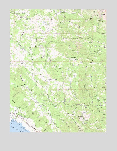
Fort Ross, CA USGS Topographic Map
Click on map above to begin viewing in our Map Viewer.

This topographic map contains these locations and features:
Feature Name Type Latitude Longitude GNIS ID View Map
Big Oat CreekStreamN38.5396°W123.1253°219223View Map
Big Oat MountainSummitN38.5471°W123.1322°219224View Map
Black MountainSummitN38.5021°W123.1608°219378View Map
Black Mountain Conservation CampLocaleN38.5155°W123.1578°219384View Map
Black Mountain RidgeRidgeN38.5074°W123.1653°219385View Map
Blue Jay CreekStreamN38.5349°W123.1356°219496View Map
Blue Jay RidgeRidgeN38.5513°W123.1456°219499View Map
Brain RidgeRidgeN38.5369°W123.1675°219767View Map
Call RanchLocaleN38.5146°W123.2453°220410View Map
Campmeeting RidgeRidgeN38.5546°W123.2347°220517View Map
Carson CreekStreamN38.5646°W123.2058°220643View Map
Creighton RidgeRidgeN38.5544°W123.1933°221817View Map
Creighton Ridge School (historical)SchoolN38.5444°W123.2017°1656946View Map
Devils RibsSummitN38.5935°W123.1672°1655966View Map
Fort RossPopulated PlaceN38.5141°W123.2436°252677View Map
Fort Ross Commanders HouseBuildingN38.5142°W123.2439°2501677View Map
Fort Ross CoveBayN38.5121°W123.2472°223704View Map
Fort Ross CreekStreamN38.5119°W123.2436°223705View Map
Fort Ross ReefBarN38.5007°W123.2345°223706View Map
Fort Ross State Historic ParkParkN38.5163°W123.2411°223708View Map
Fort Ross Volunteer Fire Department Station 1BuildingN38.5477°W123.1833°2624129View Map
Fort Ross Volunteer Fire Department Station 2BuildingN38.5298°W123.1254°2624128View Map
Fort Ross Volunteer Fire Department Station 3BuildingN38.5648°W123.2063°2624127View Map
Fort Ross Volunteer Fire Department Station 4BuildingN38.5157°W123.1576°2624134View Map
Grasshopper CreekStreamN38.6224°W123.1631°224470View Map
Gravelly SpringSpringN38.6020°W123.1259°224497View Map
Gravelly Springs CreekStreamN38.5994°W123.1306°224498View Map
Happy Hill RanchLocaleN38.5716°W123.1589°1656949View Map
Hell HoleValleyN38.5352°W123.1469°225127View Map
High RockPillarN38.6071°W123.1594°225276View Map
Jim CreekStreamN38.6213°W123.1900°226237View Map
Kings RidgeRidgeN38.5938°W123.1417°226604View Map
Kuskov HouseBuildingN38.5144°W123.2433°1799239View Map
Laton MineMineN38.6196°W123.1317°226926View Map
McKenzie CreekStreamN38.5646°W123.2058°228391View Map
McKenzie Creek ClubLocaleN38.5663°W123.2058°1656955View Map
MeteniAreaN38.5152°W123.2442°1799248View Map
Mohrhardt RidgeRidgeN38.5777°W123.1594°228899View Map
MudholesSpringN38.6155°W123.2267°229282View Map
Murphy MillLocaleN38.5146°W123.1575°1656960View Map
North GapGapN38.6155°W123.1481°229730View Map
Palmer CanyonValleyN38.5782°W123.2242°230262View Map
Peterson RanchLocaleN38.5124°W123.1250°1656968View Map
Pine HillSummitN38.6149°W123.1978°230697View Map
Pole Mountain CreekStreamN38.5341°W123.1353°230900View Map
Richardson 1429 DamDamN38.6249°W123.1861°1664323View Map
Rotchev HouseBuildingN38.5141°W123.2439°1799265View Map
Russian OrchardWoodsN38.5207°W123.2422°1799266View Map
Russian Orthodox ChapelChurchN38.5144°W123.2431°1799267View Map
Russian River-Sonoma Coast DivisionCivilN38.5713°W123.1908°1935273View Map
Russian Trough SpringSpringN38.5319°W123.2083°232053View Map
Seafeldt RanchLocaleN38.5702°W123.2358°1656974View Map
SeaviewPopulated PlaceN38.5455°W123.2281°1656975View Map
Seaview CemeteryCemeteryN38.5432°W123.2242°232769View Map
Smith RidgeRidgeN38.5152°W123.1814°234720View Map
Spring CreekStreamN38.5355°W123.1458°235236View Map
Stanley S Spyra Memorial GroveWoodsN38.5232°W123.2464°1799277View Map
Stewart RidgeRidgeN38.5721°W123.2089°235466View Map
Table MountainSummitN38.5882°W123.2111°235957View Map
The IslandSummitN38.6063°W123.1814°1656360View Map
Toners PlacePopulated PlaceN38.5307°W123.1781°1656979View Map
Trospers ClubLocaleN38.6227°W123.1631°1656981View Map
Truth HomePopulated PlaceN38.5799°W123.1386°1656983View Map
Turner CanyonValleyN38.5302°W123.1811°236649View Map
Wild Cattle CanyonValleyN38.5891°W123.2403°237747View Map
Wild Hog CanyonValleyN38.5685°W123.1989°237753View Map

Note: Coordinates in the location and feature list above are referenced to NAD83 datum.


Copyright (C) 2008-2024 Ryan Niemi / Sunset Dynamics ... All Rights Reserved