TopoQuest Logo
Do you find TopoQuest useful?
Help keep TopoQuest running and adding new maps/features by donating!
Bitcoin:  19c7KJd3qBynnjoSw5npx9KScwjBe4ifkT
Litecoin:  LXs6TkuXGGXo1vDsWCkWVdjQX94eUKd6ui
Home View Maps Find Maps Find Places Resources & Links


East Springfield, Pennsylvania Topographic Map

USGS Map Title: East Springfield, PA
USGS Map MRC: 41080H4
DRG (GeoTIFF) Download: o41080h4.tif


Neighboring USGS Topographic Map Quads:


  Fairview SW, PA  
42080A4
 

  Fairview, PA  
42080A3
 

  Conneaut, OH  
41080H5
 

  East Springfield, PA  
41080H4
 

  Albion, PA  
41080H3
 

  Pierpont, OH  
41080G5
 

  Beaver Center, PA  
41080G4
 

  Conneautville, PA  
41080G3


Map MRC Location:

N42°
W81°
N42°
W80°
H8 H7 H6 H5 H4 H3 H2 H1
G8 G7 G6 G5 G4 G3 G2 G1
F8 F7 F6 F5 F4 F3 F2 F1
E8 E7 E6 E5 E4 E3 E2 E1
D8 D7 D6 D5 D4 D3 D2 D1
C8 C7 C6 C5 C4 C3 C2 C1
B8 B7 B6 B5 B4 B3 B2 B1
A8 A7 A6 A5 A4 A3 A2 A1
N41°
W81°
N41°
W80°

East Springfield, PA USGS 1:24K Topographic Map Preview:
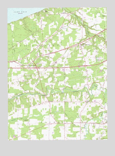
East Springfield, PA USGS Topographic Map
Click on map above to begin viewing in our Map Viewer.

This topographic map contains these locations and features:
Feature Name Type Latitude Longitude GNIS ID View Map
AkerlyPopulated PlaceN41.8906°W80.4876°1197590View Map
Bowmans CornersLocaleN41.9245°W80.3801°1197591View Map
Camp LambecLocaleN41.9962°W80.4523°1171045View Map
Center CornerPopulated PlaceN41.9562°W80.4473°1197594View Map
Char Bi Mar FarmsLocaleN41.9253°W80.3833°2711944View Map
Cherry HillPopulated PlaceN41.9112°W80.4478°1171640View Map
Cottage Church CemeteryCemeteryN41.9462°W80.4842°1172485View Map
Crayton StationLocaleN41.9609°W80.4756°1196823View Map
CrossPopulated PlaceN41.9706°W80.3751°1197595View Map
East Branch Conneaut CreekStreamN41.8962°W80.3823°1192396View Map
East SpringfieldPopulated PlaceN41.9651°W80.4073°1173878View Map
East Springfield Post OfficePost OfficeN41.9656°W80.4059°2779990View Map
East Springfield StationLocaleN41.9803°W80.4084°1198171View Map
Egley CornersLocaleN41.9934°W80.4578°1214149View Map
Hayes Tree FarmLocaleN41.9581°W80.3764°2711940View Map
Kidders CornerPopulated PlaceN41.9109°W80.4012°1178444View Map
Knapps CornersLocaleN41.8912°W80.4084°1197592View Map
Lake AnnataReservoirN41.9516°W80.3871°1168320View Map
Lexington (historical)Populated PlaceN41.9295°W80.3806°1197593View Map
Marcy FarmLocaleN41.9103°W80.4511°2711830View Map
Marsh RunStreamN41.8873°W80.4031°1180460View Map
North SpringfieldPopulated PlaceN41.9945°W80.4251°1182638View Map
Raccoon CreekStreamN41.9903°W80.4826°1184573View Map
Salsbury CemeteryCemeteryN41.9198°W80.3992°1186874View Map
Springfield CemeteryCemeteryN41.9562°W80.4556°1188292View Map
Springfield Elementary SchoolSchoolN41.9639°W80.4040°1211445View Map
Springfield Volunteer Fire Department Station 64BuildingN41.9650°W80.4064°2645369View Map
Thornton JunctionPopulated PlaceN41.9914°W80.3753°1189532View Map
Township of ConneautCivilN41.8872°W80.4302°1216409View Map
Township of SpringfieldCivilN41.9596°W80.4500°1216422View Map
Valley CemeteryCemeteryN41.8974°W80.3766°1190287View Map
West SpringfieldPopulated PlaceN41.9459°W80.4742°1191115View Map
West Springfield Post OfficePost OfficeN41.9464°W80.4739°2779643View Map
West Springfield StationLocaleN41.9389°W80.4584°1196824View Map

Note: Coordinates in the location and feature list above are referenced to NAD83 datum.


Copyright (C) 2008-2025 Ryan Niemi / Sunset Dynamics ... All Rights Reserved