TopoQuest Logo
Do you find TopoQuest useful?
Help keep TopoQuest running and adding new maps/features by donating!
Bitcoin:  19c7KJd3qBynnjoSw5npx9KScwjBe4ifkT
Litecoin:  LXs6TkuXGGXo1vDsWCkWVdjQX94eUKd6ui
Home View Maps Find Maps Find Places Resources & Links


Beaver Center, Pennsylvania Topographic Map

USGS Map Title: Beaver Center, PA
USGS Map MRC: 41080G4
DRG (GeoTIFF) Download: o41080g4.tif


Neighboring USGS Topographic Map Quads:


  Conneaut, OH  
41080H5
 

  East Springfield, PA  
41080H4
 

  Albion, PA  
41080H3
 

  Pierpont, OH  
41080G5
 

  Beaver Center, PA  
41080G4
 

  Conneautville, PA  
41080G3
 

  Leon, OH  
41080F5
 

  Linesville, PA  
41080F4
 

  Harmonsburg, PA  
41080F3


Map MRC Location:

N42°
W81°
N42°
W80°
H8 H7 H6 H5 H4 H3 H2 H1
G8 G7 G6 G5 G4 G3 G2 G1
F8 F7 F6 F5 F4 F3 F2 F1
E8 E7 E6 E5 E4 E3 E2 E1
D8 D7 D6 D5 D4 D3 D2 D1
C8 C7 C6 C5 C4 C3 C2 C1
B8 B7 B6 B5 B4 B3 B2 B1
A8 A7 A6 A5 A4 A3 A2 A1
N41°
W81°
N41°
W80°

Beaver Center, PA USGS 1:24K Topographic Map Preview:
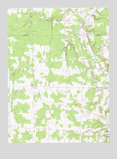
Beaver Center, PA USGS Topographic Map
Click on map above to begin viewing in our Map Viewer.

This topographic map contains these locations and features:
Feature Name Type Latitude Longitude GNIS ID View Map
Beaver CenterPopulated PlaceN41.8023°W80.4673°1168990View Map
Brooks CemeteryCemeteryN41.7778°W80.4990°1170332View Map
Conneautville StationPopulated PlaceN41.7606°W80.4023°1172345View Map
Crazy RunStreamN41.8039°W80.3792°1172660View Map
East Branch Conneaut CreekStreamN41.8642°W80.4737°1173740View Map
KeepvillePopulated PlaceN41.8684°W80.3948°1178295View Map
Keepville Wesleyan Methodist ChurchChurchN41.8678°W80.3928°2711993View Map
Marther FieldAirportN41.8735°W80.4596°1194301View Map
Middle Branch Conneaut CreekStreamN41.8551°W80.4737°1181006View Map
Misty Hollow FarmLocaleN41.8619°W80.4233°2711832View Map
Mud RunStreamN41.8639°W80.4442°1182032View Map
PalmerPopulated PlaceN41.7609°W80.4292°1183222View Map
PennsidePopulated PlaceN41.8506°W80.4012°1183525View Map
Pontius Airport (historical)AirportN41.7745°W80.4740°1194283View Map
Rausch FarmLocaleN41.8714°W80.4061°2707286View Map
Seldom Home FarmLocaleN41.8631°W80.4278°2711834View Map
ShadelandPopulated PlaceN41.8156°W80.3762°1187293View Map
Shadeland StationLocaleN41.8153°W80.3948°1205443View Map
Spring CemeteryCemeteryN41.8122°W80.3756°1193420View Map
Springboro StationLocaleN41.8017°W80.3915°1205445View Map
State Game Lands Number 101ParkN41.8528°W80.4728°1188428View Map
Stone RunStreamN41.8495°W80.4106°1188737View Map
Township of BeaverCivilN41.8037°W80.4634°1216297View Map
TracyPopulated PlaceN41.8748°W80.4712°1204824View Map
West Branch Conneaut CreekStreamN41.8676°W80.4045°1190899View Map
White CemeteryCemeteryN41.8380°W80.4180°1191254View Map
WingLocaleN41.8451°W80.4923°1205444View Map

Note: Coordinates in the location and feature list above are referenced to NAD83 datum.


Copyright (C) 2008-2025 Ryan Niemi / Sunset Dynamics ... All Rights Reserved