TopoQuest Logo
Do you find TopoQuest useful?
Help keep TopoQuest running and adding new maps/features by donating!
Bitcoin:  19c7KJd3qBynnjoSw5npx9KScwjBe4ifkT
Litecoin:  LXs6TkuXGGXo1vDsWCkWVdjQX94eUKd6ui
Home View Maps Find Maps Find Places Resources & Links


Conneautville, Pennsylvania Topographic Map

USGS Map Title: Conneautville, PA
USGS Map MRC: 41080G3
DRG (GeoTIFF) Download: o41080g3.tif


Neighboring USGS Topographic Map Quads:


  East Springfield, PA  
41080H4
 

  Albion, PA  
41080H3
 

  Edinboro North, PA  
41080H2
 

  Beaver Center, PA  
41080G4
 

  Conneautville, PA  
41080G3
 

  Edinboro South, PA  
41080G2
 

  Linesville, PA  
41080F4
 

  Harmonsburg, PA  
41080F3
 

  Meadville, PA  
41080F2


Map MRC Location:

N42°
W81°
N42°
W80°
H8 H7 H6 H5 H4 H3 H2 H1
G8 G7 G6 G5 G4 G3 G2 G1
F8 F7 F6 F5 F4 F3 F2 F1
E8 E7 E6 E5 E4 E3 E2 E1
D8 D7 D6 D5 D4 D3 D2 D1
C8 C7 C6 C5 C4 C3 C2 C1
B8 B7 B6 B5 B4 B3 B2 B1
A8 A7 A6 A5 A4 A3 A2 A1
N41°
W81°
N41°
W80°

Conneautville, PA USGS 1:24K Topographic Map Preview:
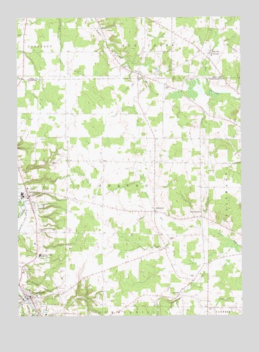
Conneautville, PA USGS Topographic Map
Click on map above to begin viewing in our Map Viewer.

This topographic map contains these locations and features:
Feature Name Type Latitude Longitude GNIS ID View Map
Borough of ConneautvilleCivilN41.7572°W80.3685°1215135View Map
Borough of SpringboroCivilN41.8006°W80.3715°1215141View Map
Conneaut Valley Elementary SchoolSchoolN41.7587°W80.3645°1211649View Map
Conneaut Valley High SchoolSchoolN41.7756°W80.3626°1172343View Map
ConneautvillePopulated PlaceN41.7578°W80.3678°1172344View Map
Conneautville Post OfficePost OfficeN41.7591°W80.3697°2772646View Map
Cribbs CemeteryCemeteryN41.7503°W80.3567°1192312View Map
East Spring ChurchChurchN41.7937°W80.2712°1173876View Map
Fellow's Club Volunteer Fire Department and Ambulance Service Department 8BuildingN41.7585°W80.3676°2644972View Map
Foster RunStreamN41.7573°W80.3715°1175042View Map
HickernellPopulated PlaceN41.7937°W80.2976°1176940View Map
Meyler RunStreamN41.7573°W80.3723°1209313View Map
PagevillePopulated PlaceN41.8601°W80.2665°1183191View Map
PapervillePopulated PlaceN41.8603°W80.2712°1201551View Map
PontPopulated PlaceN41.8514°W80.3056°1184243View Map
Ridgeview GreenhouseBuildingN41.7536°W80.2531°2650605View Map
RundellPopulated PlaceN41.7587°W80.2842°1185619View Map
Rundell CemeteryCemeteryN41.7660°W80.2764°1185620View Map
Rundelltown CreekStreamN41.7812°W80.2545°1185621View Map
Saint Nicholas ChurchChurchN41.8601°W80.2653°1186523View Map
Smith CemeteryCemeteryN41.7534°W80.2690°1187860View Map
SpringPopulated PlaceN41.7967°W80.3265°1201552View Map
SpringboroPopulated PlaceN41.8006°W80.3690°1188283View Map
Springboro Post OfficePost OfficeN41.8003°W80.3696°2773262View Map
Springboro Volunteer Fire Department 21BuildingN41.8063°W80.3712°2645479View Map
Taylor FarmsLocaleN41.8675°W80.3233°2711833View Map
Township of SpringCivilN41.8027°W80.3364°1216317View Map
Winterbreeze FarmLocaleN41.8619°W80.2683°2711947View Map

Note: Coordinates in the location and feature list above are referenced to NAD83 datum.


Copyright (C) 2008-2025 Ryan Niemi / Sunset Dynamics ... All Rights Reserved