TopoQuest Logo
Do you find TopoQuest useful?
Help keep TopoQuest running and adding new maps/features by donating!
Bitcoin:  19c7KJd3qBynnjoSw5npx9KScwjBe4ifkT
Litecoin:  LXs6TkuXGGXo1vDsWCkWVdjQX94eUKd6ui
Home View Maps Find Maps Find Places Resources & Links


East Trumbull, Ohio Topographic Map

USGS Map Title: East Trumbull, OH
USGS Map MRC: 41080F8
DRG (GeoTIFF) Download: o41080f8.tif


Neighboring USGS Topographic Map Quads:


  Madison, OH  
41081G1
 

  Geneva, OH  
41080G8
 

  Ashtabula South, OH  
41080G7
 

  Thompson, OH  
41081F1
 

  East Trumbull, OH  
41080F8
 

  Jefferson, OH  
41080F7
 

  East Claridon, OH  
41081E1
 

  Windsor, OH  
41080E8
 

  Orwell, OH  
41080E7


Map MRC Location:

N42°
W81°
N42°
W80°
H8 H7 H6 H5 H4 H3 H2 H1
G8 G7 G6 G5 G4 G3 G2 G1
F8 F7 F6 F5 F4 F3 F2 F1
E8 E7 E6 E5 E4 E3 E2 E1
D8 D7 D6 D5 D4 D3 D2 D1
C8 C7 C6 C5 C4 C3 C2 C1
B8 B7 B6 B5 B4 B3 B2 B1
A8 A7 A6 A5 A4 A3 A2 A1
N41°
W81°
N41°
W80°

East Trumbull, OH USGS 1:24K Topographic Map Preview:
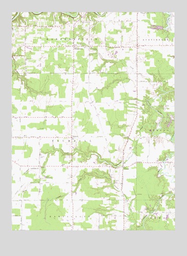
East Trumbull, OH USGS Topographic Map
Click on map above to begin viewing in our Map Viewer.

This topographic map contains these locations and features:
Feature Name Type Latitude Longitude GNIS ID View Map
Armington AirportAirportN41.7412°W80.8756°1082473View Map
Armington LakeReservoirN41.7462°W80.8801°1070666View Map
Barnes Corners (historical)Populated PlaceN41.6781°W80.9104°1067479View Map
Bronson CreekStreamN41.7042°W80.8812°1038343View Map
Bruno PondReservoirN41.7397°W80.9980°1078323View Map
Bruno Pond DamDamN41.7401°W80.9982°1078322View Map
Circle ResortLocaleN41.6359°W80.8934°1039125View Map
CorkPopulated PlaceN41.7306°W80.9515°1048631View Map
Cork CemeteryCemeteryN41.7302°W80.9448°1039373View Map
Cork Elementary SchoolSchoolN41.7323°W80.9529°1052970View Map
East TrumbullPopulated PlaceN41.6614°W80.9145°1040018View Map
East Trumbull CemeteryCemeteryN41.6617°W80.9262°1040019View Map
Echerd Airfield (historical)AirportN41.7228°W80.9865°1040062View Map
Faith ChurchChurchN41.6617°W80.9618°1064636View Map
FootvillePopulated PlaceN41.6617°W80.9781°1048743View Map
Footville CemeteryCemeteryN41.6667°W80.9779°1040544View Map
Harpersfield Fire Department Station 2BuildingN41.7301°W80.9557°2549495View Map
Lake BeaumontReservoirN41.6862°W80.8789°1078319View Map
Lake Beaumont DamDamN41.6851°W80.8798°1078318View Map
Lake ChawaukeeLakeN41.6556°W80.9745°1039009View Map
Lake GeorgeReservoirN41.7405°W80.8889°1078321View Map
Lake George DamDamN41.7401°W80.8848°1078320View Map
Mechanicsville - Windsor Road CemeteryCemeteryN41.7006°W80.9045°1731141View Map
Mud CreekStreamN41.6278°W80.8990°1043684View Map
South Harpersfield ChurchChurchN41.7303°W80.9509°1046472View Map
South River Road CemeteryCemeteryN41.7446°W80.9462°1046495View Map
Spring CreekStreamN41.6709°W80.9484°1066221View Map
Still Waters FarmLocaleN41.6611°W80.9925°2516133View Map
Three Brothers CreekStreamN41.6759°W80.8770°1047047View Map
Township of TrumbullCivilN41.6786°W80.9538°1085744View Map
TrumbullPopulated PlaceN41.6781°W80.9540°1061711View Map
Trumbull Airport (historical)AirportN41.6748°W80.9776°1082255View Map
Trumbull CemeteryCemeteryN41.6928°W80.9537°1047179View Map
Trumbull CreekStreamN41.6934°W80.8895°1047178View Map
Trumbull Post Office (historical)Post OfficeN41.6778°W80.9540°1959116View Map
Trumbull Township Fire and RescueBuildingN41.6832°W80.9544°2549485View Map

Note: Coordinates in the location and feature list above are referenced to NAD83 datum.


Copyright (C) 2008-2025 Ryan Niemi / Sunset Dynamics ... All Rights Reserved