TopoQuest Logo
Do you find TopoQuest useful?
Help keep TopoQuest running and adding new maps/features by donating!
Bitcoin:  19c7KJd3qBynnjoSw5npx9KScwjBe4ifkT
Litecoin:  LXs6TkuXGGXo1vDsWCkWVdjQX94eUKd6ui
Home View Maps Find Maps Find Places Resources & Links


Orwell, Ohio Topographic Map

USGS Map Title: Orwell, OH
USGS Map MRC: 41080E7
DRG (GeoTIFF) Download: o41080e7.tif


Neighboring USGS Topographic Map Quads:


  East Trumbull, OH  
41080F8
 

  Jefferson, OH  
41080F7
 

  Dorset, OH  
41080F6
 

  Windsor, OH  
41080E8
 

  Orwell, OH  
41080E7
 

  Cherry Valley, OH  
41080E6
 

  West Farmington, OH  
41080D8
 

  Bristolville, OH  
41080D7
 

  Gustavus, OH  
41080D6


Map MRC Location:

N42°
W81°
N42°
W80°
H8 H7 H6 H5 H4 H3 H2 H1
G8 G7 G6 G5 G4 G3 G2 G1
F8 F7 F6 F5 F4 F3 F2 F1
E8 E7 E6 E5 E4 E3 E2 E1
D8 D7 D6 D5 D4 D3 D2 D1
C8 C7 C6 C5 C4 C3 C2 C1
B8 B7 B6 B5 B4 B3 B2 B1
A8 A7 A6 A5 A4 A3 A2 A1
N41°
W81°
N41°
W80°

Orwell, OH USGS 1:24K Topographic Map Preview:
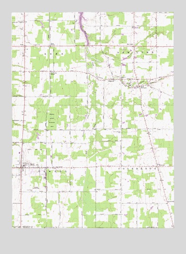
Orwell, OH USGS Topographic Map
Click on map above to begin viewing in our Map Viewer.

This topographic map contains these locations and features:
Feature Name Type Latitude Longitude GNIS ID View Map
Asbury ParkPopulated PlaceN41.5325°W80.8519°2509163View Map
Ashtabula County South Central Ambulance DistrictBuildingN41.6049°W80.8610°2550847View Map
Benton FarmsLocaleN41.5347°W80.7986°2706660View Map
Briarwood FarmLocaleN41.5008°W80.7769°2706661View Map
Champion Executive Airport (historical)AirportN41.5223°W80.8581°1082925View Map
ColebrookPopulated PlaceN41.5356°W80.7626°1056822View Map
Colebrook Elementary SchoolSchoolN41.5370°W80.7640°1052950View Map
Crosby CemeteryCemeteryN41.6154°W80.8658°1039489View Map
Deeming SchoolSchoolN41.5823°W80.7840°1039641View Map
DodgevillePopulated PlaceN41.5856°W80.7968°1048663View Map
Dodgeville CemeteryCemeteryN41.5870°W80.7915°1039729View Map
East Brownville CemeteryCemeteryN41.5837°W80.7695°1039975View Map
East OrwellPopulated PlaceN41.5351°W80.8437°1064585View Map
East Orwell Post OfficePost OfficeN41.5348°W80.8443°1957438View Map
Grand Valley Elementary SchoolSchoolN41.5437°W80.8693°1052954View Map
Grand Valley High SchoolSchoolN41.5364°W80.8659°1052955View Map
Humphries FarmLocaleN41.5158°W80.8722°2706665View Map
Hyde CemeteryCemeteryN41.6009°W80.8037°1731135View Map
Kalas FarmsLocaleN41.5156°W80.7642°2706666View Map
Lebanon CreekStreamN41.5892°W80.8151°1042467View Map
Maple Lane FarmLocaleN41.5883°W80.8256°2704743View Map
Mate's FarmsLocaleN41.5278°W80.7575°2706669View Map
New England Schoolhouse (historical)SchoolN41.5526°W80.8293°1052951View Map
New LymePopulated PlaceN41.6048°W80.7809°1065125View Map
New Lyme StationPopulated PlaceN41.5903°W80.8456°1043842View Map
New Lyme Station Post Office (historical)Post OfficeN41.6042°W80.7804°1958997View Map
North CemeteryCemeteryN41.6192°W80.8662°1043929View Map
North Colebrook CemeteryCemeteryN41.5553°W80.7906°1043932View Map
North Orwell CemeteryCemeteryN41.5392°W80.8698°1731144View Map
Northside FarmsLocaleN41.5367°W80.7853°2706670View Map
OrwellPopulated PlaceN41.5351°W80.8681°1065217View Map
Orwell Post OfficePost OfficeN41.5348°W80.8679°1957433View Map
Orwell State Wildlife AreaParkN41.5626°W80.8443°1052953View Map
Orwell Station (historical)LocaleN41.5351°W80.8484°1052956View Map
Orwell Village Police DepartmentBuildingN41.5345°W80.8647°2732986View Map
Orwell Volunteer Fire DepartmentBuildingN41.5347°W80.8650°2549499View Map
RomePopulated PlaceN41.6048°W80.8654°1045164View Map
Rome Center CemeteryCemeteryN41.6056°W80.8584°1045165View Map
Rome Post OfficePost OfficeN41.6056°W80.8651°1957430View Map
Rome StationLocaleN41.6051°W80.8454°1045167View Map
Rome Volunteer Fire DepartmentBuildingN41.6051°W80.8636°2549490View Map
Rome-Hartsgrove Elementary SchoolSchoolN41.6051°W80.8643°1052952View Map
Shanty CreekStreamN41.5720°W80.8131°1046132View Map
South New LymePopulated PlaceN41.5817°W80.7770°1065351View Map
South Orwell CemeteryCemeteryN41.5214°W80.8590°1046486View Map
Stackhouse FarmLocaleN41.5550°W80.8619°2706673View Map
Teegarden FarmLocaleN41.6061°W80.7686°2706801View Map
Township of ColebrookCivilN41.5357°W80.7616°1085722View Map
Township of New LymeCivilN41.6072°W80.7615°1085734View Map
Township of OrwellCivilN41.5361°W80.8572°1085736View Map
Township of RomeCivilN41.6070°W80.8571°1085741View Map
Village of OrwellCivilN41.5364°W80.8595°2399589View Map
Whetstone CreekStreamN41.5987°W80.8131°1047857View Map

Note: Coordinates in the location and feature list above are referenced to NAD83 datum.


Copyright (C) 2008-2025 Ryan Niemi / Sunset Dynamics ... All Rights Reserved