TopoQuest Logo
Do you find TopoQuest useful?
Help keep TopoQuest running and adding new maps/features by donating!
Bitcoin:  19c7KJd3qBynnjoSw5npx9KScwjBe4ifkT
Litecoin:  LXs6TkuXGGXo1vDsWCkWVdjQX94eUKd6ui
Home View Maps Find Maps Find Places Resources & Links


Eaton, Indiana Topographic Map

USGS Map Title: Eaton, IN
USGS Map MRC: 40085C3
DRG (GeoTIFF) Download: o40085c3.tif


Neighboring USGS Topographic Map Quads:


  Hartford City West, IN  
40085D4
 

  Hartford City East, IN  
40085D3
 

  Pennville, IN  
40085D2
 

  Wheeling, IN  
40085C4
 

  Eaton, IN  
40085C3
 

  Redkey, IN  
40085C2
 

  Muncie West, IN  
40085B4
 

  Muncie East, IN  
40085B3
 

  Farmland, IN  
40085B2


Map MRC Location:

N41°
W86°
N41°
W85°
H8 H7 H6 H5 H4 H3 H2 H1
G8 G7 G6 G5 G4 G3 G2 G1
F8 F7 F6 F5 F4 F3 F2 F1
E8 E7 E6 E5 E4 E3 E2 E1
D8 D7 D6 D5 D4 D3 D2 D1
C8 C7 C6 C5 C4 C3 C2 C1
B8 B7 B6 B5 B4 B3 B2 B1
A8 A7 A6 A5 A4 A3 A2 A1
N40°
W86°
N40°
W85°

Eaton, IN USGS 1:24K Topographic Map Preview:
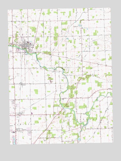
Eaton, IN USGS Topographic Map
Click on map above to begin viewing in our Map Viewer.

This topographic map contains these locations and features:
Feature Name Type Latitude Longitude GNIS ID View Map
Black CemeteryCemeteryN40.3056°W85.2927°431122View Map
Bosman DitchCanalN40.3373°W85.2808°431360View Map
Campbell CreekStreamN40.2664°W85.2847°432083View Map
Chuck's AirportAirportN40.2584°W85.2522°2676869View Map
Cullen CemeteryCemeteryN40.2534°W85.3311°433237View Map
Delaware ChapelChurchN40.2917°W85.3114°433451View Map
EatonPopulated PlaceN40.3403°W85.3508°433963View Map
Eaton Elementary SchoolSchoolN40.3431°W85.3486°446623View Map
Eaton EMTBuildingN40.3396°W85.3557°2719287View Map
Eaton Police DepartmentBuildingN40.3416°W85.3575°2758336View Map
Eden ChurchChurchN40.2912°W85.3689°434008View Map
Finney's AirparkAirportN40.2590°W85.2636°2676870View Map
Gardens of Memory CemeteryCemeteryN40.2889°W85.3702°434951View Map
Godlove CemeteryCemeteryN40.2775°W85.2830°435149View Map
GranvillePopulated PlaceN40.3173°W85.3186°435332View Map
Granville CemeteryCemeteryN40.3106°W85.3066°435333View Map
Hamilton Township Fire DepartmentBuildingN40.2623°W85.3685°2625674View Map
Holdren DitchCanalN40.3631°W85.3722°436312View Map
Horizon FieldAirportN40.3648°W85.3395°2677105View Map
Leaird CemeteryCemeteryN40.3206°W85.3343°437697View Map
Memorial ParkCemeteryN40.3586°W85.2877°438993View Map
Rees DitchCanalN40.3706°W85.2844°441870View Map
RoyertonPopulated PlaceN40.2637°W85.3655°442377View Map
ShidelerPopulated PlaceN40.3062°W85.3597°443373View Map
Swearengen DitchCanalN40.3220°W85.3508°444476View Map
Town of EatonCivilN40.3220°W85.3590°2396918View Map
Township of DelawareCivilN40.2701°W85.2745°453260View Map
Township of NilesCivilN40.3423°W85.2755°453667View Map
Union CemeteryCemeteryN40.2514°W85.2927°445062View Map
Union CemeteryCemeteryN40.3365°W85.3720°445069View Map
Union ChurchChurchN40.3495°W85.2872°445112View Map
White ChurchChurchN40.2634°W85.2502°445929View Map

Note: Coordinates in the location and feature list above are referenced to NAD83 datum.


Copyright (C) 2008-2024 Ryan Niemi / Sunset Dynamics ... All Rights Reserved