TopoQuest Logo
Do you find TopoQuest useful?
Help keep TopoQuest running and adding new maps/features by donating!
Bitcoin:  19c7KJd3qBynnjoSw5npx9KScwjBe4ifkT
Litecoin:  LXs6TkuXGGXo1vDsWCkWVdjQX94eUKd6ui
Home View Maps Find Maps Find Places Resources & Links


Farmland, Indiana Topographic Map

USGS Map Title: Farmland, IN
USGS Map MRC: 40085B2
DRG (GeoTIFF) Download: o40085b2.tif


Neighboring USGS Topographic Map Quads:


  Eaton, IN  
40085C3
 

  Redkey, IN  
40085C2
 

  Ridgeville, IN  
40085C1
 

  Muncie East, IN  
40085B3
 

  Farmland, IN  
40085B2
 

  Maxville, IN  
40085B1
 

  Mount Pleasant, IN  
40085A3
 

  Modoc, IN  
40085A2
 

  Carlos, IN  
40085A1


Map MRC Location:

N41°
W86°
N41°
W85°
H8 H7 H6 H5 H4 H3 H2 H1
G8 G7 G6 G5 G4 G3 G2 G1
F8 F7 F6 F5 F4 F3 F2 F1
E8 E7 E6 E5 E4 E3 E2 E1
D8 D7 D6 D5 D4 D3 D2 D1
C8 C7 C6 C5 C4 C3 C2 C1
B8 B7 B6 B5 B4 B3 B2 B1
A8 A7 A6 A5 A4 A3 A2 A1
N40°
W86°
N40°
W85°

Farmland, IN USGS 1:24K Topographic Map Preview:
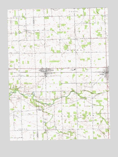
Farmland, IN USGS Topographic Map
Click on map above to begin viewing in our Map Viewer.

This topographic map contains these locations and features:
Feature Name Type Latitude Longitude GNIS ID View Map
Belknap-Icarus Acres AirportAirportN40.1352°W85.2239°449298View Map
Cabin CreekStreamN40.1687°W85.1625°431932View Map
Cedar ChurchChurchN40.1637°W85.1544°432262View Map
FarmlandPopulated PlaceN40.1878°W85.1275°434409View Map
Farmland Fire DepartmentBuildingN40.1868°W85.1252°2625636View Map
Farmland Police DepartmentBuildingN40.1876°W85.1272°2758424View Map
Freidline CemeteryCemeteryN40.1654°W85.2386°434823View Map
GeorgetownPopulated PlaceN40.1709°W85.1291°452093View Map
Little White RiverStreamN40.1398°W85.2055°438174View Map
Monroe Central Junior-Senior High SchoolSchoolN40.1923°W85.1675°439341View Map
Mount Pleasant ChurchChurchN40.2300°W85.2264°439670View Map
Parker CityPopulated PlaceN40.1889°W85.2041°440883View Map
Parker City Emergency Medical ServicesBuildingN40.1882°W85.2049°2719367View Map
Parker City Police DepartmentBuildingN40.1929°W85.2071°2758357View Map
Parker Elementary SchoolSchoolN40.1939°W85.2027°447147View Map
Parker Volunteer Fire DepartmentBuildingN40.1899°W85.2015°2626378View Map
Rehoboth ChurchChurchN40.2206°W85.1655°441880View Map
Stoney CreekStreamN40.1642°W85.2200°444221View Map
Stoney Creek SchoolSchoolN40.1456°W85.1644°444222View Map
Swingley CemeteryCemeteryN40.1446°W85.2037°444497View Map
Town of FarmlandCivilN40.1895°W85.1273°2396935View Map
Town of Parker CityCivilN40.1898°W85.2039°2396848View Map
Township of MonroeCivilN40.2106°W85.1545°453647View Map
Township of Stoney CreekCivilN40.1435°W85.1648°453878View Map
Union ChurchChurchN40.1320°W85.2033°445096View Map
White River ChurchChurchN40.1639°W85.1464°445959View Map
WindsorPopulated PlaceN40.1545°W85.2127°446175View Map

Note: Coordinates in the location and feature list above are referenced to NAD83 datum.


Copyright (C) 2008-2025 Ryan Niemi / Sunset Dynamics ... All Rights Reserved