TopoQuest Logo
Do you find TopoQuest useful?
Help keep TopoQuest running and adding new maps/features by donating!
Bitcoin:  19c7KJd3qBynnjoSw5npx9KScwjBe4ifkT
Litecoin:  LXs6TkuXGGXo1vDsWCkWVdjQX94eUKd6ui
Home View Maps Find Maps Find Places Resources & Links


Eaton, Colorado Topographic Map

USGS Map Title: Eaton, CO
USGS Map MRC: 40104E6
DRG (GeoTIFF) Download: o40104e6.tif


Neighboring USGS Topographic Map Quads:


  Nunn, CO  
40104F7
 

  Antelope Reservoir, CO  
40104F6
 

  Purcell, CO  
40104F5
 

  Severance, CO  
40104E7
 

  Eaton, CO  
40104E6
 

  Galeton, CO  
40104E5
 

  Bracewell, CO  
40104D7
 

  Greeley, CO  
40104D6
 

  Kersey, CO  
40104D5


Map MRC Location:

N41°
W105°
N41°
W104°
H8 H7 H6 H5 H4 H3 H2 H1
G8 G7 G6 G5 G4 G3 G2 G1
F8 F7 F6 F5 F4 F3 F2 F1
E8 E7 E6 E5 E4 E3 E2 E1
D8 D7 D6 D5 D4 D3 D2 D1
C8 C7 C6 C5 C4 C3 C2 C1
B8 B7 B6 B5 B4 B3 B2 B1
A8 A7 A6 A5 A4 A3 A2 A1
N40°
W105°
N40°
W104°

Eaton, CO USGS 1:24K Topographic Map Preview:
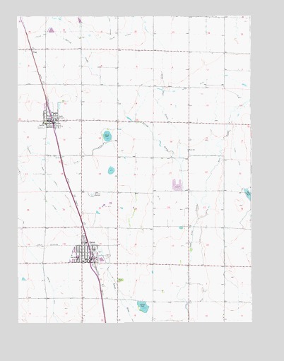
Eaton, CO USGS Topographic Map
Click on map above to begin viewing in our Map Viewer.

This topographic map contains these locations and features:
Feature Name Type Latitude Longitude GNIS ID View Map
AultPopulated PlaceN40.5825°W104.7319°180544View Map
Ault - Pierce Fire Department Station 1BuildingN40.5817°W104.7420°2666929View Map
Ault CemeteryCemeteryN40.5903°W104.7259°180541View Map
Ault Police DepartmentBuildingN40.5826°W104.7329°2735528View Map
Ault Post OfficePost OfficeN40.5832°W104.7343°2734568View Map
Bonnie Plant FarmsBuildingN40.6225°W104.7325°2707020View Map
Clark LakeReservoirN40.5762°W104.7021°180543View Map
Cozzens DamDamN40.5055°W104.6808°201004View Map
Cozzens LakeReservoirN40.5067°W104.6832°180549View Map
Crop Air Inc AirportAirportN40.5103°W104.6516°180548View Map
Crop Air Inc AirportAirportN40.5103°W104.6516°204374View Map
EatonPopulated PlaceN40.5303°W104.7114°204691View Map
Eaton and McClellan DitchCanalN40.5135°W104.6967°2712014View Map
Eaton CemeteryCemeteryN40.5173°W104.6952°180547View Map
Eaton DitchCanalN40.5694°W104.7422°180515View Map
Eaton Fire Protection District Station 1BuildingN40.5242°W104.7151°2667243View Map
Eaton Police DepartmentBuildingN40.5258°W104.7140°2735539View Map
Eaton Post OfficePost OfficeN40.5276°W104.7125°2734567View Map
Fagerberg FarmLocaleN40.5700°W104.7211°2707019View Map
Mead LateralCanalN40.5603°W104.7336°202718View Map
Owl CreekStreamN40.5422°W104.6539°180483View Map
Owl Creek DitchCanalN40.5339°W104.6398°2723975View Map
Packard ReservoirSwampN40.5524°W104.7104°180546View Map
Saxton LakeReservoirN40.5508°W104.6269°202722View Map
Shaw DamDamN40.5500°W104.6255°201226View Map
Shaw ReservoirReservoirN40.5522°W104.6267°201227View Map
Spring CreekStreamN40.5644°W104.6630°180480View Map
StagePopulated PlaceN40.6116°W104.7427°180542View Map
Tateyama DairyLocaleN40.5783°W104.6633°2707036View Map
Town LateralCanalN40.5461°W104.7297°180551View Map
Town of AultCivilN40.5874°W104.7383°2411653View Map
Town of EatonCivilN40.5272°W104.7125°2412462View Map
Wyatt SchoolSchoolN40.5703°W104.6589°180545View Map

Note: Coordinates in the location and feature list above are referenced to NAD83 datum.


Copyright (C) 2008-2025 Ryan Niemi / Sunset Dynamics ... All Rights Reserved