TopoQuest Logo
Do you find TopoQuest useful?
Help keep TopoQuest running and adding new maps/features by donating!
Bitcoin:  19c7KJd3qBynnjoSw5npx9KScwjBe4ifkT
Litecoin:  LXs6TkuXGGXo1vDsWCkWVdjQX94eUKd6ui
Home View Maps Find Maps Find Places Resources & Links


Greeley, Colorado Topographic Map

USGS Map Title: Greeley, CO
USGS Map MRC: 40104D6
DRG (GeoTIFF) Download: o40104d6.tif


Neighboring USGS Topographic Map Quads:


  Severance, CO  
40104E7
 

  Eaton, CO  
40104E6
 

  Galeton, CO  
40104E5
 

  Bracewell, CO  
40104D7
 

  Greeley, CO  
40104D6
 

  Kersey, CO  
40104D5
 

  Milliken, CO  
40104C7
 

  La Salle, CO  
40104C6
 

  Valley View School, CO  
40104C5


Map MRC Location:

N41°
W105°
N41°
W104°
H8 H7 H6 H5 H4 H3 H2 H1
G8 G7 G6 G5 G4 G3 G2 G1
F8 F7 F6 F5 F4 F3 F2 F1
E8 E7 E6 E5 E4 E3 E2 E1
D8 D7 D6 D5 D4 D3 D2 D1
C8 C7 C6 C5 C4 C3 C2 C1
B8 B7 B6 B5 B4 B3 B2 B1
A8 A7 A6 A5 A4 A3 A2 A1
N40°
W105°
N40°
W104°

Greeley, CO USGS 1:24K Topographic Map Preview:
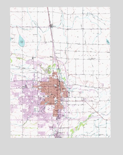
Greeley, CO USGS Topographic Map
Click on map above to begin viewing in our Map Viewer.

This topographic map contains these locations and features:
Feature Name Type Latitude Longitude GNIS ID View Map
Arlington SchoolSchoolN40.4006°W104.6933°180634View Map
Auburn School (historical)SchoolN40.3778°W104.6394°180644View Map
Brentwood Middle SchoolSchoolN40.3956°W104.7210°180608View Map
Broadview ParkParkN40.4278°W104.7269°180611View Map
Buell School (historical)SchoolN40.4739°W104.7166°180642View Map
Cameron SchoolSchoolN40.4163°W104.7005°180628View Map
CloverlyPopulated PlaceN40.4566°W104.6264°202736View Map
Cottonwood LakeReservoirN40.4096°W104.7221°180605View Map
Darling ReservoirReservoirN40.4665°W104.6277°202731View Map
Downtown Greeley Post OfficePost OfficeN40.4230°W104.6966°2734593View Map
Eaton DrawValleyN40.4406°W104.6880°180550View Map
EvansPopulated PlaceN40.3764°W104.6922°202732View Map
Evans CemeteryCemeteryN40.3909°W104.6981°180636View Map
Evans Fire and Rescue Station 2 West SideBuildingN40.3771°W104.7120°2667226View Map
Evans Police DepartmentBuildingN40.3769°W104.6977°2757284View Map
Evans Post OfficePost OfficeN40.3814°W104.6964°2734579View Map
Farr ParkParkN40.3930°W104.7011°180635View Map
Franklin Middle SchoolSchoolN40.4248°W104.7339°180616View Map
Garden CityPopulated PlaceN40.3939°W104.6894°180637View Map
Glenmere ParkParkN40.4086°W104.7047°180630View Map
Graham SeepCanalN40.4758°W104.7161°202723View Map
GreeleyPopulated PlaceN40.4233°W104.7091°180649View Map
Greeley DivisionCivilN40.4440°W104.6936°1935479View Map
Greeley Fire Department Station 1BuildingN40.4268°W104.6940°2666913View Map
Greeley Fire Department Station 2BuildingN40.4007°W104.7164°2667088View Map
Greeley Fire Department Station 3BuildingN40.4336°W104.7343°2667089View Map
Greeley Fire Department Station 4BuildingN40.4029°W104.6783°2667090View Map
Greeley Fire Department Station 6BuildingN40.4114°W104.6615°2667228View Map
Greeley JunctionPopulated PlaceN40.4555°W104.6944°180618View Map
Greeley Lake West DamDamN40.4050°W104.7289°198428View Map
Greeley Lake West ReservoirReservoirN40.4052°W104.7303°198429View Map
Greeley Number 2 CanalCanalN40.4889°W104.6864°180553View Map
Greeley Number 3 DitchCanalN40.4333°W104.7311°169496View Map
Greeley Police DepartmentBuildingN40.4235°W104.7271°2757266View Map
Greeley Post OfficePost OfficeN40.4230°W104.7440°2734624View Map
Greeley-Weld County AirportAirportN40.4267°W104.6349°204429View Map
Heath Middle SchoolSchoolN40.4150°W104.7147°180606View Map
Island Grove ParkParkN40.4389°W104.7019°180619View Map
Island Grove PitMineN40.4403°W104.7061°1683985View Map
Jackson Elementary SchoolSchoolN40.3957°W104.7114°180607View Map
Jackson FieldPopulated PlaceN40.4069°W104.6864°180633View Map
Jefferson High SchoolSchoolN40.4175°W104.6846°180624View Map
KATR-AM (Greeley)TowerN40.4375°W104.7241°204030View Map
Lincoln ParkParkN40.4250°W104.6936°180621View Map
Lincoln School (historical)SchoolN40.4216°W104.6852°180622View Map
Linn Grove CemeteryCemeteryN40.4119°W104.6569°180646View Map
LucernePopulated PlaceN40.4819°W104.6997°180640View Map
Lucerne Post OfficePost OfficeN40.4808°W104.6971°2734613View Map
Luther ParkParkN40.4222°W104.7130°180614View Map
Madison Elementary SchoolSchoolN40.4281°W104.7183°180615View Map
Maplewood Elementary SchoolSchoolN40.4197°W104.7124°180613View Map
Martinez Elementary SchoolSchoolN40.4301°W104.7027°180620View Map
Mason CornerPopulated PlaceN40.4669°W104.7019°180639View Map
Meeker Elementary SchoolSchoolN40.4012°W104.7287°180629View Map
Meeker Memorial MuseumBuildingN40.4175°W104.6925°180626View Map
Montview ParkParkN40.4130°W104.7102°180627View Map
Mumper CornerPopulated PlaceN40.4519°W104.6972°180617View Map
NCMC HeliportAirportN40.4164°W104.7064°204430View Map
North Colorado Medical CenterHospitalN40.4148°W104.7089°180631View Map
North Colorado Medical EvacuationBuildingN40.4148°W104.7108°2716953View Map
Ogilvy DitchCanalN40.4219°W104.6422°202730View Map
Olin School (historical)SchoolN40.4789°W104.6789°180641View Map
Patterson DitchCanalN40.4008°W104.6394°202735View Map
Platte Valley Youth ServicesBuildingN40.4512°W104.7137°2757357View Map
Pleasant Valley SchoolSchoolN40.4501°W104.6498°180647View Map
RosedalePopulated PlaceN40.3853°W104.6986°204694View Map
Saint Peters SchoolSchoolN40.4205°W104.6925°180625View Map
Sand CreekStreamN40.4200°W104.6347°180638View Map
Scott Elementary SchoolSchoolN40.4177°W104.7290°180612View Map
Seeley LakeLakeN40.4671°W104.7360°180643View Map
Seeley Lake DamDamN40.4669°W104.7361°199718View Map
Sunrise ParkParkN40.4208°W104.6664°180623View Map
Sunset Memorial CemeteryCemeteryN40.3908°W104.7319°180610View Map
Town of Garden CityCivilN40.3946°W104.6895°2412667View Map
Uhrich Airport (historical)AirportN40.4603°W104.6458°204431View Map
University of Northern ColoradoSchoolN40.4032°W104.7017°180632View Map
Weld County Detention CenterBuildingN40.4508°W104.7099°2735556View Map
Weld County Paramedic Services Station 1BuildingN40.4498°W104.6978°2666884View Map
Weld County Paramedic Services Station 2BuildingN40.3806°W104.6972°2667230View Map
Weld County Sheriffs OfficeBuildingN40.4507°W104.7104°2735524View Map
West GreeleyReservoirN40.4061°W104.7305°180609View Map

Note: Coordinates in the location and feature list above are referenced to NAD83 datum.


Copyright (C) 2008-2024 Ryan Niemi / Sunset Dynamics ... All Rights Reserved