TopoQuest Logo
Do you find TopoQuest useful?
Help keep TopoQuest running and adding new maps/features by donating!
Bitcoin:  19c7KJd3qBynnjoSw5npx9KScwjBe4ifkT
Litecoin:  LXs6TkuXGGXo1vDsWCkWVdjQX94eUKd6ui
Home View Maps Find Maps Find Places Resources & Links


Eddy Mountain, Montana Topographic Map

USGS Map Title: Eddy Mountain, MT
USGS Map MRC: 47115E2
DRG (GeoTIFF) Download: o47115e2.tif


Neighboring USGS Topographic Map Quads:


  Mount Headley, MT  
47115F3
 

  Priscilla Peak, MT  
47115F2
 

  Calico Creek, MT  
47115F1
 

  Thompson Falls, MT  
47115E3
 

  Eddy Mountain, MT  
47115E2
 

  Big Hole Peak, MT  
47115E1
 

  De Borgia North, MT  
47115D3
 

  Penrose Peak, MT  
47115D2
 

  Sunset Peak, MT  
47115D1


Map MRC Location:

N48°
W116°
N48°
W115°
H8 H7 H6 H5 H4 H3 H2 H1
G8 G7 G6 G5 G4 G3 G2 G1
F8 F7 F6 F5 F4 F3 F2 F1
E8 E7 E6 E5 E4 E3 E2 E1
D8 D7 D6 D5 D4 D3 D2 D1
C8 C7 C6 C5 C4 C3 C2 C1
B8 B7 B6 B5 B4 B3 B2 B1
A8 A7 A6 A5 A4 A3 A2 A1
N47°
W116°
N47°
W115°

Eddy Mountain, MT USGS 1:24K Topographic Map Preview:
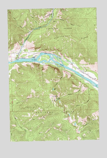
Eddy Mountain, MT USGS Topographic Map
Click on map above to begin viewing in our Map Viewer.

This topographic map contains these locations and features:
Feature Name Type Latitude Longitude GNIS ID View Map
Ashleys Settlement (historical)Populated PlaceN47.5763°W115.2468°1780981View Map
Buckeye CanyonValleyN47.6138°W115.1901°780523View Map
Cameron CreekStreamN47.5333°W115.2488°780823View Map
Camp CreekStreamN47.5163°W115.2396°780850View Map
Copper King CampgroundLocaleN47.6194°W115.1879°781653View Map
Copper King MineMineN47.6185°W115.1907°805124View Map
Copper King MineMineN47.6185°W115.1901°781655View Map
East Fork Cherry CreekStreamN47.5019°W115.2276°782824View Map
EddyLocaleN47.5583°W115.1332°1780946View Map
EddyPopulated PlaceN47.5583°W115.1332°782976View Map
Eddy MountainSummitN47.5422°W115.1876°782980View Map
Eddy Post Office (historical)Post OfficeN47.5583°W115.1332°1780960View Map
Eddy School (historical)SchoolN47.5583°W115.1332°1780831View Map
Frost (historical)LocaleN47.5833°W115.1968°1780945View Map
Goat CreekStreamN47.6030°W115.2179°784005View Map
Kookoosint RidgeRidgeN47.5988°W115.1651°785831View Map
Liver GulchValleyN47.6072°W115.2096°786399View Map
Lower Raven MineMineN47.6166°W115.1935°805143View Map
Lower Silver King MineMineN47.6138°W115.1890°805145View Map
Lynx CreekStreamN47.5124°W115.2349°786734View Map
Malone CreekStreamN47.5558°W115.1404°786801View Map
Outlaw CreekStreamN47.5702°W115.1760°788525View Map
Outlaw LakeLakeN47.5487°W115.1892°788526View Map
Quail LakeLakeN47.5396°W115.1830°789255View Map
Quartz CreekStreamN47.5510°W115.1315°789265View Map
Raven MineMineN47.6180°W115.1946°805121View Map
Raven MineMineN47.6174°W115.1943°789413View Map
Silver King MineMineN47.6127°W115.1868°790523View Map
Silver King MineMineN47.6124°W115.1868°805144View Map
SniderPopulated PlaceN47.6038°W115.2185°790767View Map
Snider Post Office (historical)Post OfficeN47.6038°W115.2185°1780987View Map
Thompson RiverStreamN47.5769°W115.2396°792103View Map
Thompson River SpurLocaleN47.5788°W115.2315°1781034View Map
Thompsons River Post Office (historical)Post OfficeN47.5763°W115.2468°1780980View Map
Tuffys LakeLakeN47.5153°W115.1592°806326View Map

Note: Coordinates in the location and feature list above are referenced to NAD83 datum.


Copyright (C) 2008-2025 Ryan Niemi / Sunset Dynamics ... All Rights Reserved