TopoQuest Logo
Do you find TopoQuest useful?
Help keep TopoQuest running and adding new maps/features by donating!
Bitcoin:  19c7KJd3qBynnjoSw5npx9KScwjBe4ifkT
Litecoin:  LXs6TkuXGGXo1vDsWCkWVdjQX94eUKd6ui
Home View Maps Find Maps Find Places Resources & Links


Mount Headley, Montana Topographic Map

USGS Map Title: Mount Headley, MT
USGS Map MRC: 47115F3
DRG (GeoTIFF) Download: o47115f3.tif


Neighboring USGS Topographic Map Quads:


  Seven Point Mountain, MT  
47115G4
 

  Vermilion Peak, MT  
47115G3
 

  Fishtrap Lake, MT  
47115G2
 

  Belknap, MT  
47115F4
 

  Mount Headley, MT  
47115F3
 

  Priscilla Peak, MT  
47115F2
 

  Table Top Mountain, MT  
47115E4
 

  Thompson Falls, MT  
47115E3
 

  Eddy Mountain, MT  
47115E2


Map MRC Location:

N48°
W116°
N48°
W115°
H8 H7 H6 H5 H4 H3 H2 H1
G8 G7 G6 G5 G4 G3 G2 G1
F8 F7 F6 F5 F4 F3 F2 F1
E8 E7 E6 E5 E4 E3 E2 E1
D8 D7 D6 D5 D4 D3 D2 D1
C8 C7 C6 C5 C4 C3 C2 C1
B8 B7 B6 B5 B4 B3 B2 B1
A8 A7 A6 A5 A4 A3 A2 A1
N47°
W116°
N47°
W115°

Mount Headley, MT USGS 1:24K Topographic Map Preview:
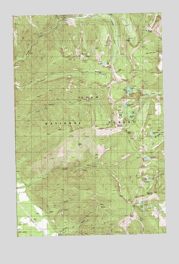
Mount Headley, MT USGS Topographic Map
Click on map above to begin viewing in our Map Viewer.

This topographic map contains these locations and features:
Feature Name Type Latitude Longitude GNIS ID View Map
Arrowhead LakeLakeN47.6816°W115.2615°779150View Map
Big SpringSpringN47.6697°W115.2719°779876View Map
Cabin LakeLakeN47.7065°W115.2799°780741View Map
Carbine LakeLakeN47.7343°W115.2769°780931View Map
Castle RockSummitN47.6763°W115.3235°807042View Map
Cube Iron MountainSummitN47.6872°W115.2907°781981View Map
Cube Iron PassGapN47.6822°W115.2825°791390View Map
Deer LakeLakeN47.6556°W115.2648°782259View Map
Duckhead LakeLakeN47.6673°W115.2658°770879View Map
Frog LakeLakeN47.6938°W115.2781°783762View Map
Goat LakesLakeN47.6413°W115.2721°784012View Map
Grass LakeLakeN47.6921°W115.2849°784198View Map
Graves LakeLakeN47.7179°W115.2889°784230View Map
Irvs CreekStreamN47.7472°W115.3368°806300View Map
Knowles LakeLakeN47.6907°W115.2797°785811View Map
Lawn LakeLakeN47.7217°W115.2992°801795View Map
Maier GulchValleyN47.6438°W115.3643°786788View Map
Mount HeadleySummitN47.7399°W115.2632°784684View Map
Mount SilcoxSummitN47.6391°W115.2777°790487View Map
Porcupine LakeLakeN47.6976°W115.2819°789107View Map
Round Top MountainSummitN47.6477°W115.2610°789814View Map
Weber GulchValleyN47.6258°W115.3404°792913View Map
Winniemuck LakeLakeN47.7165°W115.3017°793422View Map

Note: Coordinates in the location and feature list above are referenced to NAD83 datum.


Copyright (C) 2008-2024 Ryan Niemi / Sunset Dynamics ... All Rights Reserved