TopoQuest Logo
Do you find TopoQuest useful?
Help keep TopoQuest running and adding new maps/features by donating!
Bitcoin:  19c7KJd3qBynnjoSw5npx9KScwjBe4ifkT
Litecoin:  LXs6TkuXGGXo1vDsWCkWVdjQX94eUKd6ui
Home View Maps Find Maps Find Places Resources & Links


Edenville, Michigan Topographic Map

USGS Map Title: Edenville, MI
USGS Map MRC: 43084G4
DRG (GeoTIFF) Download: o43084g4.tif


Neighboring USGS Topographic Map Quads:


  Coleman NE, MI  
43084H5
 

  Gladwin, MI  
43084H4
 

  Wooden Shoe Village, MI  
43084H3
 

  Coleman, MI  
43084G5
 

  Edenville, MI  
43084G4
 

  Hope, MI  
43084G3
 

  Alamando, MI  
43084F5
 

  Sanford, MI  
43084F4
 

  Averill, MI  
43084F3


Map MRC Location:

N44°
W85°
N44°
W84°
H8 H7 H6 H5 H4 H3 H2 H1
G8 G7 G6 G5 G4 G3 G2 G1
F8 F7 F6 F5 F4 F3 F2 F1
E8 E7 E6 E5 E4 E3 E2 E1
D8 D7 D6 D5 D4 D3 D2 D1
C8 C7 C6 C5 C4 C3 C2 C1
B8 B7 B6 B5 B4 B3 B2 B1
A8 A7 A6 A5 A4 A3 A2 A1
N43°
W85°
N43°
W84°

Edenville, MI USGS 1:24K Topographic Map Preview:
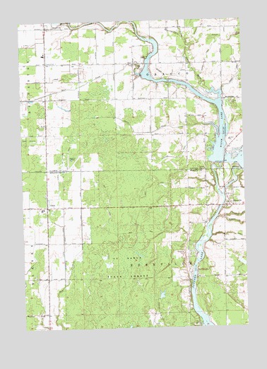
Edenville, MI USGS Topographic Map
Click on map above to begin viewing in our Map Viewer.

This topographic map contains these locations and features:
Feature Name Type Latitude Longitude GNIS ID View Map
Bear CreekStreamN43.8536°W84.4306°620832View Map
Beaverton Area Fire DepartmentBuildingN43.8647°W84.4861°2515934View Map
Beaverton Baptist ChurchChurchN43.8586°W84.4842°623290View Map
Beaverton Church of GodChurchN43.8728°W84.4850°2515945View Map
Beaverton High SchoolSchoolN43.8736°W84.4875°2515941View Map
Coolidge DrainCanalN43.8192°W84.4125°623768View Map
Crockett DrainCanalN43.8717°W84.3978°624074View Map
Curtice Post Office (historical)Post OfficeN43.7992°W84.4858°2544218View Map
CurtisPopulated PlaceN43.7992°W84.4858°624227View Map
DalePopulated PlaceN43.8578°W84.4347°624284View Map
Dale CemeteryCemeteryN43.8542°W84.4367°2515978View Map
Dale Post Office (historical)Post OfficeN43.8578°W84.4347°2515966View Map
Dale United Methodist ChurchChurchN43.8542°W84.4364°2515943View Map
Dow CreekStreamN43.8689°W84.4086°624837View Map
EdenvillePopulated PlaceN43.7995°W84.3817°625353View Map
Edenville CemeteryCemeteryN43.7986°W84.3861°2544616View Map
Edenville DamDamN43.8161°W84.3847°625354View Map
Edenville Fire and Rescue Station 1BuildingN43.8041°W84.3829°2626936View Map
Edenville Post OfficePost OfficeN43.8053°W84.3850°2544662View Map
Edenville United Methodist ChurchChurchN43.7989°W84.3853°2544664View Map
Good Shepherd Lutheran ChurchChurchN43.8578°W84.4333°2515944View Map
Hoover DrainCanalN43.8684°W84.3861°628544View Map
Little Cedar RiverStreamN43.8417°W84.3881°630594View Map
Mason DrainCanalN43.7878°W84.3822°631707View Map
Nestor DrainCanalN43.8317°W84.4364°633300View Map
Otgen DrainCanalN43.8592°W84.3950°634151View Map
Quilett DrainCanalN43.8511°W84.4839°635566View Map
Saint Anne ChurchChurchN43.8261°W84.3828°636535View Map
Seventh Day Adventist ChurchChurchN43.8006°W84.3978°2544661View Map
Seventh-Day Adventist SchoolSchoolN43.8000°W84.3811°2544620View Map
Snyder DrainCanalN43.8534°W84.4122°638220View Map
Swanton CemeteryCemeteryN43.7917°W84.3861°2544230View Map
Tittabawassee River State ForestForestN43.7742°W84.4428°1614887View Map
Tobacco RiverStreamN43.8028°W84.3872°1614893View Map
Tobacco River CampgroundLocaleN43.8653°W84.4250°2515926View Map
Township of EdenvilleCivilN43.7704°W84.4270°1626218View Map
Township of TobaccoCivilN43.8571°W84.4251°1627167View Map
Treman DrainCanalN43.8542°W84.3772°1615057View Map
Wright's Bridge Post Office (historical)Post OfficeN43.7506°W84.3933°2544192View Map
Wrights (historical)Populated PlaceN43.7506°W84.3933°2544187View Map

Note: Coordinates in the location and feature list above are referenced to NAD83 datum.


Copyright (C) 2008-2024 Ryan Niemi / Sunset Dynamics ... All Rights Reserved