TopoQuest Logo
Do you find TopoQuest useful?
Help keep TopoQuest running and adding new maps/features by donating!
Bitcoin:  19c7KJd3qBynnjoSw5npx9KScwjBe4ifkT
Litecoin:  LXs6TkuXGGXo1vDsWCkWVdjQX94eUKd6ui
Home View Maps Find Maps Find Places Resources & Links


Effingham, Kansas Topographic Map

USGS Map Title: Effingham, KS
USGS Map MRC: 39095E4
DRG (GeoTIFF) Download: o39095e4.tif


Neighboring USGS Topographic Map Quads:


  Horton, KS  
39095F5
 

  Everest, KS  
39095F4
 

  Denton, KS  
39095F3
 

  Whiting, KS  
39095E5
 

  Effingham, KS  
39095E4
 

  Lancaster, KS  
39095E3
 

  Arrington, KS  
39095D5
 

  Half Mound, KS  
39095D4
 

  Nortonville, KS  
39095D3


Map MRC Location:

N40°
W96°
N40°
W95°
H8 H7 H6 H5 H4 H3 H2 H1
G8 G7 G6 G5 G4 G3 G2 G1
F8 F7 F6 F5 F4 F3 F2 F1
E8 E7 E6 E5 E4 E3 E2 E1
D8 D7 D6 D5 D4 D3 D2 D1
C8 C7 C6 C5 C4 C3 C2 C1
B8 B7 B6 B5 B4 B3 B2 B1
A8 A7 A6 A5 A4 A3 A2 A1
N39°
W96°
N39°
W95°

Effingham, KS USGS 1:24K Topographic Map Preview:
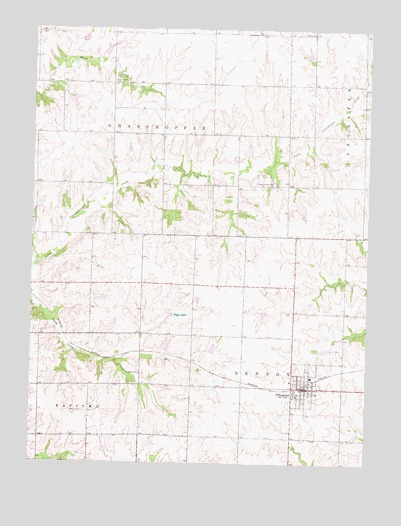
Effingham, KS USGS Topographic Map
Click on map above to begin viewing in our Map Viewer.

This topographic map contains these locations and features:
Feature Name Type Latitude Longitude GNIS ID View Map
Atchison County Community Elementary SchoolSchoolN39.5251°W95.3957°480269View Map
Atchison County Community Junior / Senior High SchoolSchoolN39.5265°W95.3921°2506432View Map
Atchison County Community Schools - District OfficeSchoolN39.5223°W95.3982°2506433View Map
Atchison County FairgroundsLocaleN39.5225°W95.3935°2695091View Map
Atchison County Rescue ServicesBuildingN39.5222°W95.3973°2696455View Map
Atchison County Rural Fire District 2 - EffinghamBuildingN39.5216°W95.3998°2111114View Map
Brush Creek CemeteryCemeteryN39.6097°W95.4705°473473View Map
Brush Creek School (historical)SchoolN39.6022°W95.4705°473472View Map
City of EffinghamCivilN39.5225°W95.3975°2394629View Map
EffinghamPopulated PlaceN39.5222°W95.4008°473477View Map
Effingham CemeteryCemeteryN39.5150°W95.3972°2673188View Map
Effingham City Fire DepartmentBuildingN39.5216°W95.3998°2111279View Map
Effingham City HallBuildingN39.5217°W95.3979°2693227View Map
Effingham Community LibraryBuildingN39.5217°W95.3979°2694728View Map
Effingham Elementary SchoolSchoolN39.5215°W95.3994°2506431View Map
Effingham Post OfficePost OfficeN39.5221°W95.3987°2693700View Map
Effingham Sewer Treatment PlantLocaleN39.5326°W95.3907°2691989View Map
Effingham Union ChurchChurchN39.5227°W95.3966°2689399View Map
Figge LakeReservoirN39.5427°W95.4451°473475View Map
Forest Grove CemeteryCemeteryN39.5809°W95.4171°473474View Map
Glacier UplandsPlainN39.5667°W95.4336°480168View Map
HelenaLocaleN39.5872°W95.3780°481899View Map
Invermay (historical)LocaleN39.6097°W95.4336°482148View Map
Jackson Farmers Grain Elevator Number 3LocaleN39.5225°W95.3988°2695299View Map
Saint Anns Catholic CemeteryCemeteryN39.5186°W95.4011°2673193View Map
Strafuss AirportAirportN39.5071°W95.4725°481459View Map
Sunny Grove SchoolSchoolN39.5653°W95.4130°473476View Map
Township of GrasshopperCivilN39.5986°W95.4865°473240View Map

Note: Coordinates in the location and feature list above are referenced to NAD83 datum.


Copyright (C) 2008-2024 Ryan Niemi / Sunset Dynamics ... All Rights Reserved