TopoQuest Logo
Do you find TopoQuest useful?
Help keep TopoQuest running and adding new maps/features by donating!
Bitcoin:  19c7KJd3qBynnjoSw5npx9KScwjBe4ifkT
Litecoin:  LXs6TkuXGGXo1vDsWCkWVdjQX94eUKd6ui
Home View Maps Find Maps Find Places Resources & Links


Everest, Kansas Topographic Map

USGS Map Title: Everest, KS
USGS Map MRC: 39095F4
DRG (GeoTIFF) Download: o39095f4.tif


Neighboring USGS Topographic Map Quads:


  Hiawatha, KS  
39095G5
 

  Robinson, KS  
39095G4
 

  Highland, KS  
39095G3
 

  Horton, KS  
39095F5
 

  Everest, KS  
39095F4
 

  Denton, KS  
39095F3
 

  Whiting, KS  
39095E5
 

  Effingham, KS  
39095E4
 

  Lancaster, KS  
39095E3


Map MRC Location:

N40°
W96°
N40°
W95°
H8 H7 H6 H5 H4 H3 H2 H1
G8 G7 G6 G5 G4 G3 G2 G1
F8 F7 F6 F5 F4 F3 F2 F1
E8 E7 E6 E5 E4 E3 E2 E1
D8 D7 D6 D5 D4 D3 D2 D1
C8 C7 C6 C5 C4 C3 C2 C1
B8 B7 B6 B5 B4 B3 B2 B1
A8 A7 A6 A5 A4 A3 A2 A1
N39°
W96°
N39°
W95°

Everest, KS USGS 1:24K Topographic Map Preview:
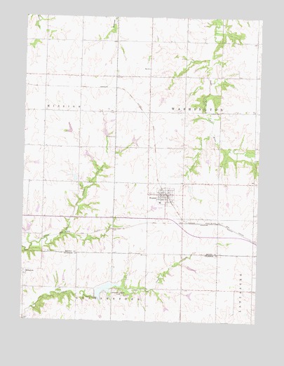
Everest, KS USGS Topographic Map
Click on map above to begin viewing in our Map Viewer.

This topographic map contains these locations and features:
Feature Name Type Latitude Longitude GNIS ID View Map
All Saints CemeteryCemeteryN39.7007°W95.4513°473257View Map
Atchison County DamDamN39.6350°W95.4603°479980View Map
Atchison County ParkParkN39.6361°W95.4489°473253View Map
Barnes Reading RoomBuildingN39.6775°W95.4267°2694640View Map
Bent Nail Ranch AirportAirportN39.6350°W95.4386°2675742View Map
Carr CemeteryCemeteryN39.7259°W95.4517°473260View Map
City of EverestCivilN39.6767°W95.4249°2394713View Map
Clear Creek LakeReservoirN39.6377°W95.4569°479979View Map
EverestPopulated PlaceN39.6772°W95.4247°473256View Map
Everest Christian ChurchChurchN39.6770°W95.4272°2690217View Map
Everest Fire DepartmentBuildingN39.6777°W95.4273°2111309View Map
Everest Middle SchoolSchoolN39.6739°W95.4275°480256View Map
Everest Post OfficePost OfficeN39.6771°W95.4260°2693714View Map
Everest Sewer Treatment PlantLocaleN39.6720°W95.4316°2692096View Map
KennekukPopulated PlaceN39.6444°W95.4989°473254View Map
Kennekuk CemeteryCemeteryN39.6535°W95.4875°473255View Map
Kimberlin CemeteryCemeteryN39.7110°W95.3966°473258View Map
Saint Leo's Catholic CemeteryCemeteryN39.6664°W95.4890°2673213View Map
Township of WashingtonCivilN39.7074°W95.3958°472991View Map
Washington Township Fire DepartmentBuildingN39.6777°W95.4273°2111969View Map
Whitehead (historical)LocaleN39.6536°W95.4289°482039View Map
Zion Lutheran ChurchChurchN39.7289°W95.4344°473259View Map
Zion Lutheran Church CemeteryCemeteryN39.7289°W95.4334°2673214View Map

Note: Coordinates in the location and feature list above are referenced to NAD83 datum.


Copyright (C) 2008-2024 Ryan Niemi / Sunset Dynamics ... All Rights Reserved