TopoQuest Logo
Do you find TopoQuest useful?
Help keep TopoQuest running and adding new maps/features by donating!
Bitcoin:  19c7KJd3qBynnjoSw5npx9KScwjBe4ifkT
Litecoin:  LXs6TkuXGGXo1vDsWCkWVdjQX94eUKd6ui
Home View Maps Find Maps Find Places Resources & Links


El Dorado SW, Kansas Topographic Map

USGS Map Title: El Dorado SW, KS
USGS Map MRC: 37096G8
DRG (GeoTIFF) Download: o37096g8.tif


Neighboring USGS Topographic Map Quads:


  Potwin, KS  
37097H1
 

  El Dorado NW, KS  
37096H8
 

  De Graff, KS  
37096H7
 

  Benton, KS  
37097G1
 

  El Dorado SW, KS  
37096G8
 

  El Dorado, KS  
37096G7
 

  Santa Fe Lake, KS  
37097F1
 

  Augusta, KS  
37096F8
 

  Leon, KS  
37096F7


Map MRC Location:

N38°
W97°
N38°
W96°
H8 H7 H6 H5 H4 H3 H2 H1
G8 G7 G6 G5 G4 G3 G2 G1
F8 F7 F6 F5 F4 F3 F2 F1
E8 E7 E6 E5 E4 E3 E2 E1
D8 D7 D6 D5 D4 D3 D2 D1
C8 C7 C6 C5 C4 C3 C2 C1
B8 B7 B6 B5 B4 B3 B2 B1
A8 A7 A6 A5 A4 A3 A2 A1
N37°
W97°
N37°
W96°

El Dorado SW, KS USGS 1:24K Topographic Map Preview:
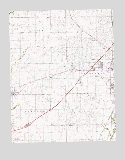
El Dorado SW, KS USGS Topographic Map
Click on map above to begin viewing in our Map Viewer.

This topographic map contains these locations and features:
Feature Name Type Latitude Longitude GNIS ID View Map
American Legion Golf CourseLocaleN37.8135°W96.8771°2694545View Map
Butler Community College Main Campus Building 100SchoolN37.8076°W96.8841°2692327View Map
Butler Community College Main Campus Building 1000SchoolN37.8081°W96.8835°2692328View Map
Butler Community College Main Campus Building 1100BuildingN37.8094°W96.8835°2692484View Map
Butler Community College Main Campus Building 1300BuildingN37.8095°W96.8824°2692485View Map
Butler Community College Main Campus Building 1500SchoolN37.8084°W96.8827°2692329View Map
Butler Community College Main Campus Building 1600SchoolN37.8093°W96.8848°2692330View Map
Butler Community College Main Campus Building 1800BuildingN37.8090°W96.8828°2692486View Map
Butler Community College Main Campus Building 1900SchoolN37.8054°W96.8820°2692239View Map
Butler Community College Main Campus Building 200SchoolN37.8073°W96.8836°2692331View Map
Butler Community College Main Campus Building 300SchoolN37.8063°W96.8834°2692332View Map
Butler Community College Main Campus Building 400SchoolN37.8059°W96.8831°2692333View Map
Butler Community College Main Campus Building 500SchoolN37.8060°W96.8823°2692334View Map
Butler Community College Main Campus Building 700SchoolN37.8076°W96.8829°2692335View Map
Butler Community College Main Campus Building 800SchoolN37.8063°W96.8839°2692336View Map
Butler Community College Main Campus Building 900SchoolN37.8071°W96.8826°2692337View Map
Butler Community College Main Campus LibraryBuildingN37.8067°W96.8829°2692676View Map
Butler County Community CollegeSchoolN37.8067°W96.8830°474594View Map
Butler County Emergency Medical ServicesBuildingN37.8251°W96.8823°2696509View Map
Butler County FairgroundsLocaleN37.7935°W96.8902°2695092View Map
Butler County Sanitary LandfillLocaleN37.7677°W96.8956°2692267View Map
Circle High SchoolSchoolN37.7946°W96.9941°2497519View Map
Circle Oil Hill Elementary SchoolSchoolN37.8240°W96.8928°474582View Map
Circle Towanda Elementary SchoolSchoolN37.8005°W96.9994°480967View Map
Circle Unified School District 375 Police DepartmentBuildingN37.7947°W96.9940°2503854View Map
City of TowandaCivilN37.7966°W96.9920°2397041View Map
El Dorado Business ParkLocaleN37.8183°W96.8934°2692223View Map
El Dorado InterchangeCrossingN37.8195°W96.9025°483175View Map
El Dorado Mobile EstatesPopulated PlaceN37.7672°W96.8786°2694081View Map
El Dorado Oil FieldOilfieldN37.8542°W96.8953°474389View Map
El Dorado PlazaLocaleN37.8185°W96.8824°481657View Map
Fairview Baptist ChurchChurchN37.8547°W96.9868°474574View Map
First Baptist ChurchChurchN37.8029°W96.9932°2690736View Map
First Southern Baptist ChurchChurchN37.8188°W96.8753°483180View Map
Hanks Mobile Home ParkPopulated PlaceN37.7939°W96.9971°2694094View Map
Jehovah's Witness Kingdom ChurchChurchN37.8244°W96.8893°483185View Map
KBTL - FM (El Dorado)BuildingN37.8057°W96.8827°2625264View Map
MidianPopulated PlaceN37.8103°W96.9531°484658View Map
Natural Resources Conservation Service El Dorado Service CenterBuildingN37.8144°W96.8842°2504245View Map
Oil HillSummitN37.8361°W96.8856°474576View Map
Oil Hill Industrial ParkLocaleN37.8229°W96.9120°2692193View Map
Pierce Oil FieldOilfieldN37.8597°W96.9831°474575View Map
Sunset Lawns CemeteryCemeteryN37.8028°W96.8781°474581View Map
Sutton CreekStreamN37.7550°W96.8798°474580View Map
TowandaPopulated PlaceN37.7975°W96.9998°474579View Map
Towanda CemeteryCemeteryN37.8027°W96.9975°2673222View Map
Towanda Service AreaLocaleN37.7662°W96.9813°480969View Map
Township of El DoradoCivilN37.7740°W96.9028°474388View Map
Township of FairviewCivilN37.8684°W96.9872°474378View Map
Township of TowandaCivilN37.7812°W96.9893°474577View Map
VanoraPopulated PlaceN37.7659°W96.8892°484690View Map
Walnut Valley Memorial ParkCemeteryN37.8118°W96.8996°474583View Map

Note: Coordinates in the location and feature list above are referenced to NAD83 datum.


Copyright (C) 2008-2025 Ryan Niemi / Sunset Dynamics ... All Rights Reserved