TopoQuest Logo
Do you find TopoQuest useful?
Help keep TopoQuest running and adding new maps/features by donating!
Bitcoin:  19c7KJd3qBynnjoSw5npx9KScwjBe4ifkT
Litecoin:  LXs6TkuXGGXo1vDsWCkWVdjQX94eUKd6ui
Home View Maps Find Maps Find Places Resources & Links


Elba, Minnesota Topographic Map

USGS Map Title: Elba, MN
USGS Map MRC: 44092A1
DRG (GeoTIFF) Download: o44092a1.tif


Neighboring USGS Topographic Map Quads:


  Plainview, MN  
44092B2
 

  Beaver, MN  
44092B1
 

  Weaver, MN  
44091B8
 

  Plainview SW, MN  
44092A2
 

  Elba, MN  
44092A1
 

  Altura, MN  
44091A8
 

  Eyota, MN  
43092H2
 

  Saint Charles, MN  
43092H1
 

  Utica, MN  
43091H8


Map MRC Location:

N45°
W93°
N45°
W92°
H8 H7 H6 H5 H4 H3 H2 H1
G8 G7 G6 G5 G4 G3 G2 G1
F8 F7 F6 F5 F4 F3 F2 F1
E8 E7 E6 E5 E4 E3 E2 E1
D8 D7 D6 D5 D4 D3 D2 D1
C8 C7 C6 C5 C4 C3 C2 C1
B8 B7 B6 B5 B4 B3 B2 B1
A8 A7 A6 A5 A4 A3 A2 A1
N44°
W93°
N44°
W92°

Elba, MN USGS 1:24K Topographic Map Preview:
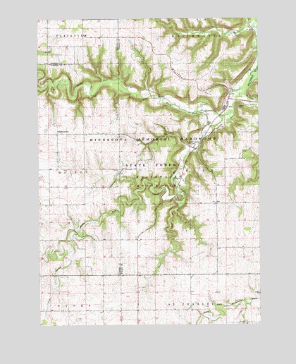
Elba, MN USGS Topographic Map
Click on map above to begin viewing in our Map Viewer.

This topographic map contains these locations and features:
Feature Name Type Latitude Longitude GNIS ID View Map
Berea CemeteryCemeteryN44.0500°W92.0246°2052187View Map
Berea ChurchChurchN44.0497°W92.0249°639946View Map
City of ElbaCivilN44.0864°W92.0181°2394633View Map
Crow SpringStreamN44.0336°W92.1074°642506View Map
ElbaPopulated PlaceN44.0886°W92.0188°643223View Map
Elba Post Office (historical)Post OfficeN44.0886°W92.0188°2051977View Map
Fairwater CemeteryCemeteryN44.0891°W92.0340°643524View Map
Kingsley CornerPopulated PlaceN44.0783°W92.1143°654778View Map
Lazy D CampgroundLocaleN44.0736°W92.0363°2052191View Map
Middle Fork Whitewater RiverStreamN44.0847°W92.0218°647810View Map
North Fork Whitewater RiverStreamN44.0847°W92.0218°648642View Map
Saint Aloysius CemeteryCemeteryN44.0958°W92.0163°650489View Map
Saint Aloysius ChurchChurchN44.0922°W92.0168°2052190View Map
South Fork Whitewater RiverStreamN44.0955°W92.0077°652305View Map
Township of ElbaCivilN44.0620°W92.0194°664059View Map
Trout RunStreamN44.0491°W92.0432°653348View Map
Van Norman's AirportAirportN44.0472°W92.0929°660391View Map
Whiskey HillSummitN44.0989°W92.0332°654065View Map
Whitewater State ParkParkN44.0583°W92.0588°654109View Map
Whitewater State Park Historical MarkerParkN44.0555°W92.0474°2052204View Map

Note: Coordinates in the location and feature list above are referenced to NAD83 datum.


Copyright (C) 2008-2025 Ryan Niemi / Sunset Dynamics ... All Rights Reserved