TopoQuest Logo
Do you find TopoQuest useful?
Help keep TopoQuest running and adding new maps/features by donating!
Bitcoin:  19c7KJd3qBynnjoSw5npx9KScwjBe4ifkT
Litecoin:  LXs6TkuXGGXo1vDsWCkWVdjQX94eUKd6ui
Home View Maps Find Maps Find Places Resources & Links


Altura, Minnesota Topographic Map

USGS Map Title: Altura, MN
USGS Map MRC: 44091A8
DRG (GeoTIFF) Download: o44091a8.tif


Neighboring USGS Topographic Map Quads:


  Beaver, MN  
44092B1
 

  Weaver, MN  
44091B8
 

  Cochrane, WI  
44091B7
 

  Elba, MN  
44092A1
 

  Altura, MN  
44091A8
 

  Rollingstone, MN  
44091A7
 

  Saint Charles, MN  
43092H1
 

  Utica, MN  
43091H8
 

  Lewiston, MN  
43091H7


Map MRC Location:

N45°
W92°
N45°
W91°
H8 H7 H6 H5 H4 H3 H2 H1
G8 G7 G6 G5 G4 G3 G2 G1
F8 F7 F6 F5 F4 F3 F2 F1
E8 E7 E6 E5 E4 E3 E2 E1
D8 D7 D6 D5 D4 D3 D2 D1
C8 C7 C6 C5 C4 C3 C2 C1
B8 B7 B6 B5 B4 B3 B2 B1
A8 A7 A6 A5 A4 A3 A2 A1
N44°
W92°
N44°
W91°

Altura, MN USGS 1:24K Topographic Map Preview:
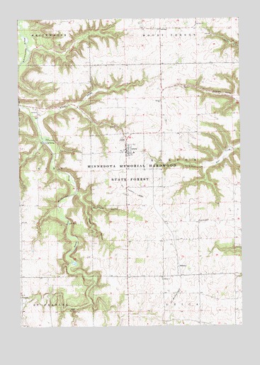
Altura, MN USGS Topographic Map
Click on map above to begin viewing in our Map Viewer.

This topographic map contains these locations and features:
Feature Name Type Latitude Longitude GNIS ID View Map
AlturaPopulated PlaceN44.0716°W91.9396°639312View Map
Altura (historical)LocaleN44.0702°W91.9410°2052175View Map
Altura Elementary SchoolSchoolN44.0705°W91.9352°2052180View Map
Altura Fire DepartmentBuildingN44.0723°W91.9399°2666332View Map
Altura Post OfficePost OfficeN44.0712°W91.9394°2052176View Map
BethanyPopulated PlaceN44.0241°W91.9115°639991View Map
Bethany (historical)LocaleN44.0241°W91.9115°2051985View Map
Bethany ChurchChurchN44.0189°W91.9199°640001View Map
Bethany Post Office (historical)Post OfficeN44.0241°W91.9115°2051986View Map
Chaffe RavineValleyN44.0545°W91.9674°641089View Map
City of AlturaCivilN44.0642°W91.9436°2393941View Map
Crystal SpringPopulated PlaceN44.0747°W91.9863°654658View Map
Hebron CemeteryCemeteryN44.0918°W91.9199°2052189View Map
Hebron ChurchChurchN44.0914°W91.9202°644824View Map
Holt SpringSpringN44.0075°W91.9693°645109View Map
Kieffer ValleyValleyN44.0856°W91.9871°646136View Map
Lake HornLakeN44.0419°W91.9727°645193View Map
Lenard Greden Detention DamDamN44.1133°W91.9502°1776573View Map
OakridgePopulated PlaceN44.1208°W91.9199°654856View Map
Oakridge Post Office (historical)Post OfficeN44.1208°W91.9199°2051960View Map
Richard J Dorer Memorial Hardwood State ForestForestN44.0636°W91.9365°659715View Map
Saint Anthony Catholic ChurchChurchN44.0705°W91.9382°2052178View Map
Saint Mary's ChurchChurchN44.0716°W91.9396°2052177View Map
Sweet RavineValleyN44.0492°W91.9621°652940View Map
Township of NortonCivilN44.0634°W91.8953°665177View Map
Trinity CemeteryCemeteryN44.0430°W91.8951°2052188View Map
Trinity ChurchChurchN44.0427°W91.8954°653305View Map

Note: Coordinates in the location and feature list above are referenced to NAD83 datum.


Copyright (C) 2008-2025 Ryan Niemi / Sunset Dynamics ... All Rights Reserved