TopoQuest Logo
Do you find TopoQuest useful?
Help keep TopoQuest running and adding new maps/features by donating!
Bitcoin:  19c7KJd3qBynnjoSw5npx9KScwjBe4ifkT
Litecoin:  LXs6TkuXGGXo1vDsWCkWVdjQX94eUKd6ui
Home View Maps Find Maps Find Places Resources & Links


Weaver, Minnesota Topographic Map

USGS Map Title: Weaver, MN
USGS Map MRC: 44091B8
DRG (GeoTIFF) Download: o44091b8.tif


Neighboring USGS Topographic Map Quads:


  Wabasha South, MN  
44092C1
 

  Alma, WI  
44091C8
 

  Cream, WI  
44091C7
 

  Beaver, MN  
44092B1
 

  Weaver, MN  
44091B8
 

  Cochrane, WI  
44091B7
 

  Elba, MN  
44092A1
 

  Altura, MN  
44091A8
 

  Rollingstone, MN  
44091A7


Map MRC Location:

N45°
W92°
N45°
W91°
H8 H7 H6 H5 H4 H3 H2 H1
G8 G7 G6 G5 G4 G3 G2 G1
F8 F7 F6 F5 F4 F3 F2 F1
E8 E7 E6 E5 E4 E3 E2 E1
D8 D7 D6 D5 D4 D3 D2 D1
C8 C7 C6 C5 C4 C3 C2 C1
B8 B7 B6 B5 B4 B3 B2 B1
A8 A7 A6 A5 A4 A3 A2 A1
N44°
W92°
N44°
W91°

Weaver, MN USGS 1:24K Topographic Map Preview:
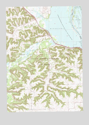
Weaver, MN USGS Topographic Map
Click on map above to begin viewing in our Map Viewer.

This topographic map contains these locations and features:
Feature Name Type Latitude Longitude GNIS ID View Map
Adams ValleyValleyN44.1742°W91.9263°639211View Map
Belvidere SloughGutN44.2457°W91.8785°2729887View Map
Dorer PoolsLakeN44.2009°W91.9607°642894View Map
East Indian CreekStreamN44.2304°W91.9353°643082View Map
Evergreen CemeteryCemeteryN44.1997°W91.8996°643454View Map
Frisch ValleyValleyN44.1496°W91.9346°643965View Map
Hidershide ValleyValleyN44.1582°W91.9312°644935View Map
Hillside CemeteryCemeteryN44.2000°W91.8977°645005View Map
Hoosier RidgeRidgeN44.2025°W91.9921°645161View Map
Lost Island LakeLakeN44.2216°W91.8786°2729886View Map
Mallard IslandIslandN44.2225°W91.8992°2729890View Map
Montgomery PointCapeN44.2139°W91.9128°2729888View Map
Muench IslandIslandN44.2458°W91.8860°1570011View Map
Pritchard Maloney LakeBayN44.2369°W91.9275°2761271View Map
Saint Marys CemeteryCemeteryN44.2008°W91.9004°650847View Map
Sand RunChannelN44.2372°W91.8860°1573700View Map
Selke ValleyValleyN44.1491°W91.9371°651847View Map
Snake CreekStreamN44.2350°W91.9238°652197View Map
Somerfield Island (historical)IslandN44.2225°W91.8757°1837556View Map
Swan IslandIslandN44.2148°W91.9031°2729889View Map
Township of MinneiskaCivilN44.2344°W91.9189°664988View Map
Township of Mount VernonCivilN44.1491°W91.9006°665058View Map
Trout CreekStreamN44.2027°W91.9457°653345View Map
WeaverPopulated PlaceN44.2150°W91.9288°653873View Map
WeaverLocaleN44.2150°W91.9286°2064579View Map
Weaver BottomsSwampN44.2378°W91.9176°2729891View Map
Weaver Goose LakeBayN44.2302°W91.9310°2761272View Map
Weaver Post Office (historical)Post OfficeN44.2150°W91.9286°2064580View Map
Whitewater RiverStreamN44.2091°W91.9032°654108View Map
Young CemeteryCemeteryN44.1813°W91.9810°654424View Map

Note: Coordinates in the location and feature list above are referenced to NAD83 datum.


Copyright (C) 2008-2024 Ryan Niemi / Sunset Dynamics ... All Rights Reserved