TopoQuest Logo
Do you find TopoQuest useful?
Help keep TopoQuest running and adding new maps/features by donating!
Bitcoin:  19c7KJd3qBynnjoSw5npx9KScwjBe4ifkT
Litecoin:  LXs6TkuXGGXo1vDsWCkWVdjQX94eUKd6ui
Home View Maps Find Maps Find Places Resources & Links


Elbing, Kansas Topographic Map

USGS Map Title: Elbing, KS
USGS Map MRC: 38097A2
DRG (GeoTIFF) Download: o38097a2.tif


Neighboring USGS Topographic Map Quads:


  Goessel, KS  
38097B3
 

  Peabody NW, KS  
38097B2
 

  Peabody, KS  
38097B1
 

  Newton, KS  
38097A3
 

  Elbing, KS  
38097A2
 

  Peabody SE, KS  
38097A1
 

  Sedgwick NE, KS  
37097H3
 

  Whitewater, KS  
37097H2
 

  Potwin, KS  
37097H1


Map MRC Location:

N39°
W98°
N39°
W97°
H8 H7 H6 H5 H4 H3 H2 H1
G8 G7 G6 G5 G4 G3 G2 G1
F8 F7 F6 F5 F4 F3 F2 F1
E8 E7 E6 E5 E4 E3 E2 E1
D8 D7 D6 D5 D4 D3 D2 D1
C8 C7 C6 C5 C4 C3 C2 C1
B8 B7 B6 B5 B4 B3 B2 B1
A8 A7 A6 A5 A4 A3 A2 A1
N38°
W98°
N38°
W97°

Elbing, KS USGS 1:24K Topographic Map Preview:
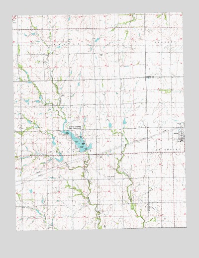
Elbing, KS USGS Topographic Map
Click on map above to begin viewing in our Map Viewer.

This topographic map contains these locations and features:
Feature Name Type Latitude Longitude GNIS ID View Map
A and D RanchLocaleN38.0154°W97.2031°2728847View Map
Bellview School (historical)SchoolN38.1167°W97.1342°482928View Map
Berean AcademySchoolN38.0506°W97.1273°484302View Map
Berean AcademySchoolN38.0500°W97.1277°481236View Map
Catfish PointCapeN38.0478°W97.1986°484305View Map
City of ElbingCivilN38.0539°W97.1277°2394635View Map
Civil War CemeteryCemeteryN38.0436°W97.1758°2739705View Map
Crown PointCapeN38.0511°W97.2061°484306View Map
ElbingPopulated PlaceN38.0528°W97.1278°478025View Map
Elbing Elementary School (historical)SchoolN38.0506°W97.1278°481237View Map
Elbing Grain Elevator Number 1LocaleN38.0520°W97.1257°2695206View Map
Elbing Post OfficePost OfficeN38.0533°W97.1267°2693702View Map
Elbing Wastewater PlantLocaleN38.0613°W97.1266°2691914View Map
Grace Hill CemeteryCemeteryN38.0293°W97.1807°2739704View Map
Grace Hill Mennonite ChurchChurchN38.0296°W97.1800°478026View Map
Harvey County East ParkParkN38.0556°W97.2086°484303View Map
Harvey County East Park LakeReservoirN38.0499°W97.2015°484304View Map
Kelly School (historical)SchoolN38.0289°W97.2459°484320View Map
Lake View LandingLocaleN38.0476°W97.2032°484307View Map
Mission CemeteryCemeteryN38.0579°W97.1626°478024View Map
Needle PointCapeN38.0511°W97.2017°484308View Map
Township of PleasantCivilN38.0434°W97.2082°473696View Map
Walnut CreekStreamN38.0292°W97.1973°478023View Map
Walton LandingLocaleN38.0569°W97.2126°484309View Map
Whitewater River Consolidated Fire District - Elbing StationBuildingN38.0530°W97.1269°2111979View Map
Zion Mennonite ChurchChurchN38.0568°W97.1271°2691058View Map

Note: Coordinates in the location and feature list above are referenced to NAD83 datum.


Copyright (C) 2008-2024 Ryan Niemi / Sunset Dynamics ... All Rights Reserved