TopoQuest Logo
Do you find TopoQuest useful?
Help keep TopoQuest running and adding new maps/features by donating!
Bitcoin:  19c7KJd3qBynnjoSw5npx9KScwjBe4ifkT
Litecoin:  LXs6TkuXGGXo1vDsWCkWVdjQX94eUKd6ui
Home View Maps Find Maps Find Places Resources & Links


Electric Peak, Montana Topographic Map

USGS Map Title: Electric Peak, MT
USGS Map MRC: 45110A7
DRG (GeoTIFF) Download: o45110a7.tif


Neighboring USGS Topographic Map Quads:


  Miner, MT  
45110B8
 

  Dome Mountain, MT  
45110B7
 

  Monitor Peak, MT  
45110B6
 

  Sportsman Lake, MT  
45110A8
 

  Electric Peak, MT  
45110A7
 

  Gardiner, MT  
45110A6
 

  Joseph Peak, WY  
44110H8
 

  Quadrant Mountain, WY  
44110H7
 

  Mammoth, WY  
44110H6


Map MRC Location:

N46°
W111°
N46°
W110°
H8 H7 H6 H5 H4 H3 H2 H1
G8 G7 G6 G5 G4 G3 G2 G1
F8 F7 F6 F5 F4 F3 F2 F1
E8 E7 E6 E5 E4 E3 E2 E1
D8 D7 D6 D5 D4 D3 D2 D1
C8 C7 C6 C5 C4 C3 C2 C1
B8 B7 B6 B5 B4 B3 B2 B1
A8 A7 A6 A5 A4 A3 A2 A1
N45°
W111°
N45°
W110°

Electric Peak, MT USGS 1:24K Topographic Map Preview:
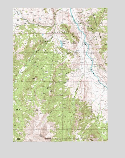
Electric Peak, MT USGS Topographic Map
Click on map above to begin viewing in our Map Viewer.

This topographic map contains these locations and features:
Feature Name Type Latitude Longitude GNIS ID View Map
08S08E31DADA01 WellWellN45.0919°W110.7824°807868View Map
08S08E32CCAD01 WellWellN45.0894°W110.7772°807851View Map
AldridgePopulated PlaceN45.0869°W110.8216°778935View Map
Aldridge CemeteryCemeteryN45.0948°W110.8129°1743126View Map
Aldridge CreekStreamN45.1016°W110.8216°778936View Map
Aldridge LakeLakeN45.0910°W110.8116°778937View Map
Aldridge Post Office (historical)Post OfficeN45.0869°W110.8216°1743181View Map
Aldridge School (historical)SchoolN45.0869°W110.8216°1743247View Map
Bassett CreekStreamN45.1102°W110.7908°779429View Map
Beatie Gulch (historical)LocaleN45.0680°W110.7841°1743090View Map
Beattie GulchValleyN45.0691°W110.7786°779586View Map
Cinnabar (historical)LocaleN45.0538°W110.7613°1743188View Map
Cinnabar BasinBasinN45.1124°W110.8705°781279View Map
Cinnabar CreekStreamN45.1091°W110.8208°781280View Map
Cinnabar MountainSummitN45.1035°W110.8037°781282View Map
Cinnabar Post Office (historical)Post OfficeN45.0538°W110.7613°1743189View Map
Cinnabar School (historical)SchoolN45.1158°W110.8655°781283View Map
Corwin School (historical)SchoolN45.1130°W110.7899°1743266View Map
Corwin SpringsPopulated PlaceN45.1130°W110.7899°770124View Map
Corwin Springs (historical)LocaleN45.1130°W110.7899°1743314View Map
Corwin Springs Fishing Access SiteLocaleN45.1130°W110.7916°1744552View Map
Corwin Springs Post Office (historical)Post OfficeN45.1130°W110.7899°1743316View Map
Cottonwood CreekStreamN45.1119°W110.8566°781733View Map
Deaf Jim CreekStreamN45.0735°W110.8563°782165View Map
Deaf Jim KnobSummitN45.0590°W110.8454°782166View Map
Devils SlideCliffN45.0922°W110.7997°782336View Map
Dixon CreekStreamN45.1185°W110.8661°782421View Map
ElectricPopulated PlaceN45.0785°W110.7819°783037View Map
Electric (historical)LocaleN45.0785°W110.7819°1743242View Map
Electric CreekStreamN45.0380°W110.7944°800753View Map
Electric PeakSummitN45.0051°W110.8376°800755View Map
Electric Post Office (historical)Post OfficeN45.0785°W110.7819°1743243View Map
Electric School (historical)SchoolN45.0785°W110.7819°1743241View Map
Evensdale (historical)LocaleN45.0708°W110.7772°1743228View Map
Henderson Post Office (historical)Post OfficeN45.1083°W110.8202°1743308View Map
Herron (historical)LocaleN45.0708°W110.7752°1743307View Map
Hoppe CreekStreamN45.0888°W110.8369°785008View Map
Horr CemeteryCemeteryN45.0732°W110.7813°794522View Map
LaDuke SpringSpringN45.0905°W110.7753°785875View Map
LaDuke Spring CampgroundLocaleN45.0952°W110.7827°801971View Map
LaDuke Springs (historical)LocaleN45.0899°W110.7744°1743296View Map
Little Joe LakeLakeN45.0579°W110.8345°786313View Map
Little Trail CreekStreamN45.0702°W110.7710°786386View Map
Newton Camp (historical)LocaleN45.0680°W110.7799°1743320View Map
Reese CreekStreamN45.0668°W110.7722°801356View Map
Spring CreekStreamN45.0838°W110.7788°791231View Map
Stephens CreekStreamN45.0489°W110.7510°801540View Map
Summit UniversitySchoolN45.1130°W110.7899°1743281View Map
Yellowstone National Park Division (historical)CensusN45.0035°W110.8016°1940750View Map

Note: Coordinates in the location and feature list above are referenced to NAD83 datum.


Copyright (C) 2008-2024 Ryan Niemi / Sunset Dynamics ... All Rights Reserved