TopoQuest Logo
Do you find TopoQuest useful?
Help keep TopoQuest running and adding new maps/features by donating!
Bitcoin:  19c7KJd3qBynnjoSw5npx9KScwjBe4ifkT
Litecoin:  LXs6TkuXGGXo1vDsWCkWVdjQX94eUKd6ui
Home View Maps Find Maps Find Places Resources & Links


Elephant Mountain, Arizona Topographic Map

USGS Map Title: Elephant Mountain, AZ
USGS Map MRC: 34113F4
DRG (GeoTIFF) Download: o34113f4.tif


Neighboring USGS Topographic Map Quads:


  Tule Wash, AZ  
34113G5
 

  Cedar Basin, AZ  
34113G4
 

  Pilot Knob, AZ  
34113G3
 

  Wikieup, AZ  
34113F5
 

  Elephant Mountain, AZ  
34113F4
 

  Negro Ed, AZ  
34113F3
 

  Greenwood Peak, AZ  
34113E5
 

  Kaiser Spring, AZ  
34113E4
 

  Grayback Mountains, AZ  
34113E3


Map MRC Location:

N35°
W114°
N35°
W113°
H8 H7 H6 H5 H4 H3 H2 H1
G8 G7 G6 G5 G4 G3 G2 G1
F8 F7 F6 F5 F4 F3 F2 F1
E8 E7 E6 E5 E4 E3 E2 E1
D8 D7 D6 D5 D4 D3 D2 D1
C8 C7 C6 C5 C4 C3 C2 C1
B8 B7 B6 B5 B4 B3 B2 B1
A8 A7 A6 A5 A4 A3 A2 A1
N34°
W114°
N34°
W113°

Elephant Mountain, AZ USGS 1:24K Topographic Map Preview:
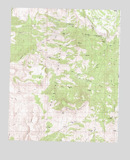
Elephant Mountain, AZ USGS Topographic Map
Click on map above to begin viewing in our Map Viewer.

This topographic map contains these locations and features:
Feature Name Type Latitude Longitude GNIS ID View Map
Arrowhead SpringSpringN34.6764°W113.4008°22814View Map
Arrowweed CanyonValleyN34.6864°W113.4230°22815View Map
Arrowweed SpringsSpringN34.6728°W113.4063°22816View Map
Bitter CreekStreamN34.7022°W113.3980°22827View Map
Box Canyon WellWellN34.6425°W113.4258°22840View Map
Brushy BasinBasinN34.6789°W113.4410°22842View Map
Brushy Basin WellWellN34.6767°W113.4324°22843View Map
Burro CliffsCliffN34.6367°W113.4758°22848View Map
Burro SpringSpringN34.7250°W113.4002°22851View Map
Chalk SpringSpringN34.7267°W113.4408°22872View Map
Chalk Spring CanyonValleyN34.7111°W113.4694°22874View Map
Dead Cow TankReservoirN34.6363°W113.3762°22906View Map
East Fork Sycamore CreekStreamN34.7136°W113.3894°22923View Map
Elephant MountainSummitN34.6636°W113.4149°22929View Map
Grey MountainSummitN34.7150°W113.4219°22966View Map
Hillside SpringSpringN34.7258°W113.4097°22993View Map
Hobo SpringSpringN34.6958°W113.4013°22994View Map
Kimble CanyonValleyN34.7036°W113.4599°23030View Map
Kimble Canyon WellWellN34.7045°W113.4535°23031View Map
Lion SpringSpringN34.6520°W113.4363°23057View Map
Muley MountainSummitN34.6786°W113.3813°23094View Map
Neale MesaSummitN34.6778°W113.4652°23103View Map
Rincon WellsWellN34.6381°W113.4549°23167View Map
Rock SpringSpringN34.7064°W113.4138°23175View Map
Slaughter TankReservoirN34.7496°W113.3781°23214View Map
Sycamore CampLocaleN34.7197°W113.3916°23241View Map
Trinidad WellWellN34.6356°W113.4060°23255View Map
Upper Bitter Creek WellWellN34.7356°W113.4333°23263View Map
Upper Cornwall WellWellN34.6486°W113.3824°23264View Map
West Fork Sycamore CreekStreamN34.7214°W113.3924°23288View Map

Note: Coordinates in the location and feature list above are referenced to NAD83 datum.


Copyright (C) 2008-2024 Ryan Niemi / Sunset Dynamics ... All Rights Reserved