TopoQuest Logo
Do you find TopoQuest useful?
Help keep TopoQuest running and adding new maps/features by donating!
Bitcoin:  19c7KJd3qBynnjoSw5npx9KScwjBe4ifkT
Litecoin:  LXs6TkuXGGXo1vDsWCkWVdjQX94eUKd6ui
Home View Maps Find Maps Find Places Resources & Links


Grayback Mountains, Arizona Topographic Map

USGS Map Title: Grayback Mountains, AZ
USGS Map MRC: 34113E3
DRG (GeoTIFF) Download: o34113e3.tif


Neighboring USGS Topographic Map Quads:


  Elephant Mountain, AZ  
34113F4
 

  Negro Ed, AZ  
34113F3
 

  Bozarth Mesa, AZ  
34113F2
 

  Kaiser Spring, AZ  
34113E4
 

  Grayback Mountains, AZ  
34113E3
 

  Bagdad, AZ  
34113E2
 

  Arrastra Mountain, AZ  
34113D4
 

  Arrastra Mountain NE, AZ  
34113D3
 

  Thorn Peak, AZ  
34113D2


Map MRC Location:

N35°
W114°
N35°
W113°
H8 H7 H6 H5 H4 H3 H2 H1
G8 G7 G6 G5 G4 G3 G2 G1
F8 F7 F6 F5 F4 F3 F2 F1
E8 E7 E6 E5 E4 E3 E2 E1
D8 D7 D6 D5 D4 D3 D2 D1
C8 C7 C6 C5 C4 C3 C2 C1
B8 B7 B6 B5 B4 B3 B2 B1
A8 A7 A6 A5 A4 A3 A2 A1
N34°
W114°
N34°
W113°

Grayback Mountains, AZ USGS 1:24K Topographic Map Preview:
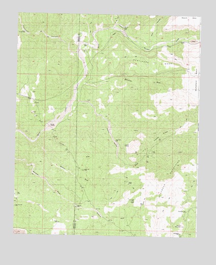
Grayback Mountains, AZ USGS Topographic Map
Click on map above to begin viewing in our Map Viewer.

This topographic map contains these locations and features:
Feature Name Type Latitude Longitude GNIS ID View Map
Agate WellWellN34.5542°W113.3069°21149View Map
Bland MineMineN34.5300°W113.2971°21188View Map
Boulder CreekStreamN34.6156°W113.3088°26645View Map
Coors MineMineN34.5195°W113.2952°21234View Map
Coors WellWellN34.5206°W113.2952°21235View Map
Copper RidgeRidgeN34.5570°W113.2763°21236View Map
Cornwall CanyonValleyN34.6034°W113.3341°22888View Map
Deer Mountain WashArroyoN34.6195°W113.3085°21251View Map
Grayback MountainsRangeN34.5353°W113.2716°21276View Map
Key MineMineN34.5234°W113.3730°23027View Map
Laurel SpringSpringN34.5512°W113.3004°21315View Map
Lower Cornwall WellWellN34.6145°W113.3699°23068View Map
Mammoth WashStreamN34.5875°W113.3071°7644View Map
Manuel WashArroyoN34.5550°W113.3596°23076View Map
Mulholland WashArroyoN34.6097°W113.2752°23976View Map
New Olea WellWellN34.5161°W113.3741°23108View Map
North Fork WellWellN34.5372°W113.3274°21359View Map
Pack Rat WellWellN34.5161°W113.3319°21372View Map
Round MountainSummitN34.5067°W113.2605°21411View Map
Round Mountain WellWellN34.5145°W113.2577°21412View Map
Six Mile CrossingPopulated PlaceN34.5611°W113.3519°25311View Map
Suicide WashArroyoN34.5603°W113.3496°23231View Map
Tortilla FlatFlatN34.5206°W113.2866°21468View Map
Zannaropolis MineMineN34.5017°W113.2619°21509View Map

Note: Coordinates in the location and feature list above are referenced to NAD83 datum.


Copyright (C) 2008-2025 Ryan Niemi / Sunset Dynamics ... All Rights Reserved