TopoQuest Logo
Do you find TopoQuest useful?
Help keep TopoQuest running and adding new maps/features by donating!
Bitcoin:  19c7KJd3qBynnjoSw5npx9KScwjBe4ifkT
Litecoin:  LXs6TkuXGGXo1vDsWCkWVdjQX94eUKd6ui
Home View Maps Find Maps Find Places Resources & Links


Cedar Basin, Arizona Topographic Map

USGS Map Title: Cedar Basin, AZ
USGS Map MRC: 34113G4
DRG (GeoTIFF) Download: o34113g4.tif


Neighboring USGS Topographic Map Quads:


  Tom Brown Canyon, AZ  
34113H5
 

  Gonzales Wash, AZ  
34113H4
 

  Mohon Peak, AZ  
34113H3
 

  Tule Wash, AZ  
34113G5
 

  Cedar Basin, AZ  
34113G4
 

  Pilot Knob, AZ  
34113G3
 

  Wikieup, AZ  
34113F5
 

  Elephant Mountain, AZ  
34113F4
 

  Negro Ed, AZ  
34113F3


Map MRC Location:

N35°
W114°
N35°
W113°
H8 H7 H6 H5 H4 H3 H2 H1
G8 G7 G6 G5 G4 G3 G2 G1
F8 F7 F6 F5 F4 F3 F2 F1
E8 E7 E6 E5 E4 E3 E2 E1
D8 D7 D6 D5 D4 D3 D2 D1
C8 C7 C6 C5 C4 C3 C2 C1
B8 B7 B6 B5 B4 B3 B2 B1
A8 A7 A6 A5 A4 A3 A2 A1
N34°
W114°
N34°
W113°

Cedar Basin, AZ USGS 1:24K Topographic Map Preview:
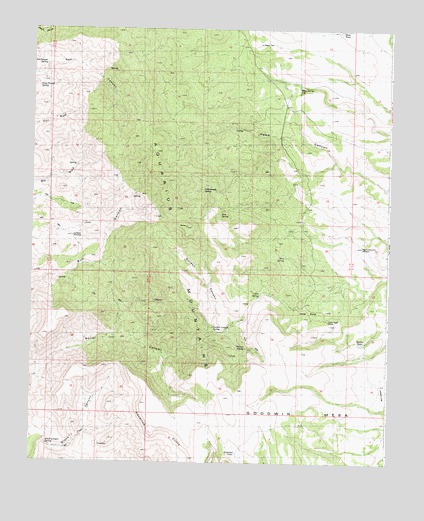
Cedar Basin, AZ USGS Topographic Map
Click on map above to begin viewing in our Map Viewer.

This topographic map contains these locations and features:
Feature Name Type Latitude Longitude GNIS ID View Map
Antelope TankReservoirN34.7531°W113.4277°22810View Map
Aquarius CliffsCliffN34.7861°W113.4685°752View Map
Black CanyonValleyN34.7558°W113.4952°22830View Map
Black Canyon SpringSpringN34.7547°W113.4944°22831View Map
Blue SpringSpringN34.8092°W113.4119°22835View Map
Cedar BasinBasinN34.7883°W113.3952°2607View Map
Cedar Basin CampLocaleN34.7911°W113.3966°22866View Map
Cottonwood SpringSpringN34.8292°W113.4406°22893View Map
Gordon CanyonValleyN34.7889°W113.4374°22958View Map
Gordon Canyon SpringSpringN34.7989°W113.4202°5179View Map
High-Lonesome WindmillWellN34.8122°W113.3849°22990View Map
Long Trough SpringSpringN34.8578°W113.4985°23065View Map
Mesa TankReservoirN34.8742°W113.3930°23081View Map
Oak SpringSpringN34.7988°W113.4200°23123View Map
Red Canyon SpringSpringN34.8647°W113.4952°10022View Map
Sam SpringSpringN34.8217°W113.4344°23188View Map
Shelton TankReservoirN34.7847°W113.3850°11210View Map
Sunburn WindmillWellN34.8150°W113.4860°23233View Map
Walnut SpringSpringN34.7831°W113.4247°23280View Map
Williams SpringSpringN34.8645°W113.4524°23299View Map
Willow Springs WellWellN34.8583°W113.4077°23303View Map

Note: Coordinates in the location and feature list above are referenced to NAD83 datum.


Copyright (C) 2008-2025 Ryan Niemi / Sunset Dynamics ... All Rights Reserved