TopoQuest Logo
Do you find TopoQuest useful?
Help keep TopoQuest running and adding new maps/features by donating!
Bitcoin:  19c7KJd3qBynnjoSw5npx9KScwjBe4ifkT
Litecoin:  LXs6TkuXGGXo1vDsWCkWVdjQX94eUKd6ui
Home View Maps Find Maps Find Places Resources & Links


Elephant Peak, Montana Topographic Map

USGS Map Title: Elephant Peak, MT
USGS Map MRC: 48115A6
DRG (GeoTIFF) Download: o48115a6.tif


Neighboring USGS Topographic Map Quads:


  Ibex Peak, MT  
48115B7
 

  Snowshoe Peak, MT  
48115B6
 

  Cable Mountain, MT  
48115B5
 

  Smeads Bench, MT  
48115A7
 

  Elephant Peak, MT  
48115A6
 

  Howard Lake, MT  
48115A5
 

  Noxon, MT  
47115H7
 

  Noxon Rapids Dam, MT  
47115H6
 

  Goat Peak, MT  
47115H5


Map MRC Location:

N49°
W116°
N49°
W115°
H8 H7 H6 H5 H4 H3 H2 H1
G8 G7 G6 G5 G4 G3 G2 G1
F8 F7 F6 F5 F4 F3 F2 F1
E8 E7 E6 E5 E4 E3 E2 E1
D8 D7 D6 D5 D4 D3 D2 D1
C8 C7 C6 C5 C4 C3 C2 C1
B8 B7 B6 B5 B4 B3 B2 B1
A8 A7 A6 A5 A4 A3 A2 A1
N48°
W116°
N48°
W115°

Elephant Peak, MT USGS 1:24K Topographic Map Preview:
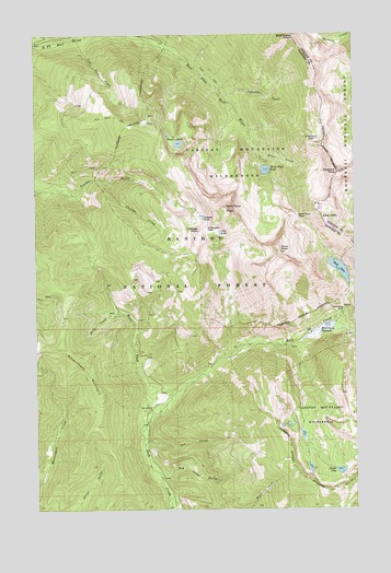
Elephant Peak, MT USGS Topographic Map
Click on map above to begin viewing in our Map Viewer.

This topographic map contains these locations and features:
Feature Name Type Latitude Longitude GNIS ID View Map
Bald Eagle PeakSummitN48.1241°W115.6491°779279View Map
Big Cedar GulchValleyN48.0085°W115.7010°779773View Map
Chicago CreekStreamN48.0869°W115.7241°781205View Map
Chicago PeakSummitN48.0735°W115.6863°781206View Map
Cliff LakeLakeN48.0727°W115.6785°781387View Map
Copper LakeLakeN48.0768°W115.6851°781656View Map
Elephant PeakSummitN48.0886°W115.6324°783041View Map
Engle LakeLakeN48.0100°W115.6321°794946View Map
Engle Peak TrailTrailN48.0077°W115.6630°783206View Map
Heidelberg MineMineN48.0525°W115.6304°784711View Map
Isabella CreekStreamN48.1094°W115.6771°785349View Map
Isabella LakeLakeN48.0976°W115.6405°785350View Map
Libby LakesLakeN48.0753°W115.6359°786090View Map
Lost Girl CreekStreamN48.1241°W115.7352°786596View Map
Milwaukee PassGapN48.0733°W115.6835°787446View Map
Moran BasinBasinN48.0986°W115.6952°787673View Map
Old Daly TrailTrailN48.1033°W115.7193°788407View Map
Orr CreekStreamN48.0174°W115.7080°788496View Map
Placer CreekStreamN48.0980°W115.6654°788973View Map
Rock Creek MeadowsFlatN48.0466°W115.6393°789697View Map
Rock LakeLakeN48.0631°W115.6318°789705View Map
Rock PeakSummitN48.0677°W115.6549°789710View Map
Saint Paul LakeLakeN48.0892°W115.6605°789952View Map
Saint Paul PassGapN48.0766°W115.6477°789954View Map
Saint Paul PeakSummitN48.0794°W115.6763°789956View Map
Snort CreekStreamN48.0519°W115.7177°790769View Map
Upper North Heidelberg MineMineN48.0558°W115.6274°805153View Map
Upper South Heidelberg MineMineN48.0522°W115.6280°805154View Map
West Fork Rock CreekStreamN48.0244°W115.7057°793069View Map

Note: Coordinates in the location and feature list above are referenced to NAD83 datum.


Copyright (C) 2008-2025 Ryan Niemi / Sunset Dynamics ... All Rights Reserved