TopoQuest Logo
Do you find TopoQuest useful?
Help keep TopoQuest running and adding new maps/features by donating!
Bitcoin:  19c7KJd3qBynnjoSw5npx9KScwjBe4ifkT
Litecoin:  LXs6TkuXGGXo1vDsWCkWVdjQX94eUKd6ui
Home View Maps Find Maps Find Places Resources & Links


Elizaville, Kentucky Topographic Map

USGS Map Title: Elizaville, KY
USGS Map MRC: 38083D7
DRG (GeoTIFF) Download: o38083d7.tif


Neighboring USGS Topographic Map Quads:


  Sardis, KY  
38083E8
 

  Mays Lick, KY  
38083E7
 

  Orangeburg, KY  
38083E6
 

  Cowan, KY  
38083D8
 

  Elizaville, KY  
38083D7
 

  Flemingsburg, KY  
38083D6
 

  Moorefield, KY  
38083C8
 

  Sherburne, KY  
38083C7
 

  Hillsboro, KY  
38083C6


Map MRC Location:

N39°
W84°
N39°
W83°
H8 H7 H6 H5 H4 H3 H2 H1
G8 G7 G6 G5 G4 G3 G2 G1
F8 F7 F6 F5 F4 F3 F2 F1
E8 E7 E6 E5 E4 E3 E2 E1
D8 D7 D6 D5 D4 D3 D2 D1
C8 C7 C6 C5 C4 C3 C2 C1
B8 B7 B6 B5 B4 B3 B2 B1
A8 A7 A6 A5 A4 A3 A2 A1
N38°
W84°
N38°
W83°

Elizaville, KY USGS 1:24K Topographic Map Preview:
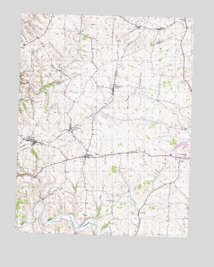
Elizaville, KY USGS Topographic Map
Click on map above to begin viewing in our Map Viewer.

This topographic map contains these locations and features:
Feature Name Type Latitude Longitude GNIS ID View Map
Andrews CemeteryCemeteryN38.4181°W83.7571°485949View Map
Bethel School (historical)SchoolN38.4234°W83.8248°2355168View Map
Bruce CemeteryCemeteryN38.4478°W83.8208°488047View Map
Charles Young Birthplace Historical MarkerParkN38.4991°W83.8019°2744548View Map
City of EwingCivilN38.4278°W83.8621°2403585View Map
Clover Hill ChurchChurchN38.3945°W83.8055°489705View Map
Crains Post Office (historical)Post OfficeN38.3882°W83.7860°2355187View Map
CraintownPopulated PlaceN38.3879°W83.7860°490276View Map
Doty BranchStreamN38.3825°W83.8220°2355192View Map
ElizavillePopulated PlaceN38.4195°W83.8255°491643View Map
Elizaville CemeteryCemeteryN38.4159°W83.8259°2355195View Map
Elizaville Census Designated PlaceCensusN38.4167°W83.8243°2629608View Map
Elizaville Post Office (historical)Post OfficeN38.4198°W83.8253°2355197View Map
EwingPopulated PlaceN38.4273°W83.8633°491858View Map
Ewing DivisionCivilN38.4072°W83.8731°1936993View Map
Ewing FairgroundsLocaleN38.4260°W83.8595°2355205View Map
Ewing Post OfficePost OfficeN38.4277°W83.8641°2355206View Map
Ewing Railroad Station (historical)LocaleN38.4262°W83.8625°2355207View Map
Ewing Volunteer Fire DepartmentBuildingN38.4267°W83.8613°2636911View Map
Fitch CemeteryCemeteryN38.3828°W83.7519°492147View Map
Flat ForkStreamN38.4565°W83.8591°492190View Map
Fleming County High SchoolSchoolN38.4221°W83.7638°2355213View Map
Fleming County HospitalHospitalN38.4223°W83.7514°2660344View Map
Flemingsburg JunctionPopulated PlaceN38.4590°W83.8069°508010View Map
Frank CemeteryCemeteryN38.4212°W83.7849°492438View Map
Franklin Runyon Sousley Historical MarkerParkN38.4158°W83.8268°2744366View Map
Harper BranchStreamN38.4070°W83.8599°493781View Map
HelenaPopulated PlaceN38.4934°W83.7752°494005View Map
Hill BranchStreamN38.4003°W83.7922°2355228View Map
Jackson CemeteryCemeteryN38.4009°W83.8438°495115View Map
John Hunt Morgans Last Raid Historical MarkerParkN38.4983°W83.7563°2744567View Map
Johnson Junction Post Office (historical)Post OfficeN38.4586°W83.8073°2355237View Map
Michael Cassidy Historical MarkerParkN38.4214°W83.7679°2744368View Map
Morgans Last Raid Historical MarkerParkN38.4915°W83.7566°2744364View Map
Mud Lick BridgeBridgeN38.4238°W83.8243°2355254View Map
Mud Lick CreekStreamN38.4331°W83.8366°499008View Map
NeptonPopulated PlaceN38.4354°W83.8341°499265View Map
Nepton Post Office (historical)Post OfficeN38.4348°W83.8370°2355258View Map
Nepton Railroad Station (historical)LocaleN38.4507°W83.8365°2355259View Map
Poorhouse BranchStreamN38.4073°W83.8599°501080View Map
Poplar CreekStreamN38.3931°W83.8560°501096View Map
Poplar Creek CemeteryCemeteryN38.4112°W83.8574°501097View Map
Poplar Run SchoolSchoolN38.4002°W83.8564°2355279View Map
Private Ambers Sapp Historical MarkerParkN38.4154°W83.8268°2744377View Map
School Number Thirty-five (historical)SchoolN38.3904°W83.7869°2355288View Map
WeedoniaPopulated PlaceN38.4990°W83.7566°509332View Map

Note: Coordinates in the location and feature list above are referenced to NAD83 datum.


Copyright (C) 2008-2024 Ryan Niemi / Sunset Dynamics ... All Rights Reserved