TopoQuest Logo
Do you find TopoQuest useful?
Help keep TopoQuest running and adding new maps/features by donating!
Bitcoin:  19c7KJd3qBynnjoSw5npx9KScwjBe4ifkT
Litecoin:  LXs6TkuXGGXo1vDsWCkWVdjQX94eUKd6ui
Home View Maps Find Maps Find Places Resources & Links


Mays Lick, Kentucky Topographic Map

USGS Map Title: Mays Lick, KY
USGS Map MRC: 38083E7
DRG (GeoTIFF) Download: o38083e7.tif


Neighboring USGS Topographic Map Quads:


  Germantown, KY  
38083F8
 

  Maysville West, KY  
38083F7
 

  Maysville East, KY  
38083F6
 

  Sardis, KY  
38083E8
 

  Mays Lick, KY  
38083E7
 

  Orangeburg, KY  
38083E6
 

  Cowan, KY  
38083D8
 

  Elizaville, KY  
38083D7
 

  Flemingsburg, KY  
38083D6


Map MRC Location:

N39°
W84°
N39°
W83°
H8 H7 H6 H5 H4 H3 H2 H1
G8 G7 G6 G5 G4 G3 G2 G1
F8 F7 F6 F5 F4 F3 F2 F1
E8 E7 E6 E5 E4 E3 E2 E1
D8 D7 D6 D5 D4 D3 D2 D1
C8 C7 C6 C5 C4 C3 C2 C1
B8 B7 B6 B5 B4 B3 B2 B1
A8 A7 A6 A5 A4 A3 A2 A1
N38°
W84°
N38°
W83°

Mays Lick, KY USGS 1:24K Topographic Map Preview:
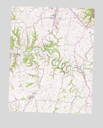
Mays Lick, KY USGS Topographic Map
Click on map above to begin viewing in our Map Viewer.

This topographic map contains these locations and features:
Feature Name Type Latitude Longitude GNIS ID View Map
Albert Sidney Johnston Historical MarkerParkN38.6156°W83.8086°2744556View Map
Alexander W Doniphan Historical MarkerParkN38.6218°W83.8086°2744546View Map
Bartholomew-Fitzgerald MillLocaleN38.5269°W83.7818°2362878View Map
Doctor Daniel Drake Historical MarkerParkN38.5194°W83.8413°2744549View Map
Finch CemeteryCemeteryN38.5409°W83.7949°492078View Map
Governor Joseph Desha Historical MarkerParkN38.6130°W83.8089°2744557View Map
House on the Hill Historical MarkerParkN38.6175°W83.8050°2744592View Map
John Hunt Morgans Last Raid Historical MarkerParkN38.5269°W83.8331°2744566View Map
Lees ChurchChurchN38.5198°W83.7626°2362902View Map
Lees CreekStreamN38.5695°W83.8496°496181View Map
LewisburgPopulated PlaceN38.5490°W83.7649°496338View Map
Lewisburg High SchoolSchoolN38.5567°W83.7730°496340View Map
Lewisburg Volunteer Fire DepartmentBuildingN38.5596°W83.7744°2636920View Map
Little Mill CreekStreamN38.5548°W83.7610°496801View Map
MarshallPopulated PlaceN38.5451°W83.7630°497569View Map
Mason CountyCivilN38.5952°W83.8242°516924View Map
Mason County Hemp Historical MarkerParkN38.6240°W83.8042°2744555View Map
May's Lick Volunteer Fire DepartmentBuildingN38.5170°W83.8413°2636433View Map
Mays LickPopulated PlaceN38.5176°W83.8419°497750View Map
Mays Lick Census Designated PlaceCensusN38.5170°W83.8451°2629649View Map
Mays Lick DivisionCivilN38.5270°W83.8725°1937139View Map
Maysville DivisionCivilN38.6194°W83.8071°1937140View Map
Meffords Fort Historical MarkerParkN38.6186°W83.8082°2744565View Map
Mill CreekStreamN38.5520°W83.7816°498265View Map
Mill Creek Christian ChurchChurchN38.5126°W83.7583°498274View Map
Mill Creek Post Office (historical)Post OfficeN38.5131°W83.7580°2362911View Map
Mill Creek Railroad Station (historical)LocaleN38.5165°W83.7767°2362912View Map
MurphysvillePopulated PlaceN38.5681°W83.8658°508665View Map
Old WashingtonPopulated PlaceN38.6159°W83.8085°517034View Map
Regional Transport Ambulance ServiceBuildingN38.6211°W83.8072°2719160View Map
Saint Patricks CemeteryCemeteryN38.6209°W83.8055°516973View Map
Saint Patricks ChurchChurchN38.6209°W83.8055°502711View Map
Smiths Wagon Road Mail Route Historical MarkerParkN38.6138°W83.8088°2744552View Map
Strodes CreekStreamN38.5615°W83.7533°504594View Map
Washington Baptist Church Cemetery Historical MarkerParkN38.6140°W83.8103°2744587View Map
Washington Volunteer Fire DepartmentBuildingN38.6116°W83.8080°2636914View Map
Wells CreekStreamN38.5729°W83.8199°506381View Map

Note: Coordinates in the location and feature list above are referenced to NAD83 datum.


Copyright (C) 2008-2024 Ryan Niemi / Sunset Dynamics ... All Rights Reserved