TopoQuest Logo
Do you find TopoQuest useful?
Help keep TopoQuest running and adding new maps/features by donating!
Bitcoin:  19c7KJd3qBynnjoSw5npx9KScwjBe4ifkT
Litecoin:  LXs6TkuXGGXo1vDsWCkWVdjQX94eUKd6ui
Home View Maps Find Maps Find Places Resources & Links


Elk Creek, California Topographic Map

USGS Map Title: Elk Creek, CA
USGS Map MRC: 39122E5
DRG (GeoTIFF) Download: o39122e5.tif


Neighboring USGS Topographic Map Quads:


  Alder Springs, CA  
39122F6
 

  Chrome, CA  
39122F5
 

  Julian Rocks, CA  
39122F4
 

  Felkner Hill, CA  
39122E6
 

  Elk Creek, CA  
39122E5
 

  Fruto, CA  
39122E4
 

  Saint John Mountain, CA  
39122D6
 

  Stonyford, CA  
39122D5
 

  Rail Canyon, CA  
39122D4


Map MRC Location:

N40°
W123°
N40°
W122°
H8 H7 H6 H5 H4 H3 H2 H1
G8 G7 G6 G5 G4 G3 G2 G1
F8 F7 F6 F5 F4 F3 F2 F1
E8 E7 E6 E5 E4 E3 E2 E1
D8 D7 D6 D5 D4 D3 D2 D1
C8 C7 C6 C5 C4 C3 C2 C1
B8 B7 B6 B5 B4 B3 B2 B1
A8 A7 A6 A5 A4 A3 A2 A1
N39°
W123°
N39°
W122°

Elk Creek, CA USGS 1:24K Topographic Map Preview:
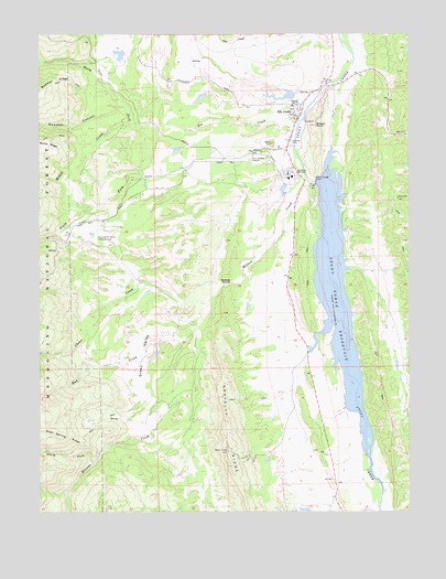
Elk Creek, CA USGS Topographic Map
Click on map above to begin viewing in our Map Viewer.

This topographic map contains these locations and features:
Feature Name Type Latitude Longitude GNIS ID View Map
Bidwell PointSummitN39.6010°W122.5325°256869View Map
Bowman CanyonValleyN39.6046°W122.5953°257401View Map
Briscoe CreekStreamN39.5935°W122.5389°257464View Map
Briscoe RocksSummitN39.5602°W122.5608°1655845View Map
Butler Landing Strip (historical)AirportN39.5857°W122.5822°276356View Map
Butler PlaceLocaleN39.5829°W122.5911°276357View Map
Circle C 375 DamDamN39.6199°W122.5961°1663846View Map
Clover CreekStreamN39.5549°W122.5692°258473View Map
Commander Industrial SawmillLocaleN39.5877°W122.5414°276328View Map
Diamond M Ranch AirportAirportN39.5705°W122.6036°1653419View Map
E A Wright 371 DamDamN39.6082°W122.5378°1663843View Map
Elk CreekStreamN39.6029°W122.5361°259845View Map
Elk CreekPopulated PlaceN39.6052°W122.5392°1655993View Map
Elk Creek Butte LookoutLocaleN39.6018°W122.5333°276327View Map
Elk Creek Census Designated PlaceCensusN39.6001°W122.5375°2628728View Map
Elk Creek Community ChurchChurchN39.6038°W122.5392°1702528View Map
Elk Creek Elementary SchoolSchoolN39.6060°W122.5400°1702529View Map
Elk Creek Fire Protection District - Elk Creek Volunteer Fire DepartmentBuildingN39.6021°W122.5385°2622141View Map
Elk Creek Junior - Senior High SchoolSchoolN39.6069°W122.5384°1702530View Map
Elk Creek Post OfficePost OfficeN39.6055°W122.5401°1702531View Map
Garrison Ranch (historical)LocaleN39.5840°W122.6158°1666646View Map
Green ValleyValleyN39.5538°W122.5689°260867View Map
Mad CreekStreamN39.5471°W122.5736°263104View Map
McGill CreekStreamN39.6010°W122.5936°263361View Map
North Fork Briscoe CreekStreamN39.5121°W122.6075°264140View Map
North Fork Elk CreekStreamN39.5985°W122.5842°264162View Map
South Fork Elk CreekStreamN39.5985°W122.5842°267457View Map
Stony Gorge DamDamN39.5849°W122.5328°1664680View Map
Stony Gorge DamDamN39.5863°W122.5325°267785View Map
Stony Gorge ReservoirReservoirN39.5561°W122.5251°267786View Map

Note: Coordinates in the location and feature list above are referenced to NAD83 datum.


Copyright (C) 2008-2024 Ryan Niemi / Sunset Dynamics ... All Rights Reserved