TopoQuest Logo
Do you find TopoQuest useful?
Help keep TopoQuest running and adding new maps/features by donating!
Bitcoin:  19c7KJd3qBynnjoSw5npx9KScwjBe4ifkT
Litecoin:  LXs6TkuXGGXo1vDsWCkWVdjQX94eUKd6ui
Home View Maps Find Maps Find Places Resources & Links


Saint John Mountain, California Topographic Map

USGS Map Title: Saint John Mountain, CA
USGS Map MRC: 39122D6
DRG (GeoTIFF) Download: o39122d6.tif


Neighboring USGS Topographic Map Quads:


  Kneecap Ridge, CA  
39122E7
 

  Felkner Hill, CA  
39122E6
 

  Elk Creek, CA  
39122E5
 

  Crockett Peak, CA  
39122D7
 

  Saint John Mountain, CA  
39122D6
 

  Stonyford, CA  
39122D5
 

  Potato Hill, CA  
39122C7
 

  Fouts Springs, CA  
39122C6
 

  Gilmore Peak, CA  
39122C5


Map MRC Location:

N40°
W123°
N40°
W122°
H8 H7 H6 H5 H4 H3 H2 H1
G8 G7 G6 G5 G4 G3 G2 G1
F8 F7 F6 F5 F4 F3 F2 F1
E8 E7 E6 E5 E4 E3 E2 E1
D8 D7 D6 D5 D4 D3 D2 D1
C8 C7 C6 C5 C4 C3 C2 C1
B8 B7 B6 B5 B4 B3 B2 B1
A8 A7 A6 A5 A4 A3 A2 A1
N39°
W123°
N39°
W122°

Saint John Mountain, CA USGS 1:24K Topographic Map Preview:
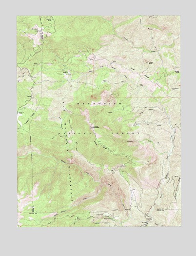
Saint John Mountain, CA USGS Topographic Map
Click on map above to begin viewing in our Map Viewer.

This topographic map contains these locations and features:
Feature Name Type Latitude Longitude GNIS ID View Map
Bear Wallow CreekStreamN39.4132°W122.7117°218903View Map
Bear Wallow TrailTrailN39.4299°W122.7089°218910View Map
Bearwallow Trailhead ParkingLocaleN39.4068°W122.6789°276361View Map
Bonnie ViewPopulated PlaceN39.3824°W122.6850°1658109View Map
Bonnie View TrailTrailN39.3796°W122.7192°219646View Map
Bowery FlatFlatN39.4415°W122.7478°219717View Map
Box SpringSpringN39.3807°W122.7055°219734View Map
Brittan RanchLocaleN39.3968°W122.6636°219855View Map
Dark Hollow CreekStreamN39.3996°W122.6861°222024View Map
Dry Creek HillSummitN39.4571°W122.6328°1658440View Map
Goulding CreekStreamN39.4168°W122.6350°224361View Map
Happy CampLocaleN39.3796°W122.6792°224895View Map
Ida CreekStreamN39.4360°W122.6347°225822View Map
Low GapGapN39.4638°W122.7403°227742View Map
Meyers CabinLocaleN39.4613°W122.6825°228558View Map
Middle Fork Stony CreekStreamN39.3777°W122.6519°228603View Map
Mule CanyonValleyN39.4427°W122.6383°229299View Map
North Fork CampgroundLocaleN39.3791°W122.6489°229649View Map
North Fork CampgroundLocaleN39.3791°W122.6486°276347View Map
North Fork Stony CreekStreamN39.3788°W122.6469°229721View Map
Open RidgeRidgeN39.4654°W122.6558°230064View Map
Paradise CreekStreamN39.3807°W122.6636°230321View Map
Peavine RidgeRidgeN39.4896°W122.7492°234442View Map
Pleasant ValleyValleyN39.4246°W122.6322°230813View Map
Red BridgeBridgeN39.3777°W122.6525°252049View Map
Red RockPillarN39.4588°W122.6572°231370View Map
Saint John MountainSummitN39.4343°W122.6930°232174View Map
Sheetiron MountainSummitN39.4918°W122.7342°232923View Map
Sheetiron SpringSpringN39.4968°W122.7245°232924View Map
South Fork Stony CreekStreamN39.3791°W122.6472°235057View Map
The PocketBarN39.4660°W122.7117°236215View Map
Triplet ButteSummitN39.4718°W122.6505°236554View Map
Twin SpringsSpringN39.4357°W122.6587°236720View Map
Watson SpringSpringN39.4664°W122.6271°237352View Map
Windy Point TrailheadLocaleN39.4571°W122.7408°276359View Map
Windy Point Trailhead ParkingLocaleN39.4477°W122.7339°276360View Map

Note: Coordinates in the location and feature list above are referenced to NAD83 datum.


Copyright (C) 2008-2025 Ryan Niemi / Sunset Dynamics ... All Rights Reserved