TopoQuest Logo
Do you find TopoQuest useful?
Help keep TopoQuest running and adding new maps/features by donating!
Bitcoin:  19c7KJd3qBynnjoSw5npx9KScwjBe4ifkT
Litecoin:  LXs6TkuXGGXo1vDsWCkWVdjQX94eUKd6ui
Home View Maps Find Maps Find Places Resources & Links


Alder Springs, California Topographic Map

USGS Map Title: Alder Springs, CA
USGS Map MRC: 39122F6
DRG (GeoTIFF) Download: o39122f6.tif


Neighboring USGS Topographic Map Quads:


  Log Spring, CA  
39122G7
 

  Hall Ridge, CA  
39122G6
 

  Newville, CA  
39122G5
 

  Plaskett Meadows, CA  
39122F7
 

  Alder Springs, CA  
39122F6
 

  Chrome, CA  
39122F5
 

  Kneecap Ridge, CA  
39122E7
 

  Felkner Hill, CA  
39122E6
 

  Elk Creek, CA  
39122E5


Map MRC Location:

N40°
W123°
N40°
W122°
H8 H7 H6 H5 H4 H3 H2 H1
G8 G7 G6 G5 G4 G3 G2 G1
F8 F7 F6 F5 F4 F3 F2 F1
E8 E7 E6 E5 E4 E3 E2 E1
D8 D7 D6 D5 D4 D3 D2 D1
C8 C7 C6 C5 C4 C3 C2 C1
B8 B7 B6 B5 B4 B3 B2 B1
A8 A7 A6 A5 A4 A3 A2 A1
N39°
W123°
N39°
W122°

Alder Springs, CA USGS 1:24K Topographic Map Preview:
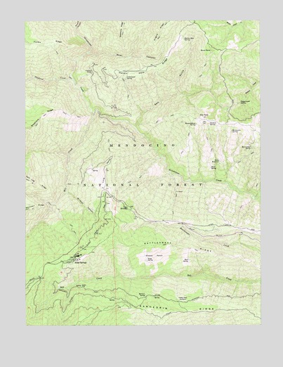
Alder Springs, CA USGS Topographic Map
Click on map above to begin viewing in our Map Viewer.

This topographic map contains these locations and features:
Feature Name Type Latitude Longitude GNIS ID View Map
Alder FlatFlatN39.6413°W122.7186°256165View Map
Alder JunctionLocaleN39.6446°W122.7433°276268View Map
Alder SpringsPopulated PlaceN39.6510°W122.7256°1657907View Map
Alder Springs Forest Service FacilityLocaleN39.6496°W122.7256°276329View Map
Alder Springs Post Office (historical)Post OfficeN39.6510°W122.7256°2026833View Map
Bathtub SpringSpringN39.7078°W122.6531°256591View Map
Bear CanyonValleyN39.7371°W122.7175°256627View Map
Bearwallow SpringSpringN39.6976°W122.6304°256757View Map
Browns CanyonValleyN39.7471°W122.7239°266487View Map
Buck PointSummitN39.7377°W122.6519°257583View Map
Buck SpringSpringN39.6518°W122.6644°257594View Map
Camp EllendaleLocaleN39.6735°W122.6964°257874View Map
Cottonwood SpringSpringN39.7266°W122.6974°258772View Map
Doe PeakSummitN39.7105°W122.6566°259434View Map
Doe SpringSpringN39.7081°W122.6568°259437View Map
Drew Cabin (historical)BuildingN39.6685°W122.6911°1666644View Map
Fiddlers GreenPopulated PlaceN39.7288°W122.7153°1658535View Map
Forks ReservoirReservoirN39.6923°W122.6476°260270View Map
Grassy PatchFlatN39.6538°W122.6822°260810View Map
Hard SpringSpringN39.6894°W122.6527°261083View Map
Hardin Hole RidgeRidgeN39.7307°W122.6828°224919View Map
Hardin Hole SpringSpringN39.7424°W122.6668°261086View Map
Hummingbird SpringSpringN39.7074°W122.6600°261622View Map
Kilgore RidgeRidgeN39.7454°W122.6794°262172View Map
Long PointRidgeN39.6885°W122.7086°262870View Map
Long Point LookoutLocaleN39.6888°W122.7086°1670445View Map
Manzanita SpringSpringN39.7049°W122.6412°263163View Map
McGrew SpringSpringN39.6373°W122.6875°263367View Map
Mill CreekStreamN39.7121°W122.7144°263605View Map
Pepperwood SpringSpringN39.7163°W122.6375°264647View Map
Rattlesnake RidgeRidgeN39.6565°W122.6686°265228View Map
Reynolds Place (historical)Populated PlaceN39.6738°W122.7128°1666650View Map
Salt GulchValleyN39.7063°W122.6925°265778View Map
Sanhedrin RidgeRidgeN39.6315°W122.6678°265833View Map
Seros SpringSpringN39.6522°W122.6865°266002View Map
Shepherd CreekStreamN39.7252°W122.7250°266095View Map
United States Forest Service Mendocino National Forest Alder Springs Work CenterBuildingN39.6516°W122.7283°2622197View Map
Valley View OrchardLocaleN39.6357°W122.6656°268659View Map
Wildcat CanyonValleyN39.6799°W122.7294°269088View Map

Note: Coordinates in the location and feature list above are referenced to NAD83 datum.


Copyright (C) 2008-2025 Ryan Niemi / Sunset Dynamics ... All Rights Reserved