TopoQuest Logo
Do you find TopoQuest useful?
Help keep TopoQuest running and adding new maps/features by donating!
Bitcoin:  19c7KJd3qBynnjoSw5npx9KScwjBe4ifkT
Litecoin:  LXs6TkuXGGXo1vDsWCkWVdjQX94eUKd6ui
Home View Maps Find Maps Find Places Resources & Links


Elk Creek Lake, Wisconsin Topographic Map

USGS Map Title: Elk Creek Lake, WI
USGS Map MRC: 44091G6
DRG (GeoTIFF) Download: o44091g6.tif


Neighboring USGS Topographic Map Quads:


  Rusk, WI  
44091H7
 

  Colfax South, WI  
44091H6
 

  Albertville, WI  
44091H5
 

  Falls City, WI  
44091G7
 

  Elk Creek Lake, WI  
44091G6
 

  Eau Claire West, WI  
44091G5
 

  Meridean, WI  
44091F7
 

  Rock Falls, WI  
44091F6
 

  Mondovi NE, WI  
44091F5


Map MRC Location:

N45°
W92°
N45°
W91°
H8 H7 H6 H5 H4 H3 H2 H1
G8 G7 G6 G5 G4 G3 G2 G1
F8 F7 F6 F5 F4 F3 F2 F1
E8 E7 E6 E5 E4 E3 E2 E1
D8 D7 D6 D5 D4 D3 D2 D1
C8 C7 C6 C5 C4 C3 C2 C1
B8 B7 B6 B5 B4 B3 B2 B1
A8 A7 A6 A5 A4 A3 A2 A1
N44°
W92°
N44°
W91°

Elk Creek Lake, WI USGS 1:24K Topographic Map Preview:
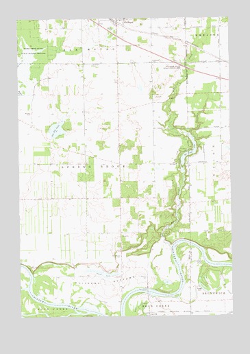
Elk Creek Lake, WI USGS Topographic Map
Click on map above to begin viewing in our Map Viewer.

This topographic map contains these locations and features:
Feature Name Type Latitude Longitude GNIS ID View Map
Amey School (historical)SchoolN44.8141°W91.6699°1578405View Map
Amy ChapelChurchN44.8136°W91.6571°1560847View Map
Brush IslandIslandN44.7536°W91.7363°2061775View Map
CaryvillePopulated PlaceN44.7513°W91.6746°1562755View Map
Caryville Savanna State Natural AreaParkN44.7536°W91.7363°2061776View Map
Chippewa BottomsBendN44.7636°W91.6999°1563040View Map
Elk CreekStreamN44.7791°W91.6613°1564518View Map
Elk Creek LakeReservoirN44.8180°W91.6499°1791731View Map
Elk Creek State Public Fishing AreaParkN44.8536°W91.6524°1564522View Map
Elk Creek WP247 DamDamN44.8138°W91.6546°1791730View Map
Elk MoundPopulated PlaceN44.8730°W91.6910°1564526View Map
Elk Mound Fire DepartmentBuildingN44.8728°W91.6899°2696721View Map
Elk Mound High SchoolSchoolN44.8737°W91.6832°2713202View Map
Elk Mound Police DepartmentBuildingN44.8724°W91.6888°2759810View Map
Evergreen CemeteryCemeteryN44.8569°W91.6704°1564754View Map
Faith ChurchChurchN44.7663°W91.6913°1564830View Map
Fishermans ParkParkN44.8283°W91.6585°1565022View Map
Fosbroke School (historical)SchoolN44.7663°W91.6902°1578410View Map
Mound View Elementary SchoolSchoolN44.8732°W91.6784°2713283View Map
Oakland School (historical)SchoolN44.8214°W91.7104°1578413View Map
Old Elk LakeLakeN44.8285°W91.7276°1570774View Map
Old Meridean Ferry (historical)CrossingN44.7666°W91.7441°1578414View Map
Peterson CemeteryCemeteryN44.7666°W91.6760°1571266View Map
Powell LakeLakeN44.7617°W91.6429°1571854View Map
Prairie Center School (historical)SchoolN44.8000°W91.7007°1578416View Map
Saint Joseph CemeteryCemeteryN44.8555°W91.7060°1573155View Map
Sand Hill CemeteryCemeteryN44.7705°W91.7418°1573669View Map
Sneen LakeLakeN44.7690°W91.7065°1574343View Map
Spring Brook CemeteryCemeteryN44.7750°W91.6910°1574603View Map
Town of Spring BrookCivilN44.8064°W91.7438°1584189View Map
Village of Elk MoundCivilN44.8744°W91.6864°1583151View Map
Waneka CemeteryCemeteryN44.8355°W91.7427°1576193View Map
Waneka School (historical)SchoolN44.8305°W91.7421°1578420View Map
West CreekStreamN44.7702°W91.6304°1576491View Map

Note: Coordinates in the location and feature list above are referenced to NAD83 datum.


Copyright (C) 2008-2025 Ryan Niemi / Sunset Dynamics ... All Rights Reserved