TopoQuest Logo
Do you find TopoQuest useful?
Help keep TopoQuest running and adding new maps/features by donating!
Bitcoin:  19c7KJd3qBynnjoSw5npx9KScwjBe4ifkT
Litecoin:  LXs6TkuXGGXo1vDsWCkWVdjQX94eUKd6ui
Home View Maps Find Maps Find Places Resources & Links


Mondovi NE, Wisconsin Topographic Map

USGS Map Title: Mondovi NE, WI
USGS Map MRC: 44091F5
DRG (GeoTIFF) Download: o44091f5.tif


Neighboring USGS Topographic Map Quads:


  Elk Creek Lake, WI  
44091G6
 

  Eau Claire West, WI  
44091G5
 

  Eau Claire East, WI  
44091G4
 

  Rock Falls, WI  
44091F6
 

  Mondovi NE, WI  
44091F5
 

  Cleghorn, WI  
44091F4
 

  Mondovi, WI  
44091E6
 

  Rossman Creek, WI  
44091E5
 

  Strum, WI  
44091E4


Map MRC Location:

N45°
W92°
N45°
W91°
H8 H7 H6 H5 H4 H3 H2 H1
G8 G7 G6 G5 G4 G3 G2 G1
F8 F7 F6 F5 F4 F3 F2 F1
E8 E7 E6 E5 E4 E3 E2 E1
D8 D7 D6 D5 D4 D3 D2 D1
C8 C7 C6 C5 C4 C3 C2 C1
B8 B7 B6 B5 B4 B3 B2 B1
A8 A7 A6 A5 A4 A3 A2 A1
N44°
W92°
N44°
W91°

Mondovi NE, WI USGS 1:24K Topographic Map Preview:
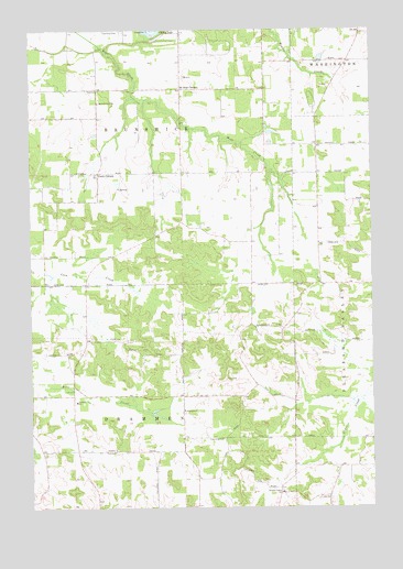
Mondovi NE, WI USGS Topographic Map
Click on map above to begin viewing in our Map Viewer.

This topographic map contains these locations and features:
Feature Name Type Latitude Longitude GNIS ID View Map
Anthony Elementary SchoolSchoolN44.6528°W91.6088°1560892View Map
Apostolic Faith ChurchChurchN44.7311°W91.5996°1560900View Map
Apple Valley FarmLocaleN44.7394°W91.5092°2727284View Map
Brunswick CemeteryCemeteryN44.7494°W91.5913°1846631View Map
Candy CornersLocaleN44.7125°W91.5999°1562701View Map
Candy Corners School (historical)SchoolN44.7194°W91.6002°1578422View Map
Cooley LakeLakeN44.7491°W91.5783°1563353View Map
Dark Horse FarmsLocaleN44.7208°W91.5878°2727322View Map
Drammen Lutheran CemeteryCemeteryN44.6497°W91.5690°1846651View Map
Drammen Lutheran ChurchChurchN44.6502°W91.5690°1564098View Map
Fairoak School (historical)SchoolN44.7091°W91.5443°1578425View Map
Gilbertson FarmsLocaleN44.7036°W91.5803°2727323View Map
Gopher Stol Airport (historical)AirportN44.6411°W91.5127°1581963View Map
Hemlock School (historical)SchoolN44.6830°W91.6102°1578427View Map
Meadowbrook School (historical)SchoolN44.6730°W91.5443°1578431View Map
Mount Hope CornersPopulated PlaceN44.7344°W91.5688°1569815View Map
Nelsonville (historical)Populated PlaceN44.6541°W91.5699°1578432View Map
Oak Grove (historical)Populated PlaceN44.6725°W91.6052°1578433View Map
Oak Grove School (historical)SchoolN44.6427°W91.5543°1578434View Map
Pleasant Valley ChurchChurchN44.6289°W91.5335°1571651View Map
Pleasant Valley Norwegian Lutheran CemeteryCemeteryN44.6294°W91.5332°1846735View Map
Prosper FarmLocaleN44.6953°W91.5572°2727424View Map
Sunnyside School (historical)SchoolN44.7413°W91.5088°1578443View Map
Town of BrunswickCivilN44.7291°W91.5881°1581144View Map
Town of DrammenCivilN44.6400°W91.5896°1583099View Map
Township Fire Department Station 5 BrunswickBuildingN44.7341°W91.5995°2698124View Map

Note: Coordinates in the location and feature list above are referenced to NAD83 datum.


Copyright (C) 2008-2025 Ryan Niemi / Sunset Dynamics ... All Rights Reserved