TopoQuest Logo
Do you find TopoQuest useful?
Help keep TopoQuest running and adding new maps/features by donating!
Bitcoin:  19c7KJd3qBynnjoSw5npx9KScwjBe4ifkT
Litecoin:  LXs6TkuXGGXo1vDsWCkWVdjQX94eUKd6ui
Home View Maps Find Maps Find Places Resources & Links


Ellensburg South, Washington Topographic Map

USGS Map Title: Ellensburg South, WA
USGS Map MRC: 46120H5
DRG (GeoTIFF) Download: o46120h5.tif


Neighboring USGS Topographic Map Quads:


  Thorp, WA  
47120A6
 

  Ellensburg North, WA  
47120A5
 

  Colockum Pass SW, WA  
47120A4
 

  Manastash Creek, WA  
46120H6
 

  Ellensburg South, WA  
46120H5
 

  Kittitas, WA  
46120H4
 

  Wenas Lake, WA  
46120G6
 

  The Cottonwoods, WA  
46120G5
 

  Wymer, WA  
46120G4


Map MRC Location:

N47°
W121°
N47°
W120°
H8 H7 H6 H5 H4 H3 H2 H1
G8 G7 G6 G5 G4 G3 G2 G1
F8 F7 F6 F5 F4 F3 F2 F1
E8 E7 E6 E5 E4 E3 E2 E1
D8 D7 D6 D5 D4 D3 D2 D1
C8 C7 C6 C5 C4 C3 C2 C1
B8 B7 B6 B5 B4 B3 B2 B1
A8 A7 A6 A5 A4 A3 A2 A1
N46°
W121°
N46°
W120°

Ellensburg South, WA USGS 1:24K Topographic Map Preview:
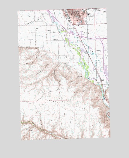
Ellensburg South, WA USGS Topographic Map
Click on map above to begin viewing in our Map Viewer.

This topographic map contains these locations and features:
Feature Name Type Latitude Longitude GNIS ID View Map
Benwy CanyonValleyN46.9310°W120.5287°1503316View Map
Bull DitchCanalN46.9710°W120.5278°1503635View Map
Cherry CreekStreamN46.9254°W120.5012°1503939View Map
Clinesmith Irrigation DitchCanalN46.9821°W120.5603°1534208View Map
Craigs HillSummitN46.9971°W120.5317°1512122View Map
Damman Elementary SchoolSchoolN46.9703°W120.5707°1530853View Map
Davis TrailTrailN46.8810°W120.5065°1504349View Map
EllensburgPopulated PlaceN46.9965°W120.5478°1519305View Map
Ellensburg DivisionCivilN46.9982°W120.5496°1939501View Map
Ellensburg High SchoolSchoolN46.9931°W120.5278°1513504View Map
Ellensburg Police DepartmentBuildingN46.9927°W120.5468°2721917View Map
Ellensburg Post OfficePost OfficeN46.9941°W120.5468°2769173View Map
Fogarty DitchCanalN46.9601°W120.5584°1504944View Map
HolmesPopulated PlaceN46.9582°W120.5301°1511038View Map
Interstate Eighty-two InterchangeCrossingN46.9690°W120.5095°1534177View Map
Kittitas County Sheriff's OfficeBuildingN46.9969°W120.5494°2722059View Map
Kittitas Fire and Rescue Station 1BuildingN46.9928°W120.5468°2767936View Map
Kittitas Valley Fire and Rescue Central HeadquartersBuildingN46.9928°W120.5468°2619390View Map
Kittitas Valley Fire and Rescue District 2BuildingN46.9992°W120.5143°2643440View Map
Kittitas Valley HospitalHospitalN46.9871°W120.5379°2625479View Map
KXLE-AM (Ellensburg)TowerN46.9998°W120.5290°1534248View Map
KXLE-FM (Ellensburg)TowerN46.9998°W120.5290°1534344View Map
Lincoln Elementary SchoolSchoolN46.9908°W120.5398°1534594View Map
Long Tom CanyonValleyN46.9523°W120.5723°1522412View Map
Manastash CreekStreamN46.9940°W120.5806°1522671View Map
Memorial ParkParkN46.9985°W120.5359°1534182View Map
Mercer CreekStreamN46.9862°W120.5542°1523004View Map
Morgan Middle SchoolSchoolN46.9919°W120.5434°1534207View Map
Mountain View ParkParkN46.9879°W120.5315°1506845View Map
Naneum CreekStreamN46.9390°W120.5059°1533513View Map
Reecer CreekStreamN46.9868°W120.5692°1524964View Map
Reed ParkParkN46.9890°W120.5323°1534204View Map
Saint Andrews SchoolSchoolN46.9812°W120.5303°1534205View Map
Shushuskin CanyonValleyN46.9487°W120.5670°1508329View Map
South Ellensburg InterchangeCrossingN46.9735°W120.5392°1534206View Map
Spring CanyonValleyN46.9373°W120.5401°1508619View Map
Stone Quarry CanyonValleyN46.9626°W120.5953°1526583View Map
ThrallPopulated PlaceN46.9304°W120.5112°1511370View Map
Tjossem DitchCanalN46.9635°W120.5417°1509036View Map
Tjossem PondReservoirN46.9598°W120.5295°1513486View Map
Tjossem Pond DamDamN46.9598°W120.5295°1532790View Map
Town CanalCanalN46.9943°W120.5103°1527333View Map
Washington Elementary SchoolSchoolN46.9973°W120.5423°1531172View Map
West Side ParkParkN46.9954°W120.5573°1509427View Map
Whitney ParkParkN46.9926°W120.5273°1534211View Map
Wilson CreekStreamN46.9168°W120.5084°1528203View Map

Note: Coordinates in the location and feature list above are referenced to NAD83 datum.


Copyright (C) 2008-2025 Ryan Niemi / Sunset Dynamics ... All Rights Reserved