TopoQuest Logo
Do you find TopoQuest useful?
Help keep TopoQuest running and adding new maps/features by donating!
Bitcoin:  19c7KJd3qBynnjoSw5npx9KScwjBe4ifkT
Litecoin:  LXs6TkuXGGXo1vDsWCkWVdjQX94eUKd6ui
Home View Maps Find Maps Find Places Resources & Links


Wenas Lake, Washington Topographic Map

USGS Map Title: Wenas Lake, WA
USGS Map MRC: 46120G6
DRG (GeoTIFF) Download: o46120g6.tif


Neighboring USGS Topographic Map Quads:


  Hudson Creek, WA  
46120H7
 

  Manastash Creek, WA  
46120H6
 

  Ellensburg South, WA  
46120H5
 

  Milk Canyon, WA  
46120G7
 

  Wenas Lake, WA  
46120G6
 

  The Cottonwoods, WA  
46120G5
 

  Tieton, WA  
46120F7
 

  Naches, WA  
46120F6
 

  Selah, WA  
46120F5


Map MRC Location:

N47°
W121°
N47°
W120°
H8 H7 H6 H5 H4 H3 H2 H1
G8 G7 G6 G5 G4 G3 G2 G1
F8 F7 F6 F5 F4 F3 F2 F1
E8 E7 E6 E5 E4 E3 E2 E1
D8 D7 D6 D5 D4 D3 D2 D1
C8 C7 C6 C5 C4 C3 C2 C1
B8 B7 B6 B5 B4 B3 B2 B1
A8 A7 A6 A5 A4 A3 A2 A1
N46°
W121°
N46°
W120°

Wenas Lake, WA USGS 1:24K Topographic Map Preview:
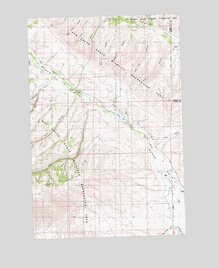
Wenas Lake, WA USGS Topographic Map
Click on map above to begin viewing in our Map Viewer.

This topographic map contains these locations and features:
Feature Name Type Latitude Longitude GNIS ID View Map
Big Burn CanyonValleyN46.8326°W120.7437°1516470View Map
Black CanyonValleyN46.8496°W120.7040°1503397View Map
Burn CanyonValleyN46.8354°W120.7198°1517113View Map
Goodwin CanyonValleyN46.8407°W120.6812°1505180View Map
Hardy CanyonValleyN46.8315°W120.7123°1520545View Map
Horse Trough CanyonValleyN46.8640°W120.7267°1520939View Map
Kelley HollowValleyN46.8012°W120.6473°1505928View Map
Lady Bug CanyonValleyN46.8340°W120.6687°1506041View Map
Lemon CanyonValleyN46.8579°W120.7184°1522012View Map
Pine CanyonValleyN46.8296°W120.6662°1507432View Map
Pine CanyonValleyN46.8223°W120.6981°1524434View Map
Reids Field (historical)AirportN46.7843°W120.6401°1512839View Map
Spud CanyonValleyN46.8437°W120.6990°1508649View Map
Watering Trough CanyonValleyN46.8426°W120.7429°1527846View Map
Wenas CemeteryCemeteryN46.7743°W120.6256°1509372View Map
Wenas DamDamN46.8143°W120.6734°1531945View Map
Wenas DamDamN46.8146°W120.6726°1511806View Map
Wenas LakeReservoirN46.8184°W120.6785°1513490View Map
Woodcamp CanyonValleyN46.8410°W120.7292°1528294View Map
Yakima County Fire District 2 Selah Fire Department Station 26BuildingN46.7808°W120.6323°2643424View Map

Note: Coordinates in the location and feature list above are referenced to NAD83 datum.


Copyright (C) 2008-2025 Ryan Niemi / Sunset Dynamics ... All Rights Reserved